U.S. Department of Transportation
Federal Highway Administration
1200 New Jersey Avenue, SE
Washington, DC 20590
202-366-4000


Skip to content U.S. Department of Transportation/Federal Highway AdministrationU.S. Department of Transportation/Federal Highway Administration

Bridges & Structures


Archived: Interstate Technical Group on Abandoned Underground Mines
Third Biennial Workshop

Presentation: Abandoned Underground Mine Inventory and Risk Assessment

May 15, 1998

Figure 1 - Process Flow Chart. The figure shows a flow chart to the Abandoned Underground Mine Inventory and Risk Assessment Process.  It starts with an initial informational review then goes to site inventory.  The process continues to initial site investigation and initial site evaluation which results in classifying into one of five groups (Surface Deformation, Mine Opening, High Rating, Low Rating, or Eliminated Sites).  The process proceeds to periodic monitoring, detailed site evaluation, prioritized site listing and priority site investigation.  All of these steps feed back to site reevaluation and possible reclassification to a different group.  From priority site investigation the process proceeds to priority site recommendations, development of construction contract documents, remedial construction, then to an active file and back to monitoring.
Figure 1. Process Flow Chart
(Click for larger image)


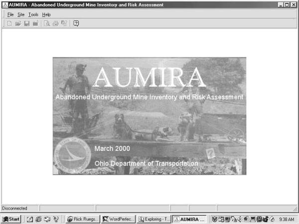
AUMRA Software Screen shot: Opening Screen
(Click for larger image)


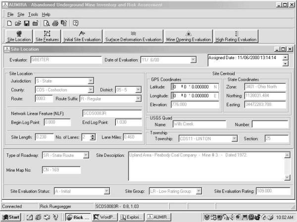
AUMRA Software Screen shot: Site Location
(Click for larger image)


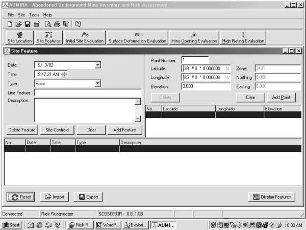
AUMRA Software Screen shot: Site Feature
(Click for larger image)


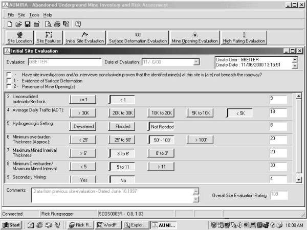
AUMRA Software Screen shot: Initial Site Evaluation
(Click for larger image)


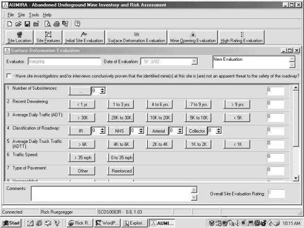
AUMRA Software Screen shot: Surface Deformation Evaluation top
(Click for larger image)


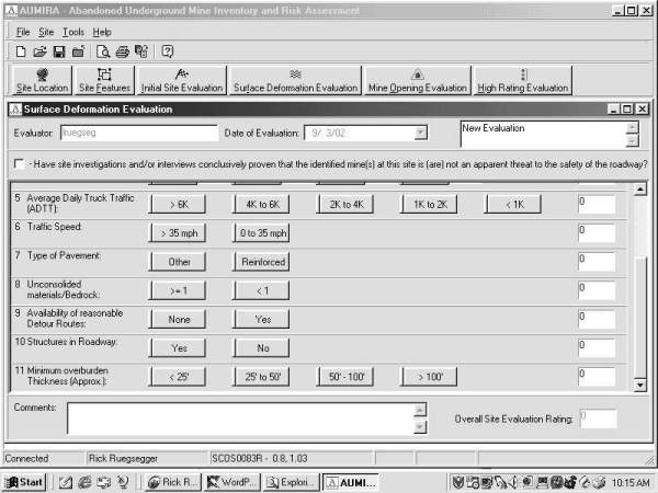
AUMRA Software Screen shot: Surface Deformation Evaluation bottom
(Click for larger image)


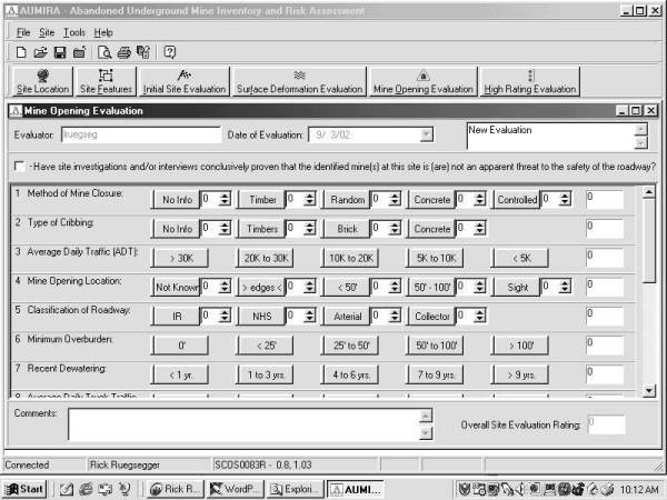
AUMRA Software Screen shot: Mine Opening Evaluation top
(Click for larger image)


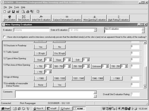
AUMRA Software Screen shot: Mine Opening Evaluation middle
(Click for larger image)


AUMRA Software Screen shot: Mine Opening Evaluation bottom
(Click for larger image)


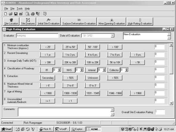
AUMRA Software Screen shot: High Rating Evaluation top
(Click for larger image)


AUMRA Software Screen shot: High Rating Evaluation bottom
(Click for larger image)


AUMRA Software Screen shot: Search - evaluation
(Click for larger image)


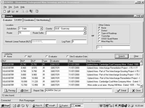
AUMRA Software Screen shot: Search - location
(Click for larger image)


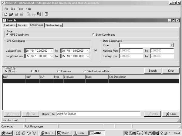
AUMRA Software Screen shot: Search - coordinates
(Click for larger image)


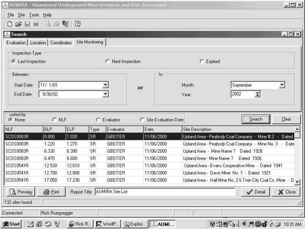
AUMRA Software Screen shot: Search - site monitoring
(Click for larger image)

Updated: 02/12/2018
Federal Highway Administration | 1200 New Jersey Avenue, SE | Washington, DC 20590 | 202-366-4000