U.S. Department of Transportation
Federal Highway Administration
1200 New Jersey Avenue, SE
Washington, DC 20590
202-366-4000
|
Status
of the Nation's Highways, Bridges, and Transit:
2002 Conditions and Performance Report |
| Chapter 18: Travel Model Improvement Program | |||||||||||||||||||||||||||||||||
|
Index Introduction Highlights Executive Summary Part I: Description of Current System
Part II: Investment Performance Analyses
Part III: Bridges
Part IV: Special Topics Part V: Supplemental Analyses of System Components
Appendices |
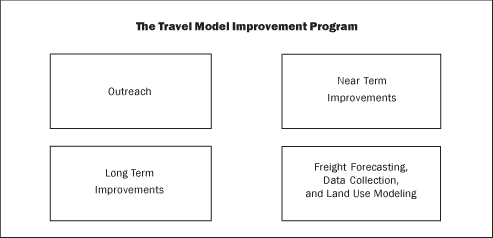
IntroductionAs discussed in Chapter 17, the Federal Highway Administration (FHWA) and the Federal Transit Administration (FTA) have a strong interest in helping State and local governments develop tools to support local transportation policy and program analysis. Among the most important such analyses are estimates of future highway and transit travel growth made by State and metropolitan transportation planning agencies. These travel estimates are critical in developing transportation plans, transportation air quality conformity analyses, and emissions forecasts. They are also an important input into the highway and transit investment needs models. Current transportation modeling procedures are based on paradigms developed more than 35 years ago. Since then, many changes have occurred in transportation policy, transportation technology, and travel behavior, all of which have placed additional demands on the modeling process. Policy changes include the requirement for models to support air quality analysis, traffic operations improvements, analysis of freight movements, and telecommuting. Technological changes include the use of Intelligent Transportation Systems (such as signal optimization and traffic operations improvements) to better manage traffic flows. Behavioral changes include an increased reliance on trip chaining and the shift in travel from peak to off-peak times. Taken together, these changes have made it necessary to significantly upgrade travel forecasting procedures and to support local areas in their improvement of travel forecasting methods. Responding to this need, FHWA, in cooperation with FTA, the Office of the Assistant Secretary for Transportation Policy, and the Environmental Protection Agency (EPA), established the Travel Model Improvement Program (TMIP). TMIP seeks to advance the state of the art and state of the practice in travel forecasting methods. TMIP has four primary components: 1) outreach, to support local areas in the deployment of travel models; 2) near term improvements, to update existing forecasting methods; 3) long term improvements, to develop an entirely new methodology for travel forecasting; and 4) freight forecasting, data collection, and land use modeling to improve the quality of the input to the travel forecasting process. OutreachThe outreach effort supports advancing the state of the practice in travel forecasting. Outreach assists local areas in improving existing techniques as well as the implementation of newly developed techniques. Outreach includes training, direct technical assistance, and building a community of practice among modelers to facilitate mutual support in the modeling process. Through the National Highway Institute, TMIP provides training on basic methodologies in travel forecasting. Courses have addressed basic and advanced methods of forecasting, data collection, and mobile source emissions. Technical assistance includes direct one-to-one technical support and the distribution of reports on TMIP products. To facilitate interaction among modelers, TMIP sponsors an Internet listserv, an Internet Web site, and periodic conferences and seminars on topics of current interest. Outreach is a two-way street, disseminating information and ensuring that TMIP focuses on user needs. To ensure that TMIP meets customer needs, a review panel composed of travel model users provides periodic comment to TMIP on the direction and scope of the program. Members of the panel include representatives from State departments of transportation, Metropolitan Planning Organizations, transit operators, State air quality agencies, environmental groups, the real estate development community, and the academic community. Near Term Improvements — Updating Existing Forecasting MethodsThe TMIP has established an extensive program to improve the capabilities of existing travel forecasting procedures. This program includes improvements to models of trip generation and trip distribution mode choice and assignment procedures. Examples of completed projects include methods to provide feedback among the components of the travel forecasting process, modeling based on trip chaining rather than individual trips, and modeling time of day of travel. TMIP also deploys the ITS Deployment Analysis System, which provides easily usable analytic tools to evaluate proposed ITS investments. The effects of such investments on the highway system are covered further in Chapter 21. The technical procedures developed as part of TMIP's Near Term improvements have been used in Air Quality Conformity Analysis, studies required by the National Environmental Policy Act, FTA's New Starts analyses, and the Metropolitan Transportation Planning Process. Long Term Improvements — Developing a New MethodologyWhile TMIP has improved existing forecasting methods, TMIP also recognizes the need for a basic redesign of the travel forecasting process. The Transportation Analysis and Simulation System (TRANSIMS) meets this need. TRANSIMS uses state-of-the-art microsimulation technology to simulate both the movements of individuals and vehicles and the activities of households. TRANSIMS can trace the activities in an urban area throughout a 24-hour time period, simulating people, vehicles, and households on a second-by-second basis. Within TRANSIMS, every trip starts as a walk trip and then shifts to other modes such as auto and transit, thus explicitly accounting for the non-motorized component of every trip. TRANSIMS has the capability to address issues that current models have found difficult to model, such as emissions analysis based on vehicle operating mode, environmental justice, and global climate change. TRANSIMS simulates the activity of individual vehicles, and vehicle activities, such as acceleration and deceleration, are input to the TRANSIMS emissions model. TRANSIMS can thus provide a better estimate of vehicle emissions than the current techniques generally used. Since TRANSIMS can identify individuals by demographic group and trace their activities through the day, it can be used as a tool to analyze environmental justice issues. TRANSIMS can also estimate the greenhouse gas emissions resulting from metropolitan travel. While not anticipated in the development process, TRANSIMS can play a major role in planning for defense against terrorist attacks. For example, in planning for biological terrorism, it is possible to use TRANSIMS to model the spread of disease, locate field hospitals, and identify optimal sites for the placement of sensors for the detection of disease. TRANSIMS can also assist in planning for emergency evacuations and modifying the transportation system to respond to or recover from terrorist attacks. The use of TRANSIMS for such purposes is also discussed in Chapter 12. TRANSIMS was developed by the Los Alamos National Laboratory, and a more user-friendly version is being developed for commercial use. TRANSIMS is now undergoing field testing in Portland, Oregon. Freight Forecasting, Data Collection, and Land Use ModelingFreight movement is probably the least understood part of the transportation system. TMIP has produced the Quick Response freight manual, designed to assist metropolitan areas in making short term improvements to their freight forecasting processes. TMIP is also developing a more comprehensive freight forecasting procedure that will address all aspects of the freight planning process. Chapter 22 includes more information on FHWA activities relating to freight operations. High quality input data provides a critical basis for the development of travel models. TMIP has several products designed to assist local agencies in improved data collection. In particular, TMIP recently published a travel survey manual to assist local areas in gathering survey information. This manual has been of immediate use, since many urban areas are currently updating surveys. Use of this manual can allow for accurate, cost effective updates to outdated surveys. With the rise of concerns about induced travel, smart growth, preservation of open space, and continuing urban sprawl, understanding land use and the role location and land use patterns play in the demand for travel has become a critical issue. TMIP has developed methods to estimate the impact of transportation on regional land use patterns. TMIP has also addressed the impact of small-scale urban design on travel, enabling local agencies to develop plans that decrease the need for additional transportation infrastructure while meeting the need for mobility. TMIP has documented methods used by localities to forecast land use, and FHWA has published a case study of these methods. Future DirectionsFor the future, TMIP will continue to respond to user needs in the development of new techniques and address the analytic needs of local planning agencies. In addition, as part of the outreach effort, TMIP will develop materials and techniques to educate decision makers about the capabilities and applications of travel models. Through such efforts, TMIP will not only support the quality of the modeling process but also encourage the use of models to improve decision-making based on modeling. The transportation community is now faced with the challenge of preparing for responses to a range of situations not previously considered. TMIP will support the development and deployment of tools to meet these new requirements. TMIP has begun this process and has had discussions with the Department of Defense concerning the use of TRANSIMS in planning for chemical and biological attacks. TMIP will continue to meet the analytical needs of the transportation planning community and change as these needs evolve. |
||||||||||||||||||||||||||||||||
| Back |