U.S. Department of Transportation
Federal Highway Administration
1200 New Jersey Avenue, SE
Washington, DC 20590
202-366-4000
Federal Highway Administration Research and Technology
Coordinating, Developing, and Delivering Highway Transportation Innovations
 |
| This report is an archived publication and may contain dated technical, contact, and link information |
|
Publication Number: FHWA-RD-98-166
Date: July 1999 |
Guidebook on Methods to Estimate Non-Motorized Travel: Supporting Documentation2.11 Pedestrian Demand Models
Descriptive Criteria: What is It? Categories: Authors and Development Dates: Haas and Morrall (1967); Ness, Morrall, and Hutchinson (1969); Kagan, Scott, and Avin (1978) Purpose: A handful of pedestrian demand models were developed in the 1960s and 1970s for forecasting pedestrian flows and prioritizing pedestrian improvements in CBD areas. These models were developed with a structure similar to standard transportation planning models, including zonal trip generation based on land use characteristics and trip distribution and assignment over a network based on a gravity model approach (see entry for "Regional Travel Models," Method 2.8). Kagan, Scott, and Avin (1978) outlined a formal Pedestrian Planning Process (PPP), including a demand modeling phase and a design and evaluation phase. The PPP was intended to help cities develop a network of pedestrian facilities, particularly in their downtown core area, which would "ensure and foster effective exchange for pedestrian trip-making between and within planned and existing activity centers." The PPP includes a comprehensive evaluation of existing and forecast pedestrian travel patterns and movement requirements. The PPP can be used to predict changes in trip patterns as a result of pedestrian facility improvements or land uses and identify and prioritize actions for improvements to facilities. At least two other studies in the 1970s sought to predict pedestrian volume in CBDs as a function of adjacent land uses and facility characteristics (e.g., sidewalk width) but did not include the development of a full pedestrian demand model based on a network of pedestrian facilities. These studies are discussed in the entry for "Pedestrian Sketch-Plan Methods," Method 2.4 (Behnam and Patel, 1977; Pushkarev and Zupan, 1971). Structure: The PPP is based on methods and concepts similar to those found in the standard four-step urban transportation planning process. A detailed 27-step analysis process is outlined, including 13 steps in the demand modeling phase and 14 steps in the design and evaluation phase. Demand modeling is based on a gravity model approach to show the distribution and assignment of pedestrian volumes over a network, under both current and forecast conditions. The primary components of the analysis include: 1. Trip generation characteristics, as a function of land use type. 2. Trip making propensity between land use activities, as a function of connecting pathway attributes. 3. The trip exchange patterns resulting from the above. 4. Assignment of these trips to alternative network pathways. As in standard transportation planning, trip characteristics are analyzed separately by purpose and by time of day. Calibration/Validation Approach: The model is calibrated based on pedestrian counts, using standard calibration methods (see entry for "Regional Travel Models," Method 2.8). Inputs/Data Needs: The FHWA method requires the following input data:
Potential Data Sources: The PPP manual includes representative values for trip generation by land use type (trips per square foot) and by time of day. Computational Requirements: The PPP was designed to be implemented using Urban Transportation Planning System (UTPS) software packages. User Skill/Knowledge: The procedure outlined is fairly complex but can be applied by anyone with a basic knowledge of standard four-step transportation planning procedures. Facility Design Factors: A fundamental element of the PPP is that network paths are described by an impedance or friction factor, which relate perceived distance to actual distance (time) along the path. Perceived distance can be a function of any number of factors, such as safety, comfort and amenities, visual interest, queues and congestion, vertical displacement, etc. These impedance factors must be developed based on site-specific surveys of facility characteristics and on assumptions about the impedances attached to various attributes, either from local pedestrian surveys or from other studies. The PPP manual includes default impedance factors, as well as guidance for rating facilities, for the following attributes:
It also includes adjustment factors for elevation changes (stairs, escalators, ramps), traffic crossings, and crowding. Output Types: The model predicts future flows on a pedestrian network, by link, under future land use and pedestrian network conditions. Real-World Examples: Hass and Morrall (1967) conducted a survey of pedestrian tunnels between all major buildings and parking lots of Carleton University in Ottawa, Canada. The objective was to develop a pedestrian demand model for future design criteria. Data were collected using an O-D questionnaire survey, and the model was calibrated using screen-line counts and walking time-distance surveys. Trips were assigned to a network system by a computer assignment program based on results of the survey. (Referenced in Behnam and Patel, 1977.) 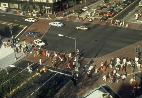
Ness, Morrall, and Hutchinson (1969) applied the gravity model technique to forecast pedestrian volume in the Toronto area. The CBD was divided into office zones, and pedestrian links were coded depending on street configuration and the locations of the centroids of these zones. Trip generation and attraction rates were measured for office zones and transportation terminals and were used in conjunction with a set of friction factors and minimum-path walking trees as inputs to the gravity-type distribution model. The minimum path was calibrated on the basis of walking time, waiting time at intersections, street attractiveness, and a turn penalty. (Referenced in Behnam and Patel, 1977.) Contacts/Source: Jeffrey Zupan: Regional Plan Association of New York (New York, NY) Publications: Behnam, Jahanbakhsh and Bharat G. Patel, A Method for Estimating Pedestrian Volume in a Central Business District, Pedestrian Controls, Bicycle Facilities, Driver Research, and System Safety, Transportation Research Record 629, Washington, DC, 1977. Hass, R.C.G. and J.F. Morrall. Circulation Through a Tunnel Network. Traffic Quarterly, April 1967. Kagan, L.S., W.G. Scott, and U.P. Avin (1978). A Pedestrian Planning Procedures Manual. Prepared for the Federal Highway Administration, Report Nos. FHWA-RD-79-45, FHWA-RD-79-46, and FHWA-RD-79-47 (3 volumes). Ness, M.P., J.F. Morrall, and B.G. Hutchinson. An Analysis of Central Business District Pedestrian Circulation Patterns. Highway Research Record 283, 1969. Pushkarev, Boris, and Jeffrey M. Zupan. Pedestrian Travel Demand. Highway Research Record 355, 1971. Evaluative Criteria: How Does It Work? Performance: No information is available. Use of Existing Resources: This method generally requires local data collection on pedestrian flows, network characteristics, land uses, and other trip generators, as well as the development of a network model using standard transportation planning software. Travel Demand Model Integration: This method is based on the same methodology used for regional travel demand models and can be implemented with standard travel modeling software. However, it requires the development of an area-specific model at the pedestrian scale, including a pedestrian network, zonal structure, and related data files. Applicability to Diverse Conditions: This method is primarily applicable to an urban CBD or other activity center with significant pedestrian activity. Usage in Decision-Making: No information is available. Ability to Incorporate Changes: Once a model is developed, a wide variety of facility improvements can be analyzed. Ease-of-Use: Development of a model and appropriate data and parameters would require a significant level of effort.
FHWA-RD-98-166 |

