
#76082: Directional Signs Outside the Village of Sea Level
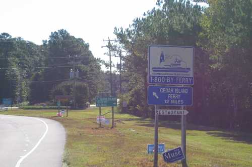
A row of directional signs greets the traveler just outside the village of Sea Level along the Outer Banks Scenic Byway. Signs on the photo include NC’s standard green directional sign, which signals the major turn just ahead, with Sea Level (the name is misspelled here as Sealevel) and Atlantic to the east, and a shortcut to Cedar Island to the left (north). The NC ferry system’s blue-and-white sign announces 12 more miles to the Cedar Island ferry. An attached handmade sign stating “restaurant,” is a hitch-hiker, designed to resemble NC’s local-level directional signs. The National Park Service’s standard sign points the way to a toll ferry ride to Portsmouth Island. NC’s green numbered marker for its bicycling system is attached.
Public Domain.
Download Original (2101 x 1401 pixels, 746.0 KB)