September 16, 2021
EDC Synergy:
Unmanned Aerial Systems and Traffic Incident Management
Using unmanned aerial systems (UAS) for traffic incident management (TIM) brings a new level of speed, precision, and efficiency to this critical function. UAS reduces responder time on scene, accelerates crash investigations, creates better situational awareness for responders, and is a cost-effective measuring and mapping alternative.

UAS has found a firm footing in the current EDC-6 Next Generation TIM effort. The synergy between the two innovations brings extensive State Department of Transportation (DOT) UAS experience to other TIM partners like public safety, towing, and emergency management. The Chula Vista, CA, police department deploys UAS as a first responder, sending the unmanned aerial vehicle to roadway incidents ahead of officers in vehicles to improve situational awareness and speed necessary resources. In addition, State and Local agencies are leveraging UAS to speed the processing of roadway crash scenes, mapping and measuring those incidents in a fraction of the time. Local towing companies are also increasingly deploying UAS at complex roadway incidents to gain vantage points that improve recovery tactics.
Transportation agencies have also benefited from the cross-innovation collaboration, improving situational awareness and monitoring traffic queues. The Utah DOT deploys UAS on their incident response vehicles, often sharing video with responder agencies. When coupled with crowdsourced data, UAS views become a powerful tool to help inform TIM response agencies and road users.
To learn more about UAS, please contact James Gray, FHWA Office of Infrastructure. To learn more about traffic incident management, contact Paul Jodoin, FHWA Office of Operations.
Weather-Responsive Management Strategies Multi-State Case Study for Flood Management
Severe flooding impacts many State roadways each year. Weather-Responsive Management Strategies (WRMS) can mitigate the impact of flooding events through preparation and prediction efforts that leverage and build data, tools, and relationships. As a result, agencies are better equipped for response and recovery efforts. This case study highlights the experiences and lessons learned from the Iowa, Missouri, and Nebraska DOTs while managing major flood events in the Missouri River Basin. The DOTs used similar strategies but different tactics given the various agency relationships and resources available for flood management.
Read more about how these DOTs used hydrologic modeling, light detection and ranging (LiDAR) maps, barrier systems, and more to respond to severe flooding events. To learn more about WRMS, contact David Johnson, FHWA Office of Operations.
Ohio DOT Shares Experience with Cone Penetration Testing
During the Advanced Geotechnical Methods in Exploration (A-GaME) webinar series, the Ohio Department of Transportation (ODOT) shared its experiences implementing cone penetration testing (CPT). In the presentation, CPT: More Holes is More Better!, Andrew Jalbrzikowski, ODOT’s field exploration manager, walks through an overview of their CPT rig equipped with a seismic pusher and how it’s being used in direct design. He also discusses specific project applications and lessons learned. Due to this method being so fast and efficient, Jalbrzikowski says ODOT is always looking to see if CPT is usable for geotechnical exploration.
Watch this presentation on-demand or for more information on CPT, contact Ben Rivers or Derrick Dasenbrock of the FHWA Resource Center.
Discover Home-Grown Innovations from Around the Country

The National STIC Network Showcase prominently features several initiatives focused on synergy with UAS. Learn about North Carolina DOT's use of UAS for aerial herbicide spraying in an environmentally sensitive area with accessibility challenges; Maryland DOT's incorporation of UAS into emergency geologic response, which enables first responders to better understand hazardous geologic site conditions in a fraction of the time, and Nebraska DOT leveraging UAS to expedite detailed damage inspection report processes, which streamlines inspections and provides better access and quality data, leading to faster road reopening and damage reimbursements.
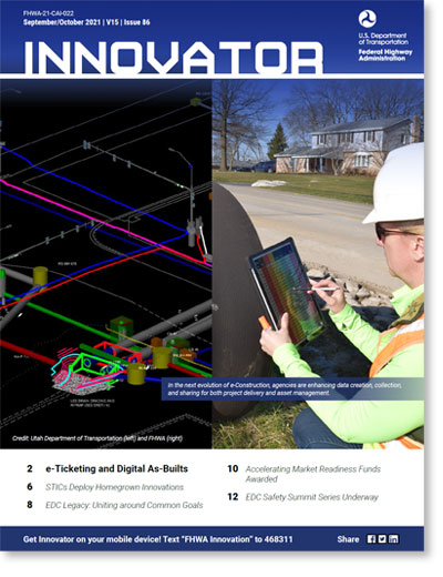
New Innovator Now Available!
The September/October issue of Innovator is now available, accessible from your computer, tablet, or mobile phone to optimize your reading experience!

In this issue:
- e-Ticketing and Digital As-Builts
- STICs Deploy Homegrown Innovations
- Accelerating Market Readiness Funds Awarded
- EDC Legacy: Bridging the Digital Divide
- And more...
Comments? Questions? We'd love your feedback! Drop us a line and let us know what you think.
Read past issues and sign up to receive Innovator by email here, or text "FHWA Innovation" to 468311 to get Innovator on your smartphone.
About EDC
Every Day Counts, a state-based initiative of the Federal Highway Administration's Center for Accelerating Innovation, works with state, local and private sector partners to encourage the adoption of proven technologies and innovations to shorten and enhance project delivery.
EDC News is published weekly by the FHWA Center for Accelerating Innovation.
Recommended Citation:
U.S. Department of Transportation, Federal Highway Administration Every Day Counts: Innovation for a Nation on the Move
EDC News: September 16, 2021 Washington, DC:
https://doi.org/10.21949/1521812


