

Applying Subsurface Utility Engineering to Highway and Road Projects
Existing Underground Utilities are the Veins and Arteries of our Cities and Roads
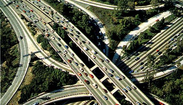
- And yet, we know very little about where they are
- Communication
- Gas / Propane
- Petroleum
- Sewerage
- Drainage
- Power
- Steam
- Water
WHY?
- Expansion
- Modernization
- Changing Utility Technology
- Changing Facility Missions
We don't keep good records
- Referenced to changed topo features
- No centralized records storage
- No standard format
- No responsibility
Where do we get Utility Info?
- Old Project Plans (As-Designed)
- Old Project Plans (Red-Lined)
- Utility Records (As-Designed)
- Utility Records (As-Built)
- Maintenance Records
- Repair Records
- Visual Observation
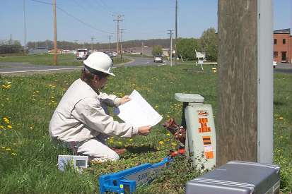
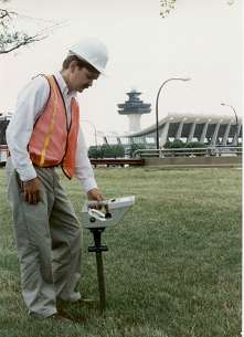
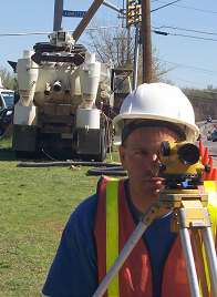
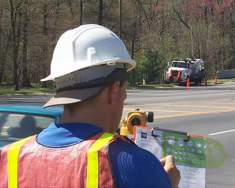
- Field Survey


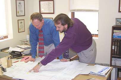
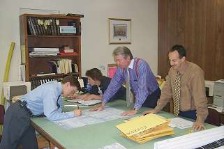
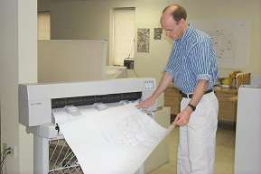
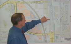
The Engineer uses these sources to compile a utility composite that overlays the new design
- Nowadays, we frequently digitize this data into a CADD or GIS System...
- This can result in even more errors

The Engineer ends up with utility data of unknown reliability
- This makes it extremely difficult to manage the risks that are created by crossing underground utilities
What are these Risks?
- Utility Damages Affecting the Safety of Construction crews, or the Public.
- The Telecommunications and other industries recognize this
There are a lot of other risks too
- $$ - Time - Intangibles
- Redesign costs
- Higher construction bids
- Change orders
- Extra work orders
- Construction Claims
- Higher insurance costs
- Higher financing costs
- Project delays
- Detours
- Bad publicity
Fortunately, there's a way to handle this risk
- Subsurface Utility Engineering
S.U.E. Combines Traditional Engineering Practices, such as...
- Utility Records Research
- Relocation Cost Estimates
- Utility Design Relocation Design
- Plotting of Utilities from Records
With New Technologies
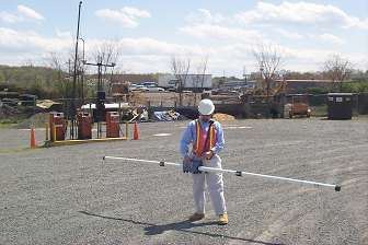
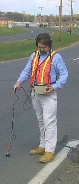
- Utility Designating via Surface Geophysical Methods
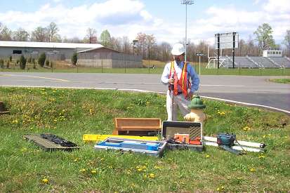
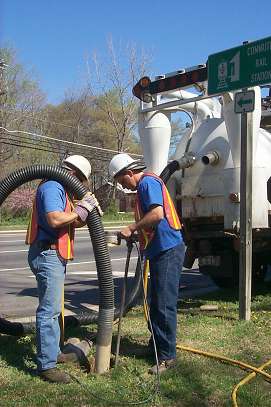
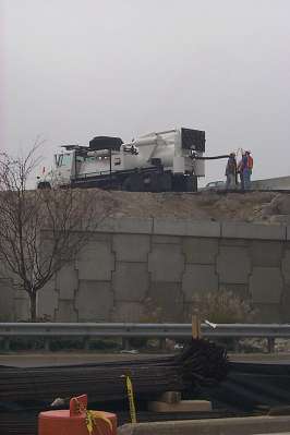
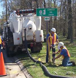
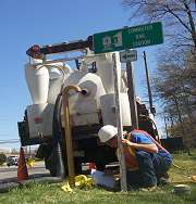
Utility Locating Via Non-Destructive Vacuum Exposure
The Most Significant Advancement is the Utility Quality Level Attribute
- Quality Level Attributes are attached to plotted utilities
- They indicate how utility data was developed
- Reliability and Accountability are defined
"Quality Level D"
The least reliable utility data
- This level of effort is great for Project Planning purposes, utility "inventories," and very preliminary utility relocation cost estimates
- Plotted on plans from records.
- Sometimes a field visit - to look for utility indications on the site - is made.
- Sometimes "verbal recollections" are plotted.
"Quality Level C"
The "traditional" utility depiction
- Problems with records interpretations still exist: e.g. schematics, no appurtenances depicted, utilities not straight between appurtenances, no records exist, and so on.
- Surface Appurtenances are surveyed and accurately plotted on a current site plan
- Utility data from records (QL D) are correlated to the appurtenances
"Quality Level B"
A significant upgrade in quality
- Non-recorded utilities found. Utilities' routes between appurtenances are imaged.
- Typically used in early preliminary design for construction footprint decisions
- Surface Geophysical Methods used to search for and trace existing utilities.
- Designated utilities are then surveyed and plotted on site plan.
"Quality Level A"
A guarantee in 3--D
- Typically used in final design stages. Allows small adjustments in design for big savings in construction
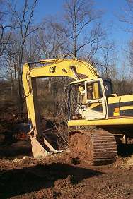
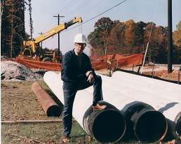
- Utilities exposed via non-destructive air-vacuum means
- Exposed utilities are then surveyed and plotted on site plan Elevations, Size, Condition, Materials, Precise Horizontal Positions are measured and documented
QL A and QL B upgrades have been successful in reducing risk on tens of thousands of highway and road projects.
- This is a tried and true process
- Used extensively by Eastern State DOTs Municipalities
SUE has an Outstanding Record
- Under recent contracts with various departments of transportation including the:
- Texas DOT
- New Jersey DOT
- North Carolina DOT
- Virginia DOT
- Pennsylvania DOT
- Delaware DOT
- Ohio DOT
- Georgia DOT
- Florida DOT
- Arizona DOT
- and the Maryland State Highway Administration
- This represents tens of thousands of separate projects, some of which involved over 200,000 feet of utilities (Quality Level B) and 850 test holes (Quality Level A)
Yet, SUE has not been used as a professional standard practice in some areas for many reasons.
- No concerted local or regional effort to educate project owners or engineers of benefits
- Lack of interest by state DOTs
- Development of SUE has been primarily on the east coast
- Few national providers
- Combined construction values in some areas lower than in others
- Lack of a well defined standard of care created little incentive for changing the status-quo
These Impediments to SUE are rapidly disappearing
National standards have been developed
- They redefine the standard of care for utility mapping by the engineering profession
- American Society of Civil Engineer / American National Standards Institute's
- National Standard Activity
- Standard Guidelines for the Collection and Depiction of Existing Subsurface Utility Data
- Available in November 2002
A January 2000 FHWA / Purdue University study (Publication No. FHWA-IF-00-014) states the following:
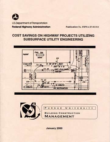
- "A savings of $4.62 for every $1.00 spent on SUE was quantified from a total of 71 projects. These projects had a combined construction value in excess of $1 billion. The costs of obtaining Quality Level "B" (QL B) and Quality Level "A" (QL A) data on these 71 projects were less than 0.5 percent of the total construction costs, and it resulted in a construction savings of 1.9 percent over traditional Quality Level C (QL C) and/or Quality Level D (QL D) data."
- One individual project had a $206.00 to $1.00 return on investment (North Carolina DOT).
- Only 3 of 71 projects had a negative return on investment.
- The simple conclusion of this study is that SUE is a viable technologic practice that reduces project costs related to the risks associated with existing subsurface utilities and, when used in a systematic manner, will result in significant quantifiable and qualitative benefits.
And there's more!
SUE is recognized as a BEST PRACTICE by:
- AASHTO
- Federal Highway Administration
- Associated General Contractors
- Office of Pipeline Safety
- National Transportation Safety Board
- Network Reliability Council
- Many state DOTs
SUE offers a One-Stop Shop for all of a projects' utility needs
A SUE Provider has the Diverse Experienced Staff necessary for these services
- Highway Designers
- Utility Design Experts
- Utility Accommodation Policy Experts
- Field SUE Specialists
- Field SUE Technicians
- Survey Party Chiefs
- Records Researchers
- CADD Technicians
- Utility Engineers
- Professional Engineers
- Professional Surveyors
- Professional Geologists
- Equipment Repair Techs
- Air/Vacuum Fabrication
- Vehicle Maintenance
Subsurface Utility Engineering offers tremendous value for your projects too
- With a mix of field and office activities
- Field survey of utility appurtenances, designating and locating data
- Utility designating via surface geophysical techniques
- Utility locating via non-destructive vacuum exposure
- Utility mapping using quality level attributes
- Utility Conflict avoidance advice and design
- Utility design and relocation design
- Utility relocation coordination
- Relocation cost estimates
- Utility records research
- Utility easement plats