U.S. Department of Transportation
Federal Highway Administration
1200 New Jersey Avenue, SE
Washington, DC 20590
202-366-4000
Focus
| Accelerating Infrastructure Innovations |
Publication Number: FHWA-HRT-10-011
Date: March 2010
Launched in 2006 with the goal of finding new and accelerated solutions for highway safety, renewal, reliability, and capacity issues, the second Strategic Highway Research Program (SHRP 2) is addressing the need to complete highway work more rapidly and with minimal disruption to the community through its renewal track research. High priority research topics include utility issues, as utilities are among the major causes of delay in highway projects. "Being able to accurately locate and characterize both above and below ground utilities is critical to preventing delays in highway projects," says Jeffrey Zaharewicz of the Federal Highway Administration (FHWA). Two SHRP 2 utility-related projects have been completed to date and four are ongoing.
Project R01, "Encouraging Innovation in Locating and Characterizing Underground Utilities," was designed to identify effective technologies for locating underground utilities and to advance the development of innovations in this area. The project's final report, Encouraging Innovation in Locating and Characterizing Underground Utilities, is available at onlinepubs.trb.org/onlinepubs/shrp2/shrp2_S2-R01-RW.pdf.
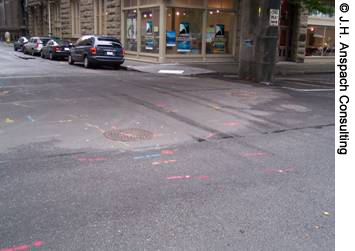
A complex underground utility
environment has been marked on this
city street and is ready for surveying.
As the report notes, rapid developments in utility marking and radio frequency tagging systems and new technologies that use global positioning systems and three-dimensional geographical information systems have changed what is technically possible in utility location.
A range of potential technologies and needs were identified, evaluated, and then ranked by a panel of experts from the transportation and utility industries. The highest priority was assigned to technologies related to the storage, retrieval, and use of utility data and the development of multisensor platforms for evaluating utilities. Also highly ranked were the development of utility-related guidelines, smart tagging systems to identify new utilities with programmable and updatable electronic markers, education and training materials, and technologies for locating deep utilities. Using these rankings, three follow-on research projects were launched in 2009.
Project R01(A), "Technologies to Support Storage, Retrieval, and Utilization of 3-D Utility Location Data," will identify best practices for modeling, storing, retrieving, visualizing, and integrating 3-D utility data, as well as demonstrate the collection, management, and use of such information in a multiutility environment. The overall goal is to reduce the time spent on repeatedly "refinding" known utilities so that resources can be better focused on unknown or previously misrecorded utilities. Project R01(B), will concentrate on "Utility Locating Technology Deployment Utilizing Multi-Sensor Platforms and Innovation in Location of Deep Utility Pipes and Tunnels." Ideally, the multisensor platforms to be tested should yield near real-time data analysis and output. Finally, Project R01(C), "Innovation in Location of Deep Utility Pipes and Tunnels," is designed to improve the detection and accurate determination of the positions of buried utilities.
Also completed is Project R15, "Strategies for Integrating Utility and Transportation Agency Priorities in Highway Renewal Projects." This project focused on how to improve coordination between utility companies and transportation agencies. The resulting final report, Integrating the Priorities of Transportation Agencies and Utility Companies, features a tool box of best practices spanning the entire life cycle of a highway project. These best practices include development of a geographic information system database, use of subsurface utility engineering (SUE) to locate existing underground utilities, and early involvement of utility companies in the planning and design phases of highway projects. For example, at the Wisconsin Department of Transportation, each highway project has a utility coordinator who routinely conducts planning meetings with utility companies to discuss any issues that may be related to the construction.
Another best practice highlighted is use of a utility impact matrix. The Georgia Department of Transportation, for example, uses such a matrix for every project involving utilities. All utility conflicts are listed on the matrix, and a SUE consultant then provides a recommendation for how to resolve the conflict.
Integrating the Priorities of Transportation Agencies and Utility Companies is available at onlinepubs.trb.org/onlinepubs/shrp2/shrp2_S2-R15-RW.pdf. A follow-on project, R15(B), "Identification of Utility Conflicts and Solutions," will build on the best practices highlighted in the R15 report by developing a Utility Conflict Matrix (UCM) to aid State transportation agencies in identifying and resolving utility-related conflicts.
To learn more about SHRP 2, visit www.trb.org/SHRP2, or contact Linda Mason, Communications Officer for SHRP 2 at the Transportation Research Board, 202-334-3241 (email: SHRP2@nas.edu). For information on FHWA's utilities resources, visit www.fhwa.dot.gov/programadmin/utility.cfm, or contact Jeffrey Zaharewicz at FHWA, 202-493-0520 (email: jeffrey.zaharewicz@fhwa.dot.gov).

