U.S. Department of Transportation
Federal Highway Administration
1200 New Jersey Avenue, SE
Washington, DC 20590
202-366-4000
Federal Highway Administration Research and Technology
Coordinating, Developing, and Delivering Highway Transportation Innovations
 |
| This report is an archived publication and may contain dated technical, contact, and link information |
|
Publication Number: N/A
Date: November 1996 |
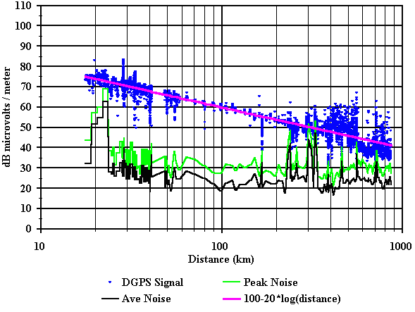
Figure 4. Signal strength vs. distance for the Aransas Pass beacon.
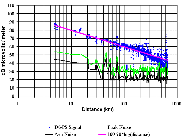
Figure 5. Signal strength vs. distance for the Galveston beacon.
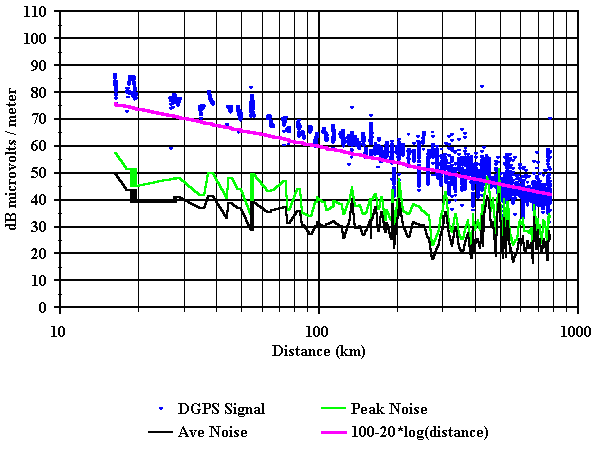
Figure 6. Signal strength vs. distance for the English Turn beacon.
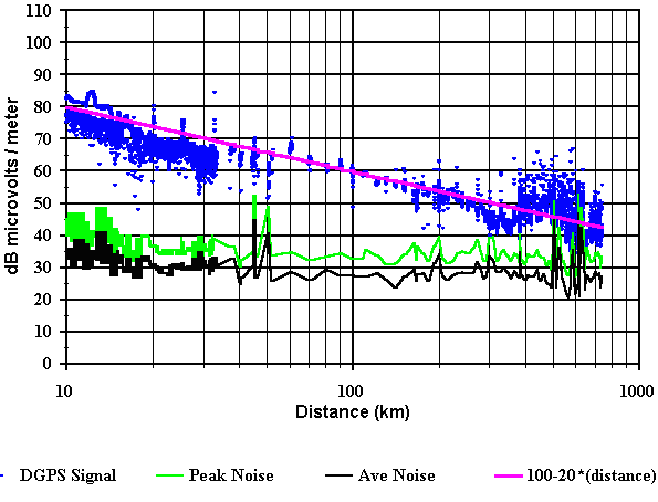
Figure 7. Signal strength vs. distance for the Mobile Point beacon.
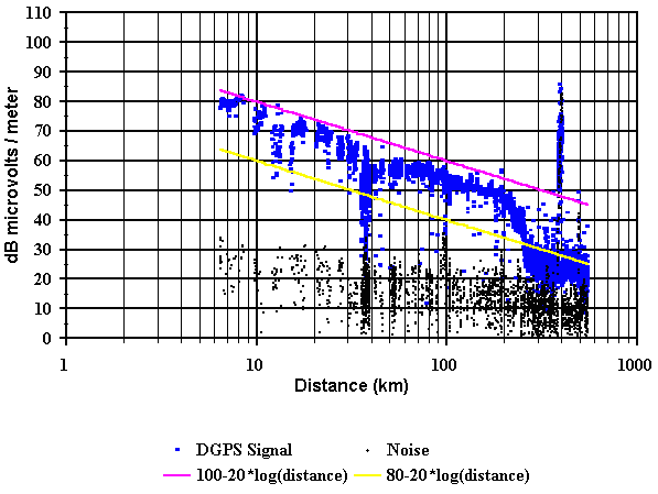
Figure 8. Signal strength vs. distance for the Pigeon Point beacon
- daytime measurements.
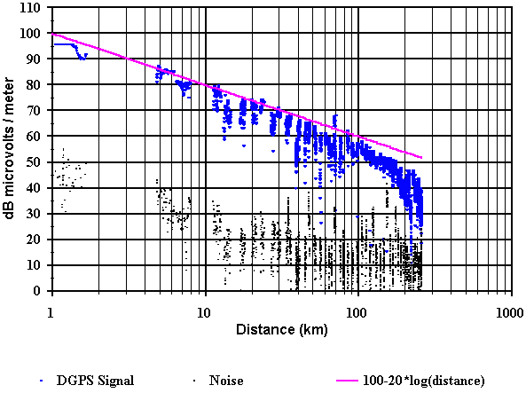
Figure 9. Signal strength vs. distance for the Pigeon Point beacon
- nighttime measurements.
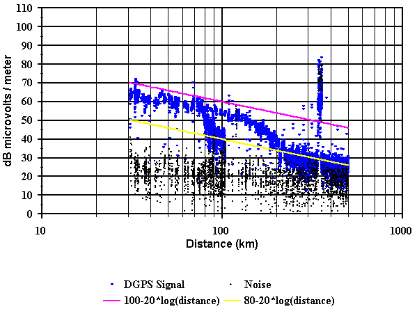
Figure 10. Signal strength vs. distance for the Point Blunt beacon
- daytime measurement.
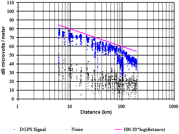
Figure 11. Signal strength vs. distance for the Point Blunt beacon
- nighttime measurement.
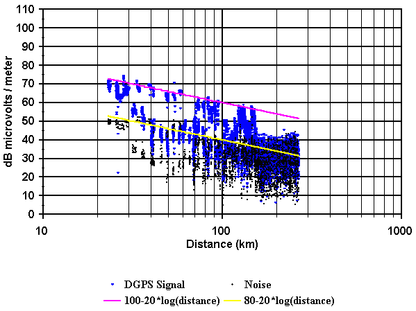
Figure 12. Signal strength vs. distance for the Cape Mendocino beacon.
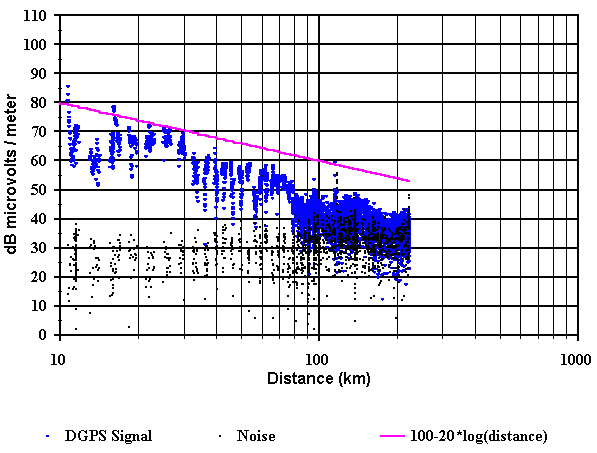
Figure 13. Signal strength vs. distance for the Fort Stevens beacon.
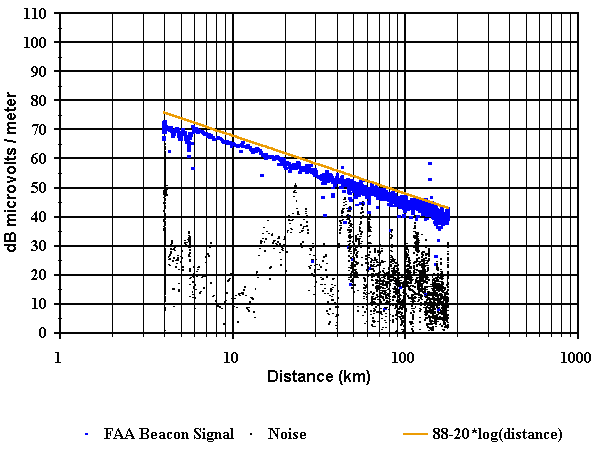
Figure 14. Signal strength vs. distance for the Bennet FAA beacon
en route to Cheyenne, Wyoming.
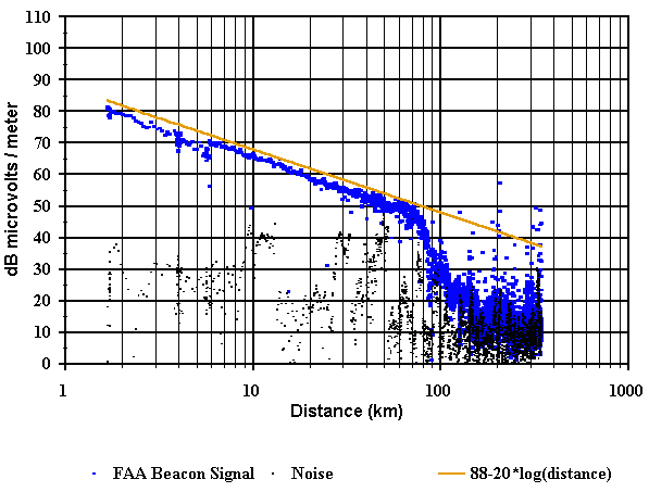
Figure 15. Signal strength vs. distance for the Bennet FAA beacon
en route to Grand Junction, Colorado.

Figure 16. Cumulative distribution of deviation from the least squares fit for Aransas Pass.
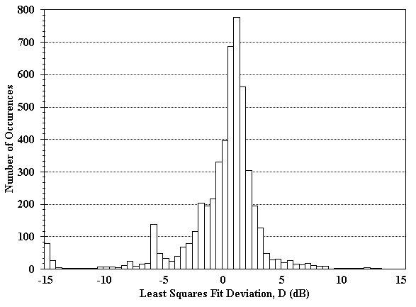
Figure 17. Histogram of deviation from the least squares fit for Aransas Pass.
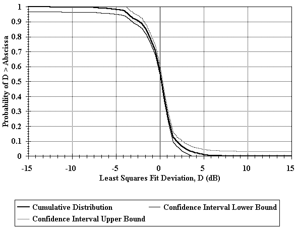
Figure 18. Cumulative distribution of deviation from the least squares fit for Galveston.
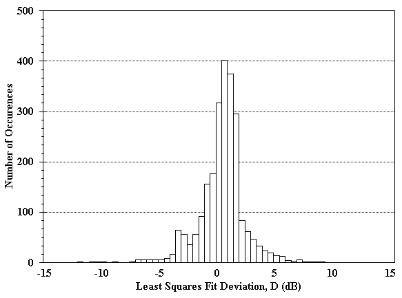
Figure 19. Histogram of deviation from the least squares fit for Galveston.
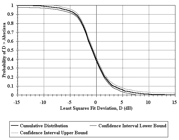
Figure 20. Cumulative distribution of deviation from the least squares fit for English Turn.
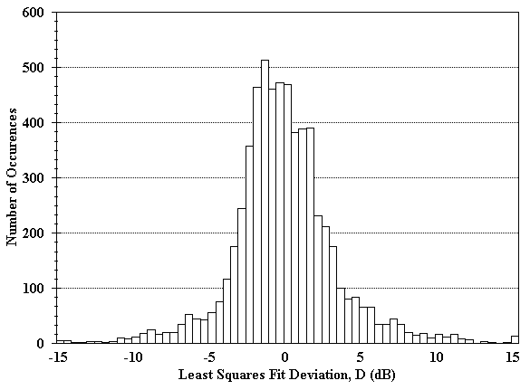
Figure 21. Histogram of deviation from the least squares fit for English Turn.

Figure 22. Cumulative distribution of deviation from the least squares fit for Mobile Point.
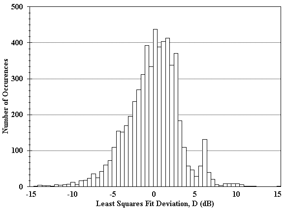
Figure 23. Histogram of deviation from the least squares fit for Mobile Point.
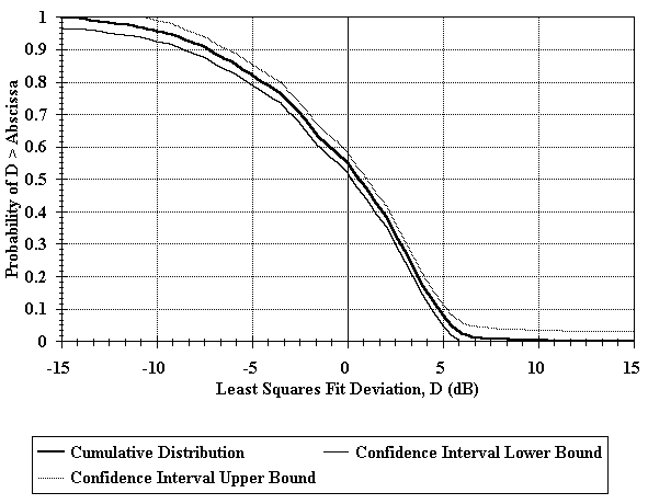
Figure 24. Cumulative distribution of deviation from the least squares fit for Pigeon Point
- nighttime acquisition.
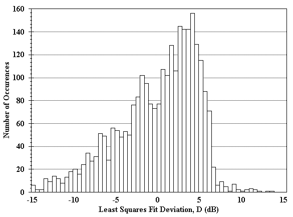
Figure 25. Histogram of deviation from the least squares fit for Pigeon Point
- nighttime acquisition.
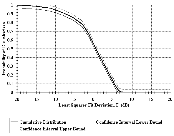
Figure 26. Cumulative distribution of deviation from the least squares fit for Point Blunt
- nighttime acquisition.
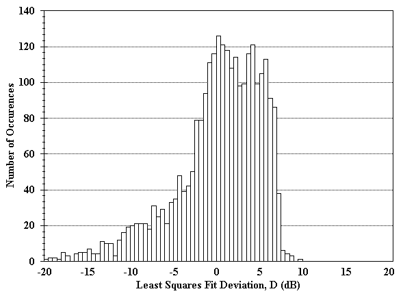
Figure 27. Histogram of deviation from the least squares fit for Point Blunt
- nighttime acquisition.
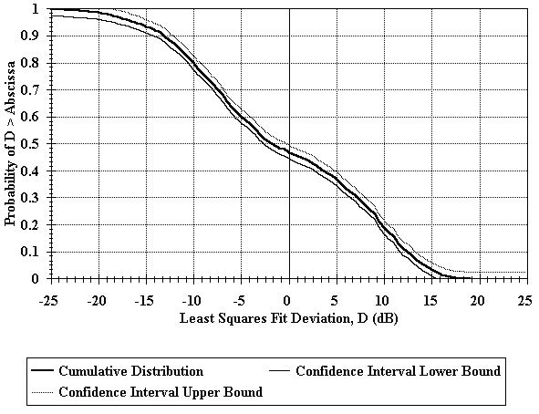
Figure 28. Cumulative distribution of deviation from the least squares fit for Cape Mendocino.
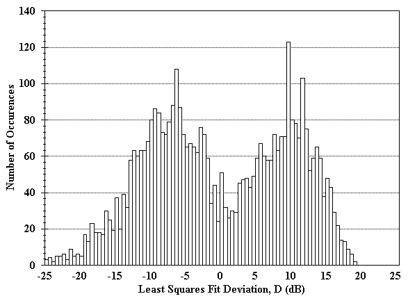
Figure 29. Histogram of deviation from the least squares fit for Cape Mendocino.
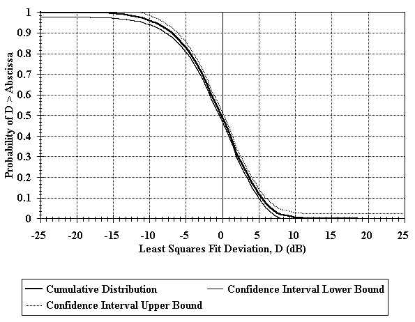
Figure 30. Cumulative distribution of deviation from the least squares fit for Fort Stevens.
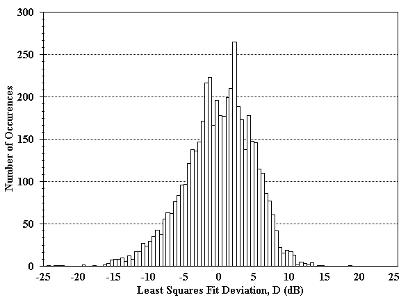
Figure 31. Histogram of deviation from the least squares fit for Fort Stevens.
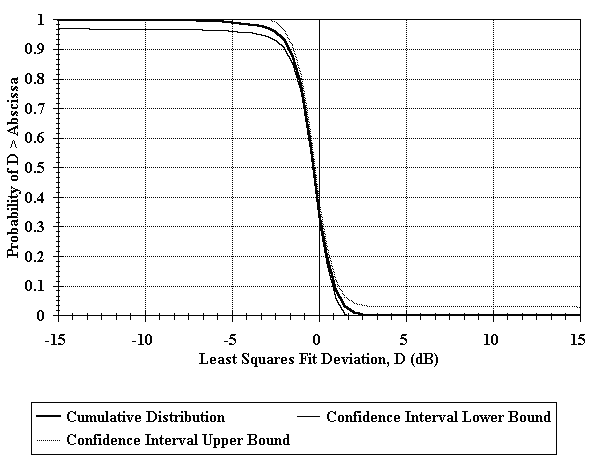
Figure 32. Cumulative distribution of deviation from the least squares fit for FAA beacon
en route to Cheyenne.
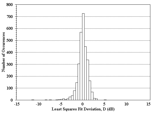
Figure 33. Histogram of deviation from the least squares fit for FAA beacon
en route to Cheyenne.
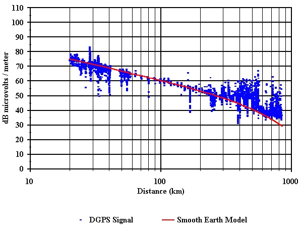
Figure 34. Comparison of measured and predicted field strength vs. distance
for Aransas Pass - smooth earth.
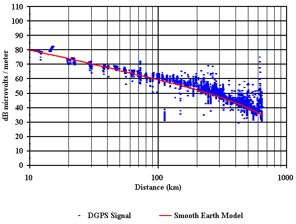
Figure 35. Comparison of measured and predicted field strength vs. distance
for Galveston - smooth earth.
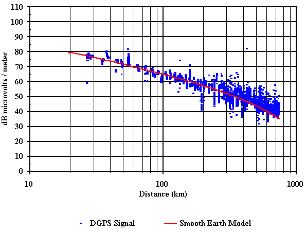
Figure 36. Comparison of measured and predicted field strength vs. distance
for English Turn - smooth earth.
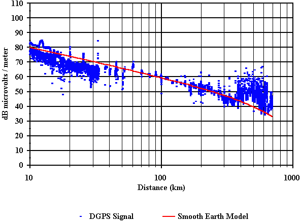
Figure 37. Comparison of measured and predicted field strength vs. distance
for Mobile Point - smooth earth.
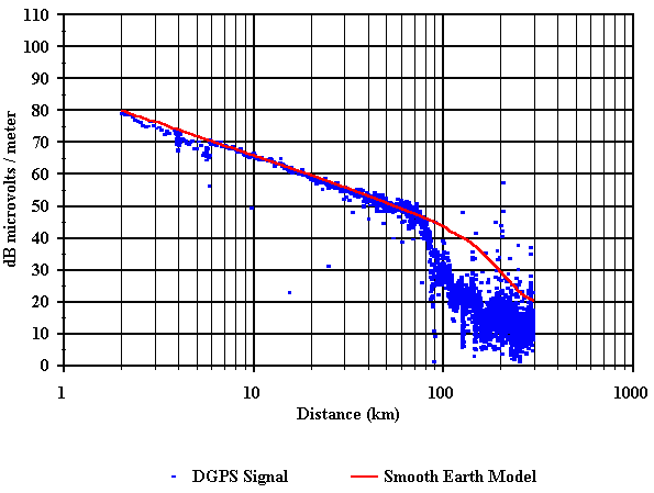
Figure 38. Comparison of measured and predicted field strength vs. distance
going west from FAA beacon - smooth earth.
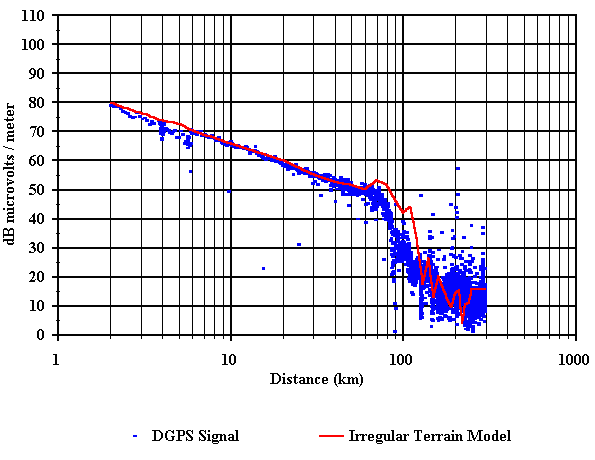
Figure 39. Comparison of measured and predicted field strength vs. distance
going west from FAA beacon - irregular terrain.
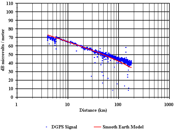
Figure 40. Comparison of measured and predicted field strength vs. distance
going north from FAA beacon - smooth earth.
Figure 41. Comparison of measured and predicted field strength vs. distance
going north from FAA beacon - irregular terrain.
| Table of Contents |

