 |
Latent Demand Score (LDS)
Model Cycle Network Model Forecasting Bicycle
and Pedestrian Travel Estimating Pedestrian Traffic For Central Business
Districts and Suburban Growth Corridors: A Sketch-Plan Method Bicycle and Pedestrian Travel Demand Forecasting
For Existing and Propsed Transportation Facilities Incorporating Bicycle and Pedestrian Factors
In Regional Models: Research and Development Needs |
In November 1996, the Federal Highway Administration (FHWA) sponsored a Trip Generation Workshop in Washington, DC. The workshop, attended by many leading non-motorized modelers, was held to exchange insights on state-of-the-practice for non-motorized transportation modeling.
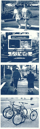
Bicycling and walking account for nearly 8 percent of all trips made according to the National Personal Transportation Survey (NPTS), and nearly $1 billion has been spent on enhancing and providing facilities for these modes. In the last fiscal year alone, $179 million was spent on independent bicycle and pedestrian projects in the United States. The FHWA, via the goals set forth in the National Bicycling and Walking Study, has made a commitment to double the current percentage of total trips made by bicycling and walking, and to simultaneously reduce by 10 percent the number of bicyclists and pedestrians killed or injured in traffic crashes.
FHWA is encouraging local planners to think of walking and bicycling as modes of transportation. This philosophy is exemplified by these quotes from several of the workshop participants.
"The past several years we have experienced a shift from our focus on safety to methods of encouraging bicycle and pedestrian travel."
- John Fegan, Bicycle Program Manager, FHWA"Pedestrian and bicycle modes are marginalized, not recognized in travel demand models. There is a gap between the state-of-the-practice and the state-of-thinking ... we need to bridge this gap."
- Michael Replogle, Environmental Defense Fund"The problem has two dimensions or levels;micro and macro. On the macro, we need to look at a whole MPO or region, and on the micro, the analysis is more at the neighborhood level."
- Bill Wilkinson, Bicycle Federation of America"For a simple sketch fix, take a first cut at the regional level by defining the non-motorized network from the motorized network. At a more local level, separate the bike mode from the walk mode."
- Michael Replogle, Environmental Defense Fund"The most urgent need is to have regional-level, multi-modal modeling capabilities. Until we have this, non-motorized modes will not be on a level playing field." ... "Who is this non-motorized population? Are they marginal and insignificant, or are they us?"
- Jim Ercolano, NYSDOT
There is a wide disparity in the sophistication of bicycle and pedestrian planning in the United States. Some progressive communities such as Portland, OR, and Seattle, WA, have gone to great lengths to plan and provide for non-motorized modes of travel. As a result, these communities have more advanced methods of modeling for these modes. All too often, however, transportation modeling is limited to motorized modes, and as a result, bicycles and pedestrians are marginalized to the degree that they do not even show up in the plans and considerations of the transportation system. Many transportation planners and engineers are totally fixated on motorized vehicles and leave out bicyclists and pedestrians. Those urban areas that do account for the bicycle and pedestrian modes in their regional transportation models are discussed in detail in William Stein's master's thesis, "Pedestrian and Bicycle Modeling in North America's Urban Areas: A Survey of Emerging Methodologies and MPO Practices."
There are several issues that contribute to non-motorized modes being left out of the modeling mix. First is the lack of available data. Bicycling and walking are local activities, and counts and surveys need to be conducted to supplement generalized data sets such as those provided by the U.S. Census. In addition, census data have been criticized for only capturing the principal mode choice for one day in the spring. This means that those people, for example, who walked or rode bicycles to transit probably did not have the bicycle or pedestrian element of the trip captured. The weather can also potentially skew the results of the census. Many have argued that early spring weather more often than not is rainy, cold, or even snowy - conditions that discourage bicycling and walking.
Bicycle and pedestrian counts are too infrequent to provide a consistent data source. And when they do occur, it is hard to gain a true measure of the number of trips that are taking place. Unlike automobiles, bicycles and pedestrians are not always confined to roadway space, but enjoy a mobility that makes them difficult to observe from any one counting station.
The following summaries are based on presentations and printed material from the 2-day workshop:
LATENT DEMAND SCORE (LDS) MODEL
Bruce Landis, Sprinkle Consulting Engineers
The LDS Model was developed to give bicycle planners the ability to quantify latent bicycle travel demand. The LDS Model differs from the classic four-step highway travel demand model in the following way: where the highway's gravity model requires extensive network coding and algorithms to simulate travel between its trip generators and attractors, the LDS Model quickly estimates the probability of bicycle travel on individual road or street segments based on their proximity, frequency, and magnitude of adjacent bicycle trip generators and/or attractors. The steps of the LDS are outlined below:
1. Establish trip-making thresholds of bicycle trip attractors and generators for the four trip purposes: (1) home-based work, (2) home-based shopping, (3) home-based recreational, and (4) home-based school trips. The attractors/generators include, respectively, home-based work markets per census block group, commercial employment per traffic analysis zone, public parks (stratified into minor, staffed, and major), and elementary- and middle-school student populations (within their transportation exclusion zone).
2. For each segment, geo-code and/or map the attractors/generators and record (in the data base), the number of indicators, stratifying according to proximity using geographic information system (GIS) or computer-aided design (CAD) software.
3. Compute the trip-making probability summation (TPS):
a. Calibrate for the urban area the Trip Probability vs. Distance (impedance) curves for each trip purpose.
b. Multiply, for each distance category, the number of indicators by its distance impedance.
c. Sum, for each trip purpose, its value for the segment.
a. Estimating the average independent variable of each attractor/generator.
b. Calculating the average trip generation of each attractor/generator using the Institute of Transportation Engineers (ITE) Trip Generation Manual.
6. Calculate the segment's latent demand score (LDS) by summing the results of Step 5.
The LDS model uses readily available demographic data, employing simplified geocoding and data input for spreadsheet-based gravity computations. It is important to note that the LDS Model estimates the relative latent demand of bicycle travel on each segment of a road network. It provides a clear indication of the relative level of desired bicycle use should a bicycle facility be provided on the road segment.
With regard to "Real-Time Human Perceptions: Toward a Bicycle Level of Service (LOS)," the essential variables for calculating bicycle LOS are:
For data collection, a course was put together in Tampa, FL, and 150 participants rated each segment of the course by how comfortable they were riding on that segment. Traffic volumes ranged from 550 to 36,000 ADT. Among other items, they found that having a lane stripe makes a big difference in LOS.
Further research topics:
CYCLE NETWORK MODEL
Henk Tromp, DHV
This model is being used extensively in The Netherlands and is bicycle-specific computer software. The cycling model consists of a traffic model and an evaluation model. A personal computer is used for the calculations. In the traffic model, a calculation is made for all stretches of road, including separated facilities, to see how many cyclists use a particular stretch of road each day and where they come from and go to. The evaluation model includes calculations of how far cyclists deviate from the straight-line compass route. It also shows where cycling facilities are needed when taking traffic safety into account.
The traffic model and the evaluation model describe the present situation, simulate changes in the network or in the number of inhabitants, and calculate the effects on traffic safety and on cycling distance by adding a bicycle facility. In principle, improving traffic safety is always worthwhile, while shortening distance will attract new cyclists. The calculated results reflect a measure of increased traffic safety and a shift in modal split. The number of cyclists changes with travel times and cost. An important feature of the model is the option of presenting the calculations graphically.
For example, at a glance, one can see the cycling network and identify any gaps as well as the locations where accidents occur. Streets without a bicycle facility that carry a large volume of motor vehicles as well as bicycle traffic can be highlighted. If these streets are also proven to be high accident spots, these areas will be identified as urgently needing a bicycle facility.
Other observations made by Mr. Tromp include the following:
FORECASTING BICYCLE
AND PEDESTRIAN TRAVEL
William Schwartz and Earl Ruiter, Cambridge Systematics
Recommendations include:
- Vehicle availability/automobile ownership.
- Trip generation.
- Trip distribution.
- Pre-mode choice: motorized vs. non-motorized.
- Mode choice.
- Change the variables used in the model so that there is less reliance
on area-type dummy variables and more reliance on density and accessibility
variables. Define pedestrian/cyclist environment variables to include building
setbacks, street connectivity, ease of street crossings, topography, availability
of sidewalks and bicycle paths, and auto ownership.
- GIS-based, point-to-point non-motorized variables for estimation.
- More careful formulation to predict intra-zonal travel.
- Consider non-motorized LOS in composite impedance variables.
Current techniques and approaches at both the facility level and the regional level were presented. Facility-level techniques include:
Issues of incorporating non-motorized modes into regional travel models include answering the following questions:
Technical challenges for incorporating non-motorized modes into regional travel models include the following:
ESTIMATING PEDESTRIAN TRAFFIC FOR CENTRAL BUSINESS
DISTRICTS AND SUBURBAN GROWTH CORRIDORS: A SKETCH-PLAN METHOD
Jim Ercolano, New York State Department of Transportation
Better tools for estimating pedestrian traffic are needed to improve transportation safety, access, and mobility. This paper introduces a Asketch-plan" method to estimate peak-hour pedestrian trips at intersection/crossing (node) and sidewalk/midblock (link) locations. The procedure uses standard traffic data to quantify pedestrian trip activity for integration into routine trip-estimation work. The methodology presented is based on access/egress mode trip generation and applies peak vehicle/hour turning movements, transit vehicle or passenger counts, and walk/bicycle counts or projections to produce total peak pedestrian/hour (PPH) trips. The new method updates and replaces a 20-year-old technique that required detailed land-use data, and did not distribute or assign pedestrian trips. The new technique was applied to a case study suburban-growth corridor in Plattsburgh, NY, illustrating how projection of pedestrian travel demand, in addition to vehicular traffic forecasting, helps in adopting balanced facility treatments to benefit mobility and safety needs for all transportation modes.
Mr. Ercolano distributed a memo by Chris O=Neill, a senior transportation planner with the Capital District Transportation Committee (CDTC). This memo pertained to AEstimation of Potential Bicycle Travel Markets."
The relative market size for potential bicycle use was identified through Adivertable" vehicle trips from the CDTC's regional trip file. The CDTC maintains a base year (1990) p.m. peak-hour vehicle trip set. This trip set represents a 500 zone-by-500 zone origin-destination matrix, and is the summation of 500-by-500 trip sets for home-to-work, work-to-home, home-to-other, other-to-home, other-to-other, and through trips.
This total p.m. peak-hour trip set was converted to a divertable trip set by checking the trip distance in miles for the origin and destination, and factoring the total trip set into a divertable trip set, based on the trip purpose and trip distance.
Setting the "factor" at 1.00 (100 percent) for all home-to-work and work-to-home trips less than 8 km (5 mi), a steep decay curve was used: factor = (5.0)3 / (distance)3. Using this equation, a trip of 9.7 km (6 mi) would have a factor of 0.58; a trip of 16 km (10 mi) would have a factor of 0.13; and a trip of 32 km (20 mi) would have a factor of 0.02.
For non-work trips, a shorter distance threshold was established. "Trip chaining" of short work-to-shop (other-to-other) and shop-to-home (other-to-home) trips would create overall trip chains of more than 8 km (5 mi). For non-work trips, the threshold was set at 4.8 km (3 mi), with a factor for trips of more than 4.8 km (3 mi) = (3.0)3 / (distance)3.
The factored trip set reflects the decreased potential for bicycle travel to serve long trip lengths. The resulting trip set represents a reasonable estimate of the maximum potential for diversion of vehicle trips to bicycles in the study area. A full accommodation of bicycles on appropriate facilities would result in diverting a percentage of these Adivertable" trips.
The location of the strongest markets for bicycle travel was determined using the TMODEL2-based STEP model to assign the trips to highway links. This was accomplished using a 24-km/h (15-mi/h) speed on all highway links (except Interstate highways, which were assigned a value of 3.2 km/h [2 mi/h]) and allowing the model to select the shortest time paths for each trip.
BICYCLE AND PEDESTRIAN TRAVEL DEMAND FORECASTING FOR
EXISTING AND PROPOSED TRANSPORTATION FACILITIES
Shawn Turner, Texas Transportation Institute
The research goal for this Texas Department of Transportation (TxDOT) study is to develop a methodology that will provide personnel with the information and a decision-making framework to assess existing and proposed travel demand by bicyclists and pedestrians. The research objectives are to:
The project will use mostly screen-line and existing data. Following the literature review, data collection will start in Spring 1997.
Disaggregate, sketch planning, and facility locator (treating bicycle facilities as destinations) models are being considered. The basic questions are, "What are the needs?" and "How are we applying these models?"
TRANSIMS
Michael Culp and Sam Zimmerman, Federal Highway Administration
The focus of the Travel Model Improvement Program (TMIP) is to provide tools to meet regulatory needs.
TRANSIMS is a new modeling system that makes microsimulations of trips on a regional basis using aggregate census data. It synthesizes characteristics of trip makers. These characteristics vary by the size of the area and by geographical location. A simulation component tracks travelers.
INCORPORATING BICYCLE AND PEDESTRIAN FACTORS IN
REGIONAL MODELS: RESEARCH AND DEVELOPMENT NEEDS
Michael Replogle, Environmental Defense Fund
In most regions, models do not consider non-motorized trips, or mention them and throw them away. An example is Washington, DC, where the model takes into account only vehicle trips and transit; it doesn't include non-motorized trips.
About 10 years ago, they worked on developing a model for Montgomery County, MD. The model overestimated transit use in suburban activity centers. It didn't include the quality of the pedestrian environment.
Then they developed another model that included building setbacks and the quality and connectivity of sidewalks and bicycle facilities. They considered alternative scenarios of bicycle and pedestrian transportation, and showed that the non-automobile mode share could be doubled over a 30-year period.
In addition, they have worked with others to incorporate pedestrians and bicycles into a sketch model. The LUTRAQ model in Portland, OR, used a pedestrian environment factor. This factor was statistically significant in explaining automobile ownership. Sacramento, CA, picked up the pedestrian environment factor.
The longer term action agenda should include the following:
Efforts to cross-fertilize should take place in the following areas:
Top action priorities are:
Related Intermodal Surface Transportation Efficiency Act issues should include:
Explore model transferability:
Data collection is a big need. Specific areas of need include the following:
What is the effect on trips of building a facility? For example, how much activity can you expect from adding a sidewalk? Issues here include the following:
In the area of GIS applications, a compendium of state-of-the-practice is needed, including:
The following were identified:
A quick response tool is needed that would allow one to evaluate projects in a simple way. At the same time, non-motorized modes need to be included in established motor vehicle models, as well as TRANSIMS. At a minimum, there is a need to store and manage existing data in a GIS and build from there. Inventorying the existing non-motorized facilities is a first step in this direction.
Other needs mentioned by workshop participants include:
-Expand the NPTS and turn it into a revolving panel or use it as a longitudinal study.
-Geo-reference PUMS data in order to analyze proximity relationships.
-Recommend that the U.S. Census Bureau add questions about access mode and line-haul mode.
-Need good case studies in places with high bicycle use, such as Davis, CA, and Boulder, CO.
-Use aerial photography to do bicycle/pedestrian counts.
The fundamental problem is data-where do you find it, how do you collect it, and what do you do with it? Possible solutions:
Models:
Planning:
It was unanimously agreed that a follow-up meeting on the subject of trip generation should be held in 2 years to evaluate progress-in the United States and abroad-in this important area.
A Compendium of Available Bicycle and Pedestrian Trip Generation Data in the United States: A Supplement to the National Bicycle and Walking Study.
Chesapeake Bay Foundation and Environmental Defense Fund, A Network of Communities: Evaluating Travel Behavior Effects of Alternative Transportation and Community Designs for the National Capital Region, May 1996.
A Project of the Chesapeake Bay Foundation, Environmental Defense Fund, American Council for an Energy-Efficient Economy, and Washington Regional Network, in cooperation with Cambridge Systematics, Inc. and MCV Associates. Evaluating Travel Behavior Effects of Alternative Transportation, Land Use, and Urban Design: A New Approach for the Washington, DC, Region.
Julie Mercer Matlick, "Forecasting Pedestrian Use and Flows: If We Build It, Will They Come?", Pro-Bike/Pro-Walk >96 Resource Book.
Michael Replogle, Integrating Pedestrian and Bicycle Factors Into Regional Transportation Planning Models: Summary of the State-of-the-Art and Suggested Steps Forward.
William R. Stein, Pedestrian and Bicycle Modeling in North America's Urban Areas: A Survey of Emerging Methodologies and MPO Practices.
Scott E. Davis, Ellis King, and Douglas Robertson, APredicting Pedestrian Crosswalk Volumes," Transportation Research Record 1168.
James M. Ercolano, Douglas M. Spring, and Jeffery S. Olson, Sketch Plan Method to Evaluate Peak-Hour Pedestrian Traffic for Central Business Districts and Suburban Corridors.
Edward Weiner and Frederick Ducca, Upgrading Travel Demand Forecasting Capabilities.
TFHRC Home | FHWA Home | Feedback United States Department of Transportation - Federal Highway Administration |