The Federal Highway Administration (FHWA) Office of Planning, Environment and Realty's (HEP) Surface Transportation Environment and Planning Cooperative Research Program (STEP) ended on September 30, 2012. For current HEP research information, please see HEP's research web site.
Presents
Webinar
May 26, 2010
12:00 p.m. to 1:30 p.m.
Also available as Microsoft Powerpoint (16 MB) and Adobe PDF (4.5 MB) fornats.
To view PDF files, you need the Acrobat® Reader®. A PowerPoint viewer is available from Microsoft.
Felicia Young
Team Leader, Research and Financial Service
FHWA Office of Human Environment
Good afternoon and thank you for attending the first Surface Transportation Environment Planning and Research Cooperative Program (STEP)'s webinar on Livability.
Outreach and stakeholder feedback are used to refine and implement national research agenda
Examples of outreach activities
Shari Schaftlein
Acting Director
FHWA Office of Human Environment
Gabe Rousseau
Team Leader, Livability
FHWA Office of Human Environment
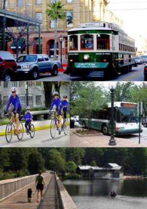
Livability is about tying the quality and location of transportation facilities to broader opportunities such as access to good jobs, affordable housing, quality schools, and safe streets.
Livability is, "investing in a way that recognizes the unique character of each community."
U.S. DOT Secretary Ray LaHood
Livability is about tying the quality and location of transportation facilities to broader opportunities such as access to good jobs, affordable housing, quality schools, and safe streets. This includes addressing safety and capacity issues on all roads through better planning and design, maximizing and expanding new technologies such as ITS and the use of quiet pavements, using Travel Demand Management approaches to system planning and operations, etc.
US DOT Secretary Ray LaHood defined livability as "investing in a way that recognizes the unique character of each community. The era of one-size-fits-all transportation projects must give way to one where preserving and enhancing unique community characteristics, be they rural or urban, is a primary mission of our work rather than an afterthought."
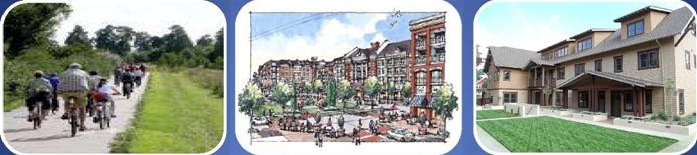
A livable community is one in which people have multiple, convenient transportation and housing options as well as destinations easily accessible to people traveling in and out of cars.
Livable communities are where transportation, housing and commercial development investments have been coordinated such that people have access to adequate, affordable and environmentally sustainable travel. The specific attributes that define livability in any individual community are shaped by the values of its citizens and unique local conditions. |
 |
Provide More Transportation Choices |
Coordinate Policies and Leverage Investment | Promote Equitable Affordable Housing |
Enhance Economic Competitiveness |
Support Existing Communities | Value Communities and Neighborhoods |
In March 2009 HUD and DOT announced an interagency partnership to promote sustainable communities to help families gain better access to affordable housing, more transportation options, and lower transportation costs. In June 2009, EPA joined with the HUD and DOT to form the Partnership for Sustainable Communities. The goal of the Partnership is to improve access to affordable housing, to provide more transportation options and to lower transportation costs, all while protecting the environment.
The Partnership developed the following set of guiding livability principles:
Provide more transportation choices. Develop safe, reliable and economical transportation choices to decrease household transportation costs, reduce our nations' dependence on foreign oil, improve air quality, reduce greenhouse gas emissions and promote public health.
Promote equitable, affordable housing. Expand location- and energy-efficient housing choices for people of all ages, incomes, races and ethnicities to increase mobility and lower the combined cost of housing and transportation.
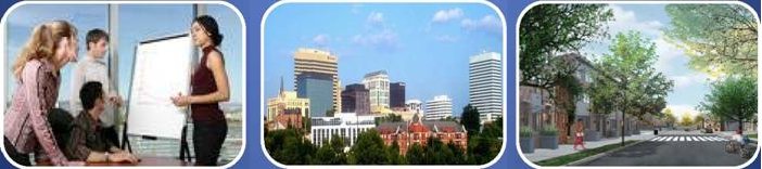
Enhance economic competitiveness. Improve economic competitiveness through reliable and timely access to employment centers, educational opportunities, services and other basic needs by workers as well as expanded business access to markets.
Support existing communities. Target federal funding toward existing communities - through such strategies as transit oriented, mixed-use development and land recycling - to increase community revitalization, improve the efficiency of public works investments, and safeguard rural landscapes.
Coordinate policies and leverage investment. Align federal policies and funding to remove barriers to collaboration, leverage funding and increase the accountability and effectiveness of all levels of government to plan for future growth, including making smart energy choices such as locally generated renewable energy.
Value communities and neighborhoods. Enhance the unique characteristics of all communities by investing in healthy, safe and walkable neighborhoods - rural, urban or suburban.
Context Sensitive Solutions (CSS) Clearinghouse sponsored a webinar on DOT's role in livability. The discussion was led by Beth Osborne, Deputy Assistant Secretary for Transportation Policy, Gloria Shepherd, FHWA's Associate Administrator for Planning, Environment, and Realty, and Robert Tuccillo, FTA's Associate Administrator for Budget and Policy.
FHWA and FTA developed and held joint training for its field planners on livability. The purpose of the training was 1) to prepare Division/Regional/Technical Service Team Planners to work with State DOTs, Transit Operators and Metropolitan Planning Organizations in implementing the Livability Initiative 2) to identify livability linkages within current programs and initiatives and 3) to discuss strategies that FHWA/FTA planners can employ to advance Livability. Speakers from the FHWA Office of Planning, Environment and Realty, the FHWA Resource Center, and the FTA Office of Planning and Environment provided information on livability's role in public participation, land use, context sensitive solutions, safety, climate change, operational strategies, bicycle/pedestrian and transit oriented development. Case studies of states implementing the principles of livability were also presented.
FHWA and FTA in conjunction with the Center for Transportation and the Environment, held a live webcast to discuss the DOT, HUD, EPA Interagency Partnership for Sustainable Communities. The webcast was held in the form of a panel discussion. Panelist included Elizabeth Wilkins, White House Policy Assistant for Urban Affairs and Mobility and Opportunity with the White House Domestic Policy Council, Beth Osborne, Deputy Assistant Secretary for Transportation Policy with the U.S. DOT, Shelley Porticha, Senior Advisor for Sustainable Housing and Communities, with the U.S. Department of Housing and Urban Development, John Frece, Smart Growth Program Director, with the U. S. Environmental Protection Agency. The webcast provided an overview of the DOT, HUD, and EPA Partnership for Sustainable Communities and highlighted the partnership's current efforts. More than 1100 people registered from all 50 states as well as people from British Columbia, Ontario, Canada, Sydney, Australia, and Madrid, Spain participated in the webcast.
FHWA held a Planning on the Web (POW) session that focused on Livability: Connecting Transportation and Land Use. Staff from FHWA's field offices, resource center and headquarters gave presentations. The session was a follow up to the October 27th Let's Talk Planning webinar on Livability
Capacity Building
Livable Communities Strategic Initiative research project was identified as a part of FHWA's strategic initiative priorities. The objective of the project is to develop tools to support livability and strategies that promote livable communities. The project includes the development of a white paper, livability workshops, toolbox of materials, regional comprehensive livability plan and a marketing plan that will support the promotion of the aforementioned tasks.
Ken will talk more about the Livability Transportation Guidebook
Presented by
Ken Petty
FHWA Office of Planning
America's transportation industry has built the worlds largest and best highway network that connects people, business and communities all across the country. However it is now time to complete our multi modal transportation networks and providing multiple transportation options for those they can't drive or choose not to drive.
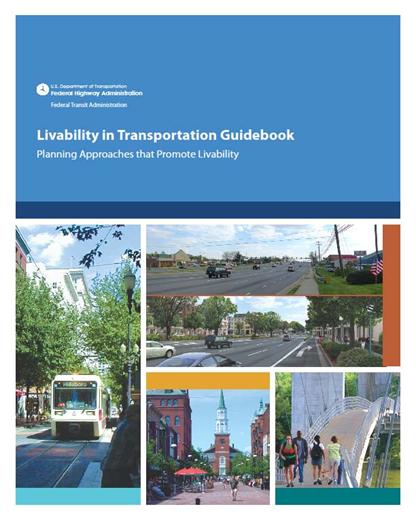
The Livability Guidebook is intended to be used as a Guidance manual for making sure people of all ages, have real choices for walking, transit and other modes of transportation and to help improve the health and quality of life for all residents.
As we all know, Transportation Planning is not a standalone process. While many of the concepts of Livability have been around for a long time the new concept behind Livability is to bring all these initiatives together under one big umbrella. The Livability Guidebook does just that, it shows how and where walkable communities have been successful, it looks at Smart Growth, CSS and Complete Streets and shows that Livability is not a one size fits all process.
100% STEP funded, the Guidebook is based on a series of case studies using both rural and urban examples. We have also add case studies that look at how communities have better connected their communities through their transportation system, how mixed use development can improve the Quality of Life for its residents and a host of other topics shown here. Once the Guidebook is complete a downloadable version it will be posted on our Livability web site which is https://www.fhwa.dot.gov/livability/. Please enjoy this new publication and we look forward to hearing back from you.
Chris O'Neill
Sandy Misiewicz, AICP
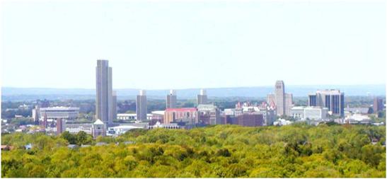
Capital District Transportation Committee
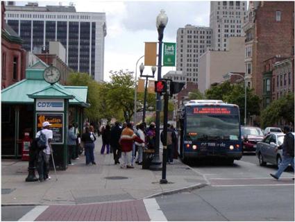
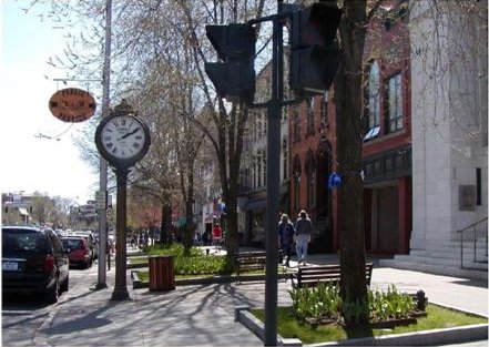
Protection of urban, suburban and rural character

Public Participation is key to making trade offs and defining community values.
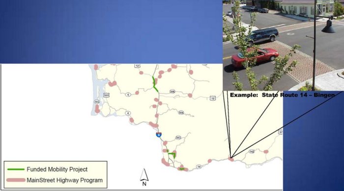
Presented By Paula Reeves, AICP
Manager, Community Design Assistance

We provide educational, technical, and financial support with federal oversight to local customers to help them achieve their transportation goals...
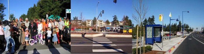
$300 million annually includes all formula funds that go to local agencies such as: STP regional, bridge, CMAQ and congressional earmarks identified in SAFETEA-LU.
Responsible for preparing and submitting the Statewide Transportation Improvement Program (STIP) to FHWA, which includes federally funded and regionally significant WSDOT and local agency projects

WSDOT's Community Design and Bicycle and Pedestrian Websites
http://www.wsdot.wa.gov/localprograms/
Washington's Safe Routes Website
http://www.wsdot.wa.gov/bike/Safe_Routes.htm
Contact WSDOT Community Design Assistance:
Paula Reeves
Manager, Community Design Assistance
Reevesp@WSDOT.WA.GOV
360-705-7258
Charlotte Claybrooke
Safe Routes to Schools Coordinator
ClaybrC@WSDOT.WA.GOV
360-705-7302
Ian Macek
Bicycle and Pedestrian Coordinator
Maceki@WSDOT.WA.GOV
360-705-7596
Ed Spilker
Scenic Byways Coordinator
Spilker@WSDOT.WA.GOV
360-705-7387
Presented by:
Barbara McCann
Executive Director
National Complete Streets Coalition

A Joint project of the American Planning Association and the National Complete Streets Coalition 
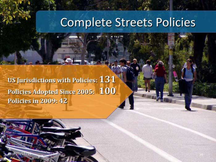
Some jurisdictions have adopted more than one policy.
Photo: Davis, CA (Dan Burden, Walkable and Livable Communities Institute, Inc.)

Total for 2009: 44. The acceleration in policy adoption is indicative of a nationwide movement to change the way we approach our transportation networks. People want choices, safe streets, and healthy, livable environments.
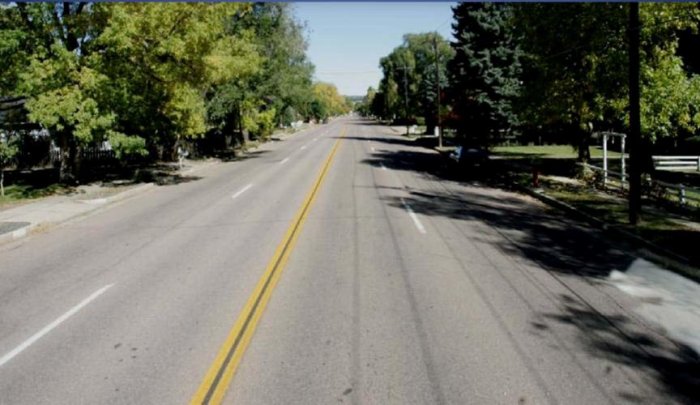
Photo credit: City of Colorado Springs
Excellent example of incremental and low cost approach to "completing streets" - Cheyenne Blvd.
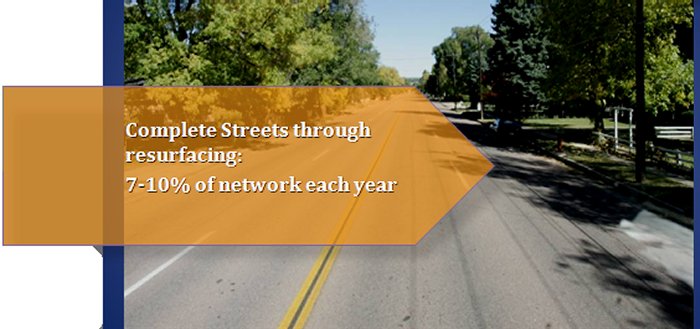
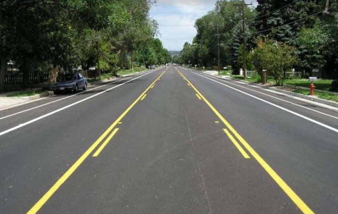
Photo credit: City of Colorado Springs
Converted the street to a 3-land configuration, with bike lanes and on-street parking
Very low cost - a little more solid striping and some additional signage for bike lanes
Preserved all on-street parking - even added spaces by middle school at west end of corridor
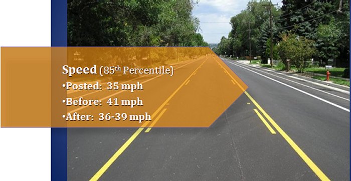
85th percentile speeds dropped from 41 mph (posted 35) to 38 mph; no diversion of traffic to parallel corridor. Temporary increase to over 13,000 vpd was handled well when parallel corridor was closed for major utility work last year.
Supported by most neighbors and very well liked now; however, there was some initial push back (2 weeks of angry emails, calls, newspaper coverage). ADVICE: Trust your professional judgment and ride it out.
NOTE: Cheyenne Blvd is still not "complete" several sections of missing sidewalk, numerous missing transit pads but these are being targeted in near future - good example of incrementalism. Cheyenne Blvd may still be somewhat incomplete but it is much better than before.
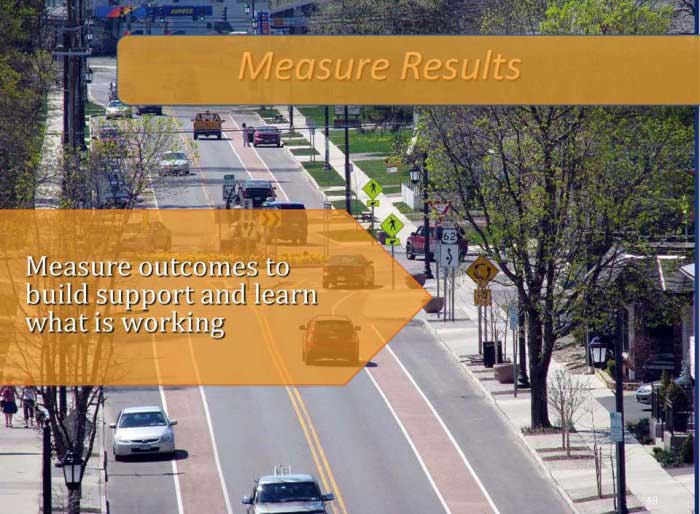
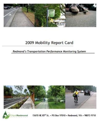
Numbers at your fingertips
| How Much/Many? | Of What? | Trend |
| 7,729 | Students riding the bus to school | down |
| 862 | Traffic collisions | even |
| 38 | Collisions involving pedestrians or bicyclists | even |
| 7.6% | Traffic growth for selected intersections since 1996 | up |
| 31% | AM commuters traveling by non-single occupancy vehicle (2007) | up |
Data for 2008 unless otherwise noted. Log on to http://redmond.gov/cms/one.aspx?portalId=169&pageId=26754 for more information about the above figures.
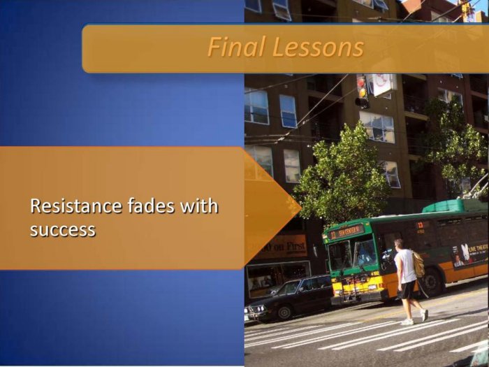
Photo: (John LaPlante)
Presented by
Fred Bowers
FHWA Office of Planning
Scenario planning, is a process that forecasts the consequences of investing in different modes of transportation, development locations and funding strategies. When combined with visualization, citizens can really begin to see what the future holds. FHWA's Scenario Planning Program is completely STEP Funded 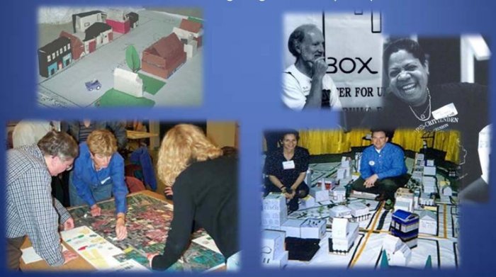
Locations of previous workshops are highlighted in yellow |
|
Scenario planning is fully STEP funded and is very good way to visualize transforming a community to make it a more livable environment.
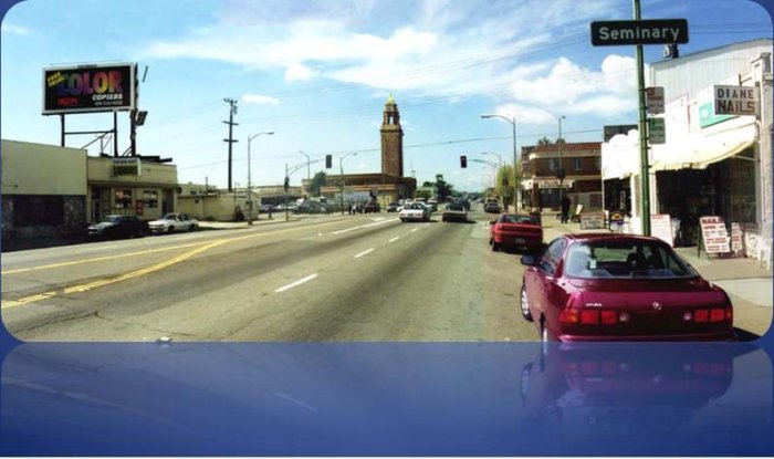
Scenario planning in public involvement allows you get the public perception for how a community might grow or change. Through the use of visualization tools, you can demonstrate to the public how you can go from a street system that looks like this -
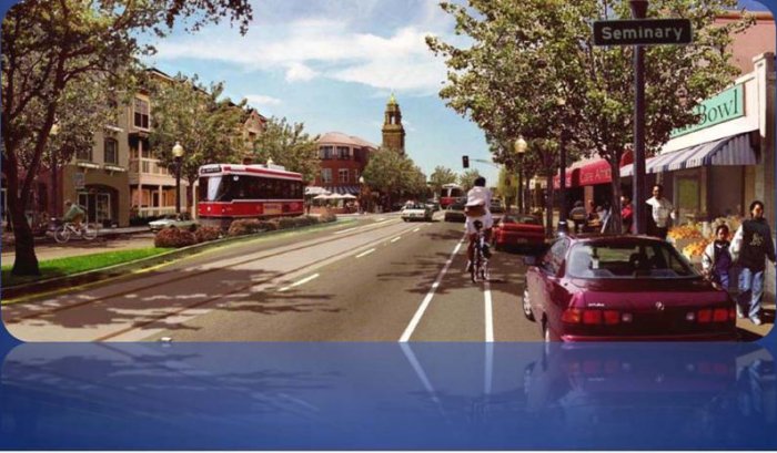
To grow into a street system that looks like this.
Key long-term benefits from sustained scenario planning efforts can include:
 |
The statewide "Envision Utah" process conducted public values research With over 200 workshops involving more than 20,000 residents to decide their own future Since the completion of the vision several years ago, they have continued to partner with the participating communities They continue to monitor and steer the rural and urban growth into patterns that the residents themselves desire |
|
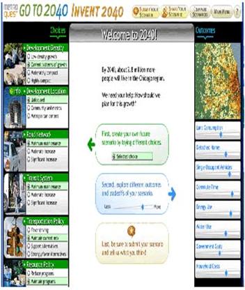
Source: Chicago Metropolitan Agency for Planning |
Traditional land use/transportation scenario planning efforts have focused on a limited range of land use and transportation investment scenarios, with analysis and evaluation leading to a preferred scenario.
Next generation scenario planning efforts seek to capture a broader range of issues and challenges than previously considered in scenario creation and analysis, such as alternative energy, technological innovation, security, climate change, or economic shifts.
Presented by
Keith Moore
FHWA Office of Project Development and Environmental Review
|
|
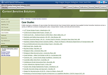
CSS Clearinghouse - Building a Community of Practice through - Over 1000 registered site users
Webinar Series
WEBINAR
The Dialog will be spearheaded by a series of five, one-day workshops to be held in various locations across the country. Each workshop will focus on a particular aspect of CSS, and use transportation projects or programs to highlight CSS best practices and provide a springboard for discussion and interaction. The workshop topics will vary, depending on the topics of most interest to the local workshop audience and the specific best practices selected for presentation. Potential topics could include effective and meaningful community engagement; facility design or construction that harmonizes with the existing natural and community context; or the use of a collaborative, multi-disciplinary team to develop a project design or program. The workshops will be fully documented and the documentation will be made widely available. The workshops are tentatively planned to be held from July 2009 through December 2009.
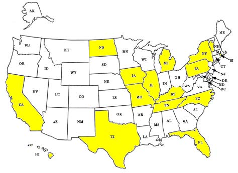
Big tent approach to the Steering Committee and Dialog - wide range of traditional partners and new ones Scenic America, US EPA Headquarters, National Center for Environmental Health, Centers for Disease Control and Prevention, National Association of Regional Councils (NARC), Project for Public Spaces, Center for Neighborhood Technology, NYC DOT, American Council of Engineering Companies, Kimley-Horn and Associates, Inc., Congress for the New Urbanism, FHWA -RC, HEPN, HIPA, HSA, Arkansas ,Texas Division, North Dakota, Indiana, NCDOT Tennessee DOT, Oregon State University, Caltrans Headquarters, University of Minnesota, Center for Transportation Studies, City of Terrell, University of Connecticut, USDA Forest Service Engineering, Minnesota DOT
The goals of the dialog are to:
If you have general questions about STEP or this webinar, contact Felicia.Young@dot.gov
Livability Information Gabe.Rousseau@dot.gov