


August 22, 2019
Innovation of the Month:
Unmanned Aerial Systems
Agencies that use unmanned aerial systems (UAS) provide faster and more targeted response to flooding, wind, landslides, fire, and earthquake events. The birds-eye-view during incident response and damage assessments is safer for inspectors and helps agencies obtain quality data and make more informed decisions.
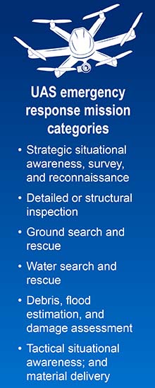
FHWA's tech brief provides examples of how UAS supports emergency management of flooding events. UAS missions are divided into seven basic categories covering operations before, during and after an event.
These missions tap into the ability of UAS to carry high-resolution cameras, high-definition video cameras, infrared sensors, global positioning systems, and other customizable sensor loadouts to meet the requirements of each mission.
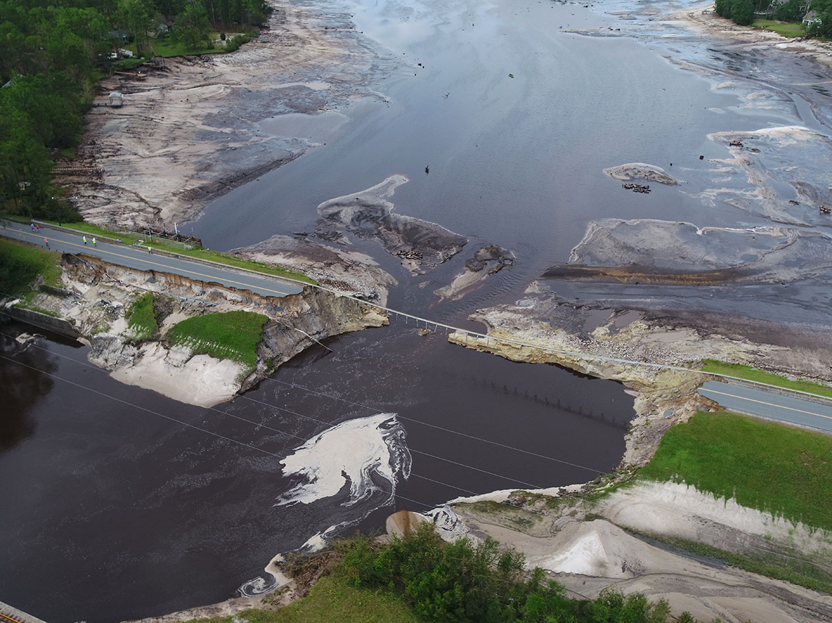
During Hurricane Florence, 15 UAS teams supported emergency support functions with over 260 flights before, during, and after the flood crest, capturing over 8,000 images and videos. UAS gathered images for photogrammetric maps of affected areas. These images helped answer questions such as where the flooding was, its severity, if people were in distress, and the condition of roads and bridges. Much of the data was live streamed to emergency response teams, allowing officials to respond quickly where needed.
A UAS program can be started with a relatively small investment. To learn how your State can effectively respond to emergency response incidents using UAS, please contact James Gray with the FHWA Office of Infrastructure or John Haynes of the FHWA Utah Division.
Leading Pedestrian Intervals Key to Pedestrian Safety in the District
The FHWA Safe Transportation for Every Pedestrian (STEP) program promotes leading pedestrian intervals (LPIs) as a proven safety countermeasure for pedestrians crossing at signalized intersections. LPIs allow pedestrians to walk—usually 3 to 5 seconds—before vehicles receive a green signal to turn left or right.
The District Department of Transportation (DDOT) in Washington D.C, is implementing LPIs across their network. Starting in 2018 with the Citywide Signal Optimization program, DDOT developed selection guidelines and criteria where intersections could be evaluated quickly for LPI implementation. These guidelines capture the magnitude and severity of pedestrian-vehicle interactions at signalized intersections, and identify locations where the physical characteristics of the intersection make those interactions more dangerous.
The data used to drive these decisions includes crash data, pedestrian and vehicle volume counts, land use, and a visual inspection of sight line obstructions and crosswalk locations.
Under DDOT's program, every signal in the city will be evaluated for LPI implementation by the end of the current five-year cycle. Last fall, DDOT implemented approximately 90 new LPIs, bringing its total to over 330. This year, it expects to implement over 250 new LPIs as they maintain their commitment to Vision Zero.
Is your agency considering widespread installation of LPIs? If so, please contact Becky Crowe of the FHWA Office of Safety or Peter Eun of the FHWA Resource Center.
e-Construction Saves Time and Money in Disaster Response
Following Hurricanes Maria and Harvey, the Mobile Solution for Assessment and Reporting (MSAR) application showcased e-Construction disaster recovery benefits. The app replaced paper-based surveys and inspection reports on disaster damage required for FHWA's Emergency Relief program.
After Maria devastated Puerto Rico, damage surveys for 1,300 sites were conducted within 3 weeks with MSAR, compared to one year with paper surveys after Hurricane Katrina. When the Texas Department of Transportation (TxDOT) used the app after Hurricane Harvey, more than 500 sites were approved for Federal recovery funds within 7 months instead of up to 2 years using a paper-based process. Reducing administrative work and time needed to create reports saved TxDOT about $1.3 million.
To learn about MSAR, please contact Sergio Mayorga with the Office of Federal Lands Highway.
About EDC
Every Day Counts, a State-based program of the Federal Highway Administration’s Center for Accelerating Innovation, works with State, local, and private sector partners to encourage the adoption of proven technologies and innovations to shorten and enhance project delivery.