


August 27, 2020
Innovation of the Month:
Focus on Reducing Rural Roadway Departures
Last week, we discussed the systemic approach, which identifies and prioritizes locations across a network for safety improvements. The final Focus on Reducing Rural Roadway Departures (FoRRRwD) pillar we will discuss is Safety Action Plans.
Remember—30 people die each day in rural roadway departures, and over 40 percent of those deaths happen off the State system. This means that local agencies must work alongside departments of transportation to help save these lives.
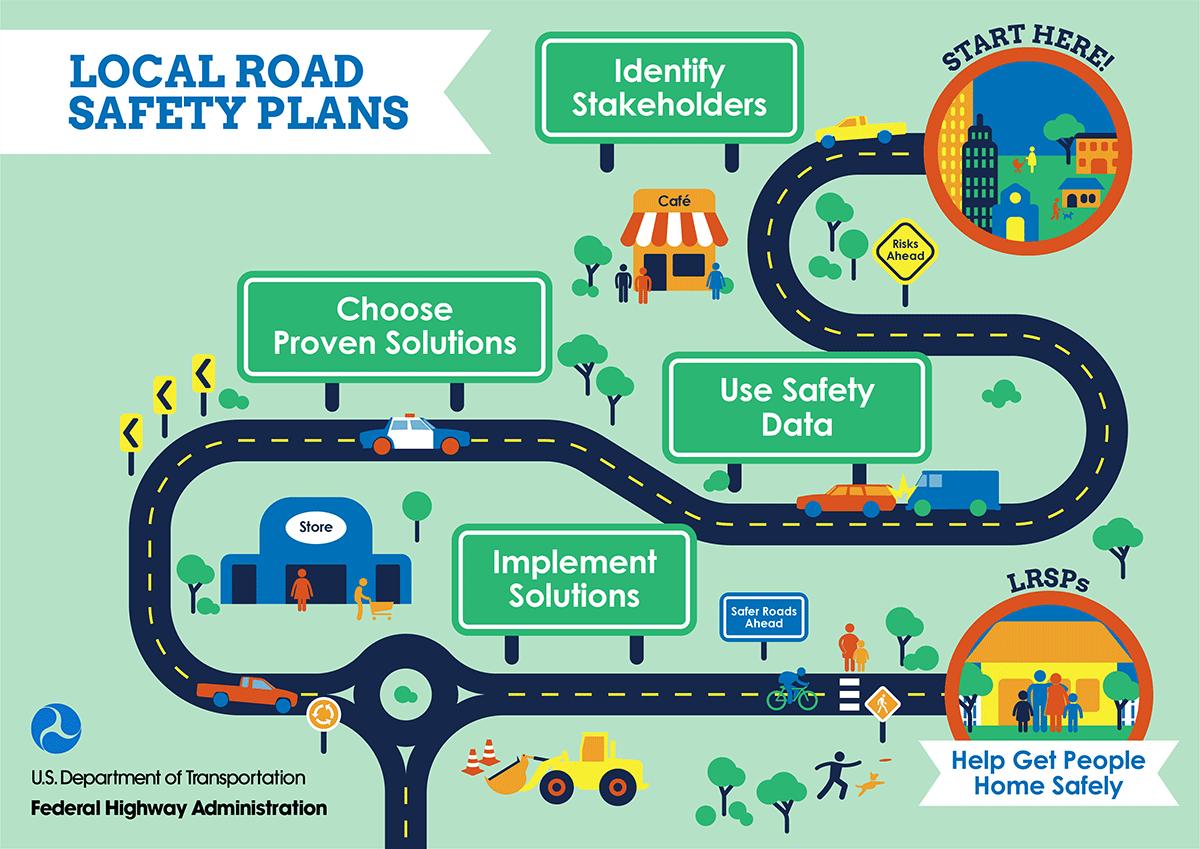
Local road safety plans (LRSPs), one form of safety action plans, are a data-driven way to prioritize safety activities and improvements and justify agency investment decisions. LRSPs are scalable and can be modified for any level of available data and expertise. LRSPs involve stakeholders from the 5Es of traffic safety: engineering, enforcement, emergency medical services, education, and everyone else. Like State Strategic Highway Safety Plans, the LRSPs include a vision and mission component, helping all entities, including elected officials, rally around a shared vision, such as helping residents they serve get home safely.
In California, 62 percent of fatal crashes occur on locally-owned roads. The California Department of Transportation (Caltrans) Office of Local Assistance has assisted local agencies in the development of systemic safety analysis reports since 2016. However, Caltrans realized that more could be gained from a holistic approach by developing LRSPs. To encourage LRSP development, Caltrans hosted two in-state peer exchanges, and conducted several webinars that reached hundreds of local agencies. Caltrans also provides funding to develop LRSPs. A California agency with a completed LRSP that submits a project application through the 2020 Local Highway Safety Improvement Program (HSIP) will be awarded "bonus points" during the selection process. In the next Local HSIP funding cycle (2022), Caltrans will require agencies to have an LRSP to be eligible to submit a project application.
If your agency is interested in creating its own LSRP, please contact Cate Satterfield with the FHWA Office of Safety or Dick Albin with the FHWA Resource Center. Also keep an eye out for the FHWA LSRP Do-It-Yourself website coming in September. This site will walk through the steps of developing a LRSP and include tutorials, tips, resources and examples in video and print format.
Using Road Weather Data and Tools for Flood Prediction and Preparation
The increase of significant flood events is moving agencies to find opportunities to use data and tools for flood prediction and preparation.
In March 2019, a major flood event hit the Missouri River basin. To prepare, the Missouri DOT (MoDOT) actively used river gauge and hydrograph predictions from the National Oceanic and Atmospheric Administration (NOAA) and National Weather Service (NWS) to plan for closures. NOAA hydrograph information contains details, such as water levels, that will impact downstream bridges. This information was available to MoDOT supervisors on their mobile devices, which helped staff understand when water was being released from upstream dams, and where to position equipment and staff, to keep roads open for as long as possible before floodwaters crossed a road.
During the same flooding event, Iowa DOT used a 2D hydraulic model called TUFLOW to determine the flood stages and velocities along the entire 50 river miles of the Missouri River. This information provided forecasting, assessment, and response information as the U.S. Army Corps of Engineers temporarily repaired the State's damaged levee system. Hydraulic modeling also provided detailed information for emergency relief betterment analysis to improve resiliency options for DOT infrastructure.
For additional information and publications on weather responsive management strategies (WRMS), check out the WRMS Toolkit. To learn more about how you can implement WRMS in your agency, contact David Johnson, EDC-5 team lead.
Florida Engineers Bring Their A-GaME for Bridge Replacement
Advanced Geotechnical Methods in Exploration (A-GaME) techniques helped designers understand and address subsurface conditions that had caused bridge foundation problems since the 1980s. The Choctawhatchee Bay Bridge in Florida is a 2.5-mile crossing over a sensitive marine environment with a history of frequent storm damage and erosion. The structure encountered deep foundation construction challenges, and experienced ongoing settlement in its causeway.
When it was time to replace the bridge, extensive site characterization was needed to understand subsurface conditions and provide recommendations for a new structure that were safe, long-lasting, and environmentally responsible.
Seismic data and strategically placed cone penetration testing and dilatometer tests provided a refined subsurface model for analysis and design. The improved site characterization revealed why features of the project were behaving the way they were, helped explain the ongoing settlement issues, and provided a roadmap for driving structural pile foundations for the new bridge.
To learn more about how to incorporate proven, innovative geotechnical methods like these into your site characterization plans, contact Ben Rivers of the FHWA Resource Center or Silas Nichols of the FHWA Office of Infrastructure.
About EDC
Every Day Counts, a State-based program of the Federal Highway Administration’s Center for Accelerating Innovation, works with State, local, and private sector partners to encourage the adoption of proven technologies and innovations to shorten and enhance project delivery.