
Michigan Deploys Drones for Day-to-Day Operations
The Michigan Department of Transportation (MDOT) and Michigan Technical University are collaborating to expand use of unmanned a erial systems (UAS) to meet systems operations and maintenance data needs.
MDOT and Michigan Tech demonstrated how UAS collection of aerial and thermal imagery, light detection and ranging (LiDAR) data, and video can support decision making on infrastructure condition assessment, asset management, and systems operations. They developed several tools that will enable MDOT to integrate UAS data into the agency’s everyday workflows.
One tool uses high-resolution aerial imagery and digital elevation models useful in nondestructive evaluation of bridges. UAS-collected imagery is processed and passed through an algorithm that automatically detects spalls—concrete surface defects—in a bridge deck. Known as the “spallgorithm,” the algorithm identifies the precise location, depth, surface area, and volume of spalls. This allows MDOT staff to obtain bridge defect information while spending less time on bridge sites, improving safety. The team also developed an algorithm that analyzes UAS-collected thermal imagery to distinguish delamination—concrete subsurface defects—from healthy areas of a bridge deck.
Using UAS data, the project team created three-dimensional (3D) digital models that can be used for building information modeling (BIM), a 3D model-based process that supports decision making on built assets. BIM can provide MDOT bridge managers with a method to document maintenance information over the lifetime of a bridge.
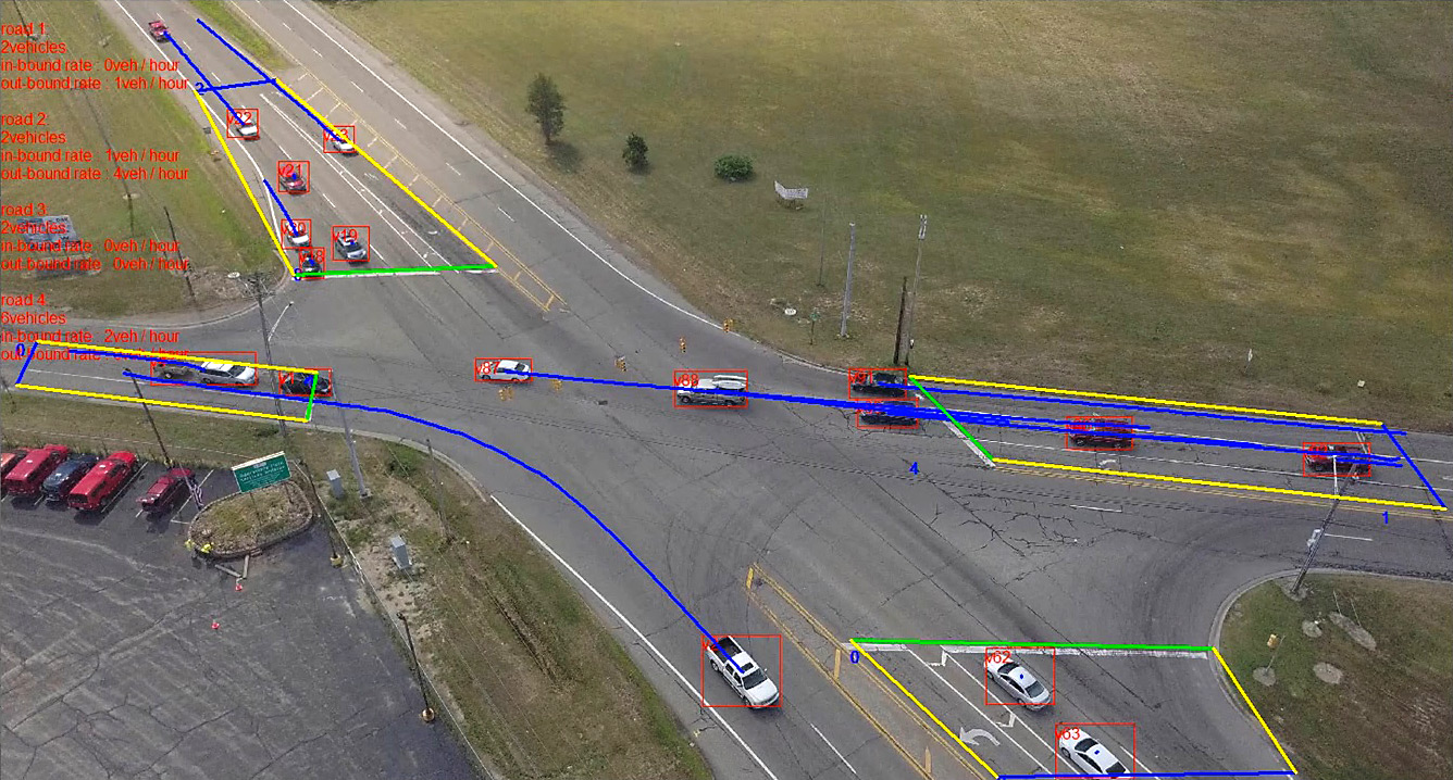 A UAS-based traffic monitoring algorithm helps the Michigan Department of Transportation generate data from traffic video.
The team is working on a UAS-based traffic monitoring algorithm to provide quantitative data from live-streamed traffic video. Data that can be generated from traffic video include vehicle trajectory, speed, and traffic volume for use in traffic studies, capacity analysis, and other applications.
MDOT is also developing a best practices guide for collecting LiDAR data based on the differences between ground- and UAS-based LiDAR systems, which use lasers to rapidly acquire 3D geometric data. The guide will help users determine appropriate uses of UAS LiDAR in design survey projects.