


States Innovate!
Idaho Recognized for PEL Study
The Idaho Transportation Department (ITD) received a 2022 FHWA Environmental Excellence Award for its I-15/US-20 Connector planning and environmental linkages (PEL) study. According to the award description, stakeholders in Idaho Falls had been at an impasse on how to improve the Interstate 15 and U.S. Highway 20 junction and corridors there for more than 20 years, then ITD took a new approach and collaborated with local agencies to conduct a PEL study—the first to be done in Idaho. PEL represents a collaborative approach to decision-making that considers environmental, community, and economic goals early in the planning process. Through the PEL study process, ITD evaluated the potential impacts of more than a dozen alternative plans and removed from consideration those that would impact a veterans memorial park, a Tribal burial site, and historically disadvantaged communities. These efforts reduced what had previously been a 7- to 10-year process to 3 years. The project’s success spurred five more PEL studies across the State.
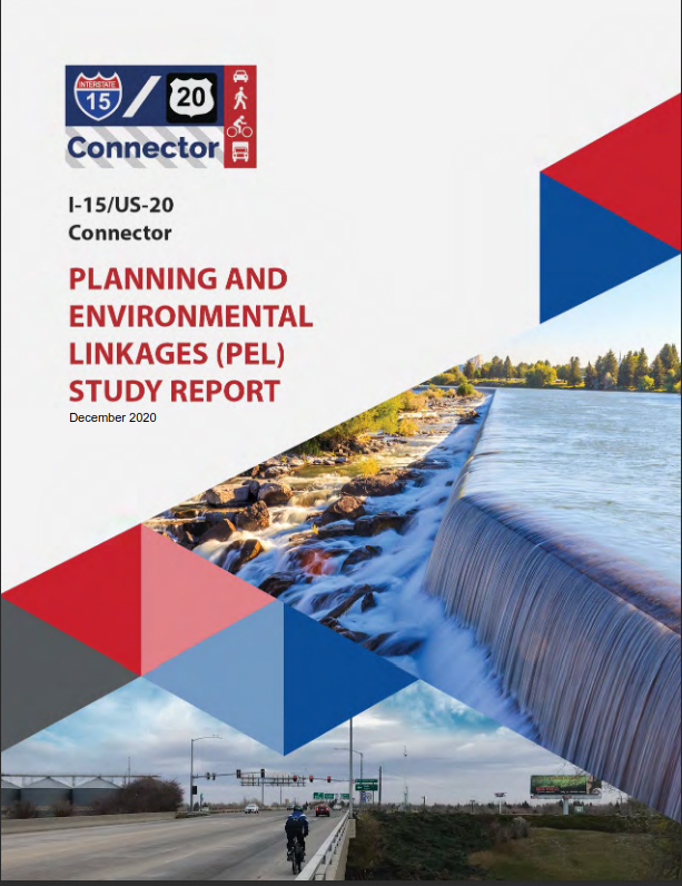
The Idaho Transportation Department’s first planning and environmental linkages study helped shorten the project timeline and build community support.
Credit: Idaho Transportation DepartmentMaine Accelerates Bridge Replacement with SPMTs
The Maine Department of Transportation (MaineDOT) used accelerated bridge construction techniques to replace an aging bridge carrying Interstate 295 over Veranda Street in Portland. The Veranda Plan project involved building the upper portion of the new bridge to the side of the existing one on temporary supports. At the same time, the new bridge foundations were built beneath the existing bridge. Then, during a weekend road closure, the new bridge was lifted and slid into place using self-propelled modular transporters (SPMTs). This was MaineDOT’s first use of SPMTs for slide-in bridge construction. MaineDOT also incorporated virtual public involvement techniques, including virtual meetings and a project story map, to encourage stakeholder engagement, explain the need for the project and road closure, gather comments, and answer questions.
Maine DOT’s Veranda Plan project video tells the story of the agency’s slide-in bridge replacement on Interstate 295 in Portland.
Credit: Maine Department of TransportationOklahoma Cuts Fatal Crash Roadway Clearance Time with UAS
Measuring traffic crash scenes is an important part of an investigation that not only documents the evidence, but also forms the basis for calculations about vehicle speeds and trajectories that can point to causation and sometimes criminal charges. Using State Transportation Innovation Council funding, the Oklahoma Highway Patrol (OHP) purchased unmanned aerial systems (UAS) to map fatal crash scenes on critical interstates and other highways. The OHP previously used total station and robotic total station technologies to map collision scenes, taking an average of 1 hour and 30 minutes to 2 hours, depending on the system used. With the adoption of UAS, troopers reduced that time to just 26 minutes, a savings of between 71 and 78 percent. When adding a real-time kinematic Global Positioning System, the scene time was slightly higher at 36 minutes but still provided savings of between 60 and 70 percent.
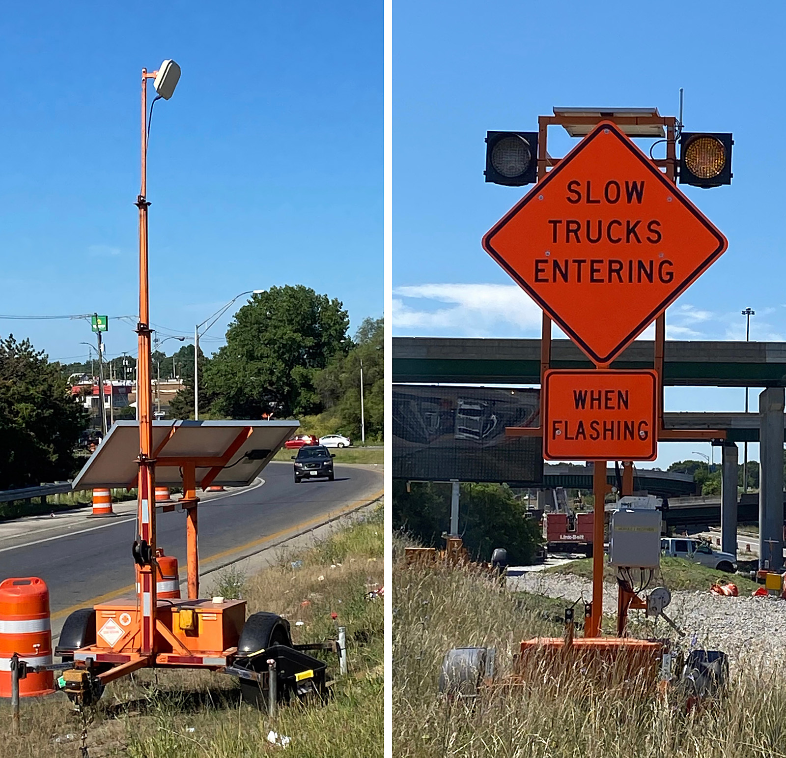
The Ohio DOT is deploying queue detection systems and flashing signs at construction exits for its I-70/71 project in downtown Columbus.
Credit: Ohio Department of TransportationOhio Employs Smarter Work Zone Technologies
The Ohio Department of Transportation (ODOT) introduced smarter work zone technology on a project in downtown Columbus to reduce the risk of congestion-related work zone crashes. To address potential backups due to construction at Interstates 70/71 and State Route 315, ODOT added queue detection systems along SR 315 south and I-70 east to warn drivers of slow traffic ahead. The system includes sensors along the road to detect the speed of traffic and relay that information to digital message boards. The message boards then alert drivers to real-time speeds, allowing them to safely slow down and avoid rear-end crashes. In an agency news release, ODOT District 6 Deputy Director Anthony Turowski stated, “With a project of this scale, it’s important to think outside of the box. These innovative tools allow us to effectively and quickly communicate real-time information to help drivers make better decisions while traveling through this area.”
The Mississippi DOT created a video to show travelers how J-turns improve driver safety and efficiency at busy multi-lane crossings.
Credit: Mississippi Department of TransportationMississippi Boosts Safety with J-Turns
In recent years, the Mississippi Department of Transportation (MDOT) has been implementing restricted crossing U-turns, also known as J-turns, throughout the State. J-turns are a type of reduced left-turn conflict intersection where drivers approaching divided highways from a side street are restricted from making direct left turns or crossings. Instead, they are required to turn right onto the divided highway then make a U-turn at a designated median opening. According to a recent MDOT news release, the J-turns are a more cost-effective choice compared to other alternatives while offering significant safety advantages for travelers by reducing the number of conflict points for vehicles crossing or turning left at a multi-lane, divided highway intersection. MDOT’s Drive Smart MS website includes a video explaining the benefits of J-turns and how to navigate them, as well as videos and information on other roadway or intersection features such as rumble strips, diverging diamond interchanges, and roundabouts.
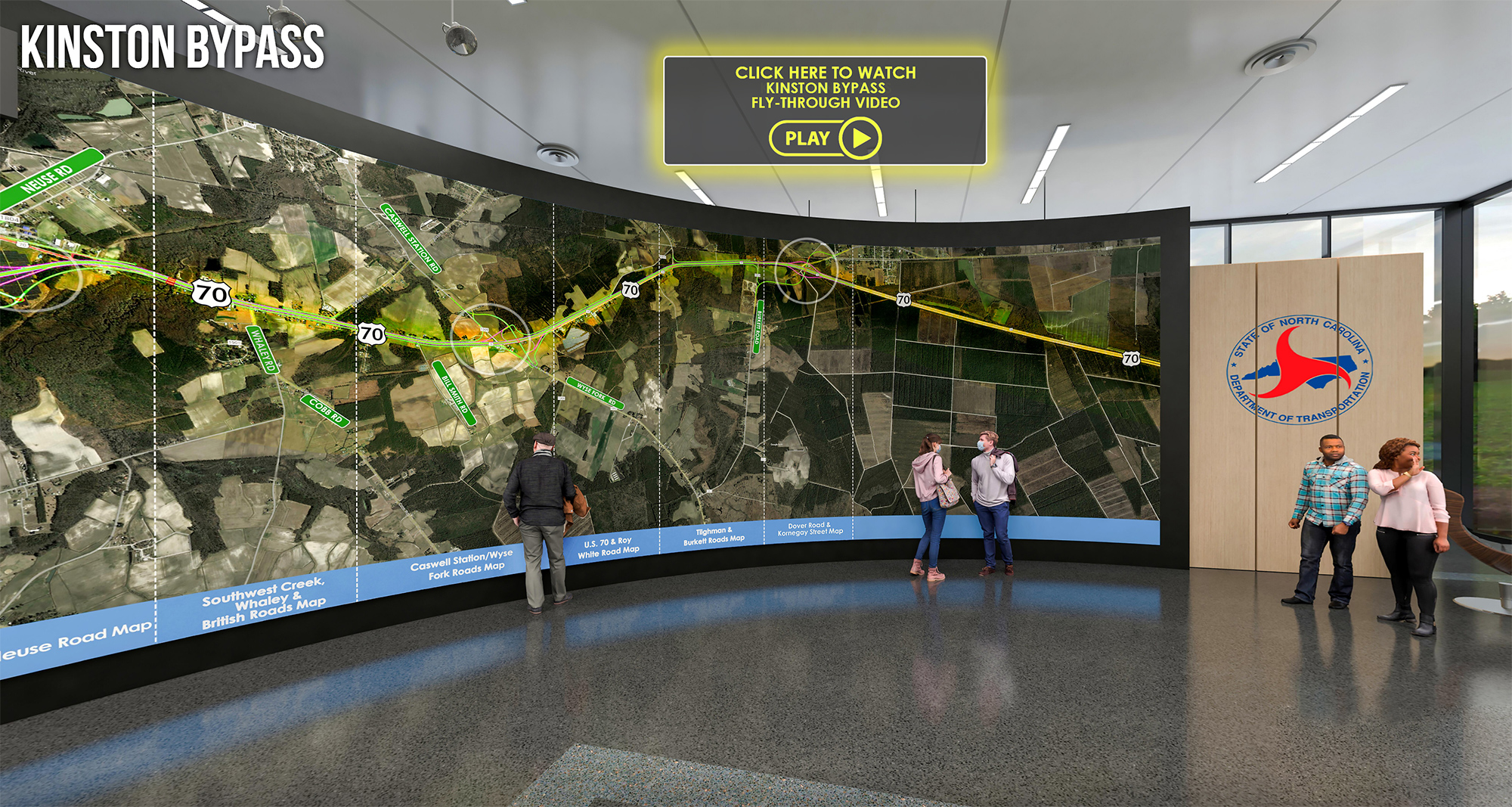
North Carolina DOT created a virtual, 3D meeting room to increase public engagement during project planning .
Credit: North Carolina Department of TransportationNorth Carolina Enhances Public Engagement
The North Carolina Department of Transportation (NCDOT) expanded its use of virtual public involvement techniques to include a new, online tool that provides a three-dimensional (3D) view of proposed projects. NCDOT developed the 3D virtual room for its Kinston Bypass project to provide an interactive way to see the preliminary design. Visitors to the website navigate through a 3D room designed to look like an NCDOT public meeting. Within the virtual room, they can look through the large map of the proposed project, watch a fly-through video of the future bypass and 30-second videos at each interchange, and explore maps of each section of the project. According to an agency news release, NCDOT plans to continue using the 3D tool for future projects.
Concrete Overlays in Missouri Save Time, Improve Safety
The Missouri Department of Transportation (MoDOT) used concrete overlays to resurface a 9-mile stretch of Interstate-44 that serves as a main connector between the Lake of the Ozarks and St. Louis. With the Lake of the Ozarks being a major recreation and vacation destination, construction-related traffic delays were a major concern; therefore, the contract specified 90 calendar days for completion. Two miles of the project involved milling 11 inches of the existing asphalt pavement and inlaying an 11-inch concrete overlay. Seven miles of the project involved placing an 8-inch unbonded concrete overlay using a geotextile fabric as the separation layer. Using this targeted overlay pavement solution, the contractor paved 219,137 square yards of concrete in 47 days and turned over the project to the State in only 66 days.
Notice: The U.S. Government does not endorse products or manufacturers. Trademarks or manufacturers’ names appear in this article only because they are considered essential to the objective of the document.
Recommended Citation: U.S. Department of Transportation, Federal Highway Administration - Washington, DC (2022) Innovator Newsletter, September/October 2022, Volume 16 (92). https://doi.org/10.21949/1521850