U.S. Department of Transportation
Federal Highway Administration
1200 New Jersey Avenue, SE
Washington, DC 20590
202-366-4000
Federal Highway Administration Research and Technology
Coordinating, Developing, and Delivering Highway Transportation Innovations
 |
| This report is an archived publication and may contain dated technical, contact, and link information |
|
Publication Number: FHWA-HRT-08-034
Date: August 2008 |
Wildlife-Vehicle Collision Reduction Study: Report To CongressPDF Version (2.92 MB)
PDF files can be viewed with the Acrobat® Reader® Chapter 9. Planning and Design ConsiderationsMany of the WVC mitigation measures discussed in this paper focus on spot or corridor solutions where WVCs are already a problem on existing roadways. However, integration of transportation planning and wildlife management on a regional level can impact WVCs. Typically these planning efforts are focused on mitigating environmental impacts. The context-sensitive design and context-sensitive solution (CSD/CSS) process may be a way to incorporate consideration of WVCs in planning and design. This section discusses selected planning efforts that can have an impact on reducing WVCs, including the following:
Identifying and Prioritizing WVC Problem AreasWVC "hot spots" can be identified with crash and carcass data. To develop an understanding of the root causes of WVCs, one must also consider a context broader than simply the site of an animal carcass. This approach is multidisciplinary in nature and involves landscape ecology (a discipline that stresses understanding of the interactions of physical and biological phenomena at multiple spatial and temporal scales) and conservation biology (a discipline that integrates biological, social and physical sciences to develop a sound basis for the conservation, management, and restoration of biological resources). These scientific fields of study can lend understanding to the effects of spatial patterns, ecological processes, animal behavior, and related factors. Design of transportation systems and ecological networks (habitat linkage zones or greenways) should be based on such concepts. In turn, this scientific knowledge can be used in coordinated planning at multiple scales (e.g., site, local and regional planning) to address WVCs in broader contexts, thus avoiding such conflicts whenever possible. In order to focus limited resources, some states have identified and prioritized habitat linkage zones that act as corridors for animals to move between major areas of habitat (e.g., development of Wildlife Habitat Linkage Plans). Again, the primary motivation is to improve habitat connectivity for wildlife and not necessarily to reduce WVCs. However, with proper planning these habitat corridors can focus animal movement to specific locations along the highway, which in turn allows for more focused mitigation of WVCs at those crossing locations. There are a number of methods for prioritizing habitat linkage zones. One method is to look at existing WVC data to identify hot spots. Although this is a primary input for many prioritization methods, by itself it is not very forward looking, because changes in land use patterns can cause changes in animal movements. Also, there are many other sources of information that can be used to identify potential future WVC problem areas, such as known locations of threatened and endangered species and known migration corridors. Ruediger has been involved in a number of regional and statewide wildlife habitat linkage plans.(383) In formulating such plans, he suggests using a variety of data including aerial photos, vegetation maps, topography maps, wildlife habitat and range maps, and roadkill information. Another important source of information is local knowledge, which can be accessed by holding a workshop with appropriate stakeholders. The aforementioned data should be collected and presented on maps for this workshop. Also, a method for selecting prioritized linkage zones should be determined prior to the meeting. It is important to record information about the linkage zones identified (e.g., location, species of concern, local agencies and individuals with special knowledge of the linkage zone, major purpose of the linkage zone, and a prioritization ranking for the linkage zone). According to Levy, a prioritized linkage zone map was created for Arizona.(384) The map was created during Arizona's Missing Linkages Workshop in April 2004. The workshop included representatives from ADOT, FHWA, U.S. Fish and Wildlife Service, Arizona Game and Fish Department, U.S. Department of the Interior's Bureau of Land Management, Tonto National Forest, and Northern Arizona University. This initial map was refined during six ecoregional workshops in November 2004. Geographic Information Systems (GIS) databases were helpful in obtaining some of the data that were used in prioritizing the linkage zones. The University of Alaska Anchorage produced a "toolbox" for the Alaska Department of Transportation and Public Facilities to assess how Alaskan roads affect habitat quality and connectivity.(385) The project specifically addressed the use of GIS to assist transportation planners with project development. Based on workshops, GIS data sets, and relevant literature, the effort identified high-priority areas for habitat linkage based on four criteria: Places where good data exist on habitat features and that represent the diversity of ecosystems. Riparian corridors. Places where funding can be leveraged. Places that can provide a source of baseline data. The Florida Department of Transportation has created a program to identify and prioritize habitat linkage zones that intersect with highways.(386) The purpose of this program is to consider underpasses or culverts on a statewide level in order to restore habitat connectivity and ecological processes. This method uses a rule-based GIS model to assimilate multiple factors such as roadkill hot spots, riparian areas, greenways, protected conservation lands, and known wildlife movement routes. The Idaho Transportation Department identified wildlife connectivity areas using an approach that integrated GIS spatial data, GIS linkage model analysis, and expert workshops to identify areas of interest for mitigation consideration in the southeast corner of the state.(387) A number of models predict optimal crossing locations for specific species such as Key deer in Big Pine Key, FL, and grizzly bear in the area around Evaro Hill, MT.(388,389) Once habitat linkage zones are identified and prioritized, efforts need to be made to preserve them. A crossing structure can be constructed in a high WVC zone only to have development adjacent to the highway block animal movement so the animals cross at another location along the highway. This type of effort is inherently multi-agency in nature and should involve local land grants, cities, counties, special interest groups, land owners, resource agencies, rail lines, and State DOTs. A team is attempting to follow this process for Interstate 90 on Bozeman Pass in Montana. The team includes Gallatin Valley Land Trust, Forest Service, Montana Department of Transportation, Montana Rail Link, American Wildlands, and others. This location is clearly a habitat corridor as two areas of the Gallatin National Forest are separated by a corridor that includes private land under heavy development, an interstate, and a rail line. Any effort to preserve the corridor by a single agency would be ineffective, because increased interstate traffic and increased development each threaten to block animal movement. However, by prioritizing specific crossing locations, land trusts can focus efforts to preserve adjacent lands, and the Montana Department of Transportation can optimize its investment in mitigation measures on the interstate. The effort must go beyond prioritizing greenways to incorporation of linkage zones into transportation and conservation planning elements (of comprehensive plans) that are developed at both local and state levels of government. At a minimum, the statewide transportation improvement program should be reviewed annually for reconstruction projects that cross these habitat linkage zones. Incorporating WVC mitigations into a reconstruction project (especially at the initial project planning stage) will be much less expensive than installing them as separate projects. Case Studies and ContactsFor information on efforts in Arizona, contact Steve Thomas, Environmental Program Manager, FHWA Arizona Division, steve.thomas@fhwa.dot.gov. For information on Florida's prioritization efforts, contact Dan Smith, Western Transportation Institute, (406) 994-6114, dan.smith@coe.montana.edu. For general methodologies for prioritizing habitat linkage zones, contact Bill Ruediger, Wildlife Consulting Resources, (contracted by USDA Forest Service, Wildlife, Fish and Watershed Unit, Washington Office) bruediger@fs.fed.us. For information on the Bozeman Pass collaboration in Montana, contact Deborah Wambach, Montana Department of Transportation, (406) 444-0461, dwambach@mt.gov; or Josh Burnim, American Wildlands, (406) 586-8175, jburnim@wildlands.org. For general information on the planning process, consult chapter 6 in National Research Council, chapter 3 in NCHRP Synthesis 305 by Evink, chapters 6 and 7 in Moore and Thorsnes, and the following Web sites: FHWA, www.fhwa.dot.gov/planning/, and American Planning Association, www.planning.org.(86,302,390) Data Collection and MonitoringLike prioritizing habitat linkage zones (discussed in the previous section), data collection and monitoring will not have direct benefits in reductions of WVCs, but without good data on the magnitude, location, and type of WVCs, all other mitigations discussed in this report cannot be installed at the locations where they will have the most impact. WVC data are crucial in justifying and prioritizing locations for mitigation. Additionally, in order to utilize the most effective mitigations for WVCs, the effectiveness of currently installed measures must be evaluated. As discussed in the chapter on Causes and Factors, there are three primary sources of WVC data: insurance data (which are not spatially located), crash reports, and animal carcass counts. The NCHRP Project 20-05–Topic 37-12 provides a current state of the practice on WVC data collection. The report for this project is currently in draft form.(31) A survey conducted as part of this report asked states if they collected WVC data (crashes or carcasses). Of the 30 State transportation departments that responded to the survey, 19 collected crash data on WVCs, 13 collected carcass data, and 8 collected neither. It should be noted that although the states reported that they did not collect WVC data, a review of crash reports shows that every state except one has "animal" as a check box on the crash form. Of the 30 responding state departments of natural resources, 9 said they collected crash data, 15 said they collected carcass data, and 12 said they collected neither. There is also a dramatic drop in data collection on local and collector roads compared to interstates and arterials. Many states discussed problems with the data, including inconsistencies, location accuracy, and underreporting. There are currently efforts underway to improve WVC data. For collecting carcass data, the Maryland Department of Transportation has a program Large Animal Accident Removal Reporting System (LARRS) that is implemented from the top down so that there is a consistent standard within the department. This program is integrated with an existing form for maintenance tasks that maintenance workers are required to fill out regardless of carcass data collection. Since maintenance workers are required to fill out the form anyway, they are more likely to accurately complete the required form (as opposed to adding another form exclusively for carcass data). To assist with data collection of carcasses, GPS-enabled handheld computers (personal digital assistants) have been developed, mostly as prototypes. One such system is the Roadkill Observation Collection System (ROCS) currently under development by the Western Transportation Institute. Another potential source of data is the use of volunteers. Case Studies and ContactsFor information on the Maryland LARRS carcass data collection method, contact William Branch, Maryland Department of Transportation, (410) 545-8626, WBranch@sha.state.md.us. For more information on handheld GPS units for automatically collecting data (ROCS), contact Amanda Hardy, Western Transportation Institute, (406) 994-2322, ahardy@coe.montana.edu. Alternative Alignment, Road Removal, or No New RoadIntegration of transportation and conservation planning at multiple scales is essential to addressing WVCs. With this integration, the transportation network can be developed with consideration of ecologically sensitive areas, and some efforts can be made to minimize environmental impacts in locating new roads and possibly closing existing roads. Typically these efforts are aimed at conservation but can have an impact on reducing WVCs. There are several models that are used to assess the ecological impact of new roadway alignment options on wildlife. Maurer developed one such model for the Pennsylvania Department of Transportation.(391) A community-based, landscape-level terrestrial decision support system was developed with the objective to maintain the ecological integrity of Pennsylvania ecosystems. This model is founded on seven basic characteristics: comparison, reasonableness, practicality, sensitivity, data, process, and decision making. Variables for Assessing Reasonable Mitigation in New Transportation (VARMINT) include habitat importance, stewardship, patch size and shape, connectivity, proximal land use, relative significance, natural processes, diversity, anthropic use, and intangibles. Each site is assigned scores for each of these criteria. Comparison of scores determines relative ranking. CSD/CSS processes are used to incorporate community values, aesthetics, and environmental and other priorities into the design process. Using the CSD/CSS process could result in alignments that minimize the impact of WVCs. For more information on the overall CSD/CSS process, refer to the following reports: NCHRP 480,A Guide to Best Practices for Achieving Context Sensitive Solutions.(392) AASHTO Guide for Achieving Flexibility in Highway Design.( 393) NCHRP Report 69, Performance Measures for Context Sensitive Solutions: A Guidebook for State DOTs.(394) Note that this report details how to develop a CSD/CSS program and track performance with surveys. Although there is some discussion on developing performance criteria (at the project and programmatic level), specific measures are not discussed as the title may imply. In 2003, the California Department of Transportation closed a functional but little-used highway interchange (e.g., on ramps, off ramps and underpass) on State Route 91 called the Coal Canyon Interchange. The mainline is eight lanes with 200,000 vehicles per day, but the interchange was used by fewer than 150 motorists per day. The main motivation for the closure was connecting habitat between Chino Hills and Cleveland National Forest. However, WVCs were another consideration due to mountain lion roadkills.(395) The underpass (in combination with fencing) now serves as a critical connection in a wildlife migration route.(395) Closing the Coal Canyon Interchange was seen by one city as a loss of tax revenue since it limited development on one side of the highway. There will likely be heavy opposition to such closures by some landowners based on concerns regarding reduced property values and ability to develop property. Obviously, significant resources went into the original construction and maintenance of the roadway and removing a roadway essentially wastes that initial investment in infrastructure. A better option is to more strategically plan the transportation network (e.g., do not build the road in the first place). However, in some cases it may be feasible to remove a roadway given the right mix of limited development, public grass roots support, and preservation of surrounding habitat. The Coal Canyon project cost $440,000 to remove the roadway underpass, remove the on/off ramps, provide a median turnaround for emergency vehicles, and provide fencing to guide animals to the underpass. Note that $40,000,000 was used to purchase the surrounding land to protect the habitat. Most other examples of removing roadways in the United States involve gravel roads on public lands (e.g., forest service roads). As Switalski and others point out, the impact to wildlife has not been monitored or researched.(396) Switalski and others suggest costs for road removal are as follows:
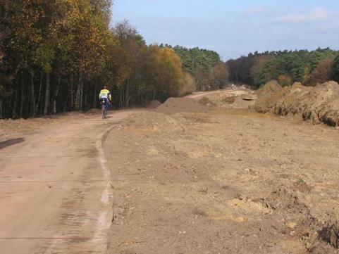
Figure 59 shows a road removal in process in Belgium. In this case there was an alternate route, and this roadway was considered unneeded. It was replaced by a nonmotorized multiuse pathway. Figure 59. Photo. Road removal in progress in Belgium . (note that a path for pedestrians and bicyclists remains in place). (copyright: Bethanie Walder). Case Studies and ContactsFor further information on the Coal Canyon Interchange removal, contact California Department of Transportation, District 12, (949) 724-2000. Although primarily focused on roads on public lands, a good source of information on road removal is the Wildlands Center for Preventing Roads, http://www.wildlandscpr.org/ (accessed January 25, 2007). Consideration of Design FeaturesConsideration of some basic WVC mitigation principles in designing various elements of a highway could minimize the potential for WVCs. Some of these items have been discussed in the previous chapters but could be implemented as part of the initial design and thus are mentioned here. The following items should be considered when designing roadways that have a high likelihood for WVCs (see chapter 2), such as two-lane, rural/suburban, low-/medium-volume highways that pass through wildlife habitat:
|