
FHWA Supports:


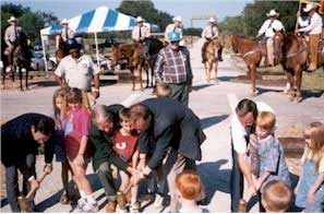
Photo from the National Transportation Enhancements Clearinghouse
Mineral Wells to Weatherford Rail-Trail, Mineral Wells, TX.
Opening day and dedication of the Mineral Wells to Weatherford Rail Trail.
(Photo: Texas DOT).
Return to Presentation Index · Return to Top · Next Slide
Return to Presentation Index · Return to Top · Next Slide
Return to Presentation Index · Return to Top · Next Slide
Return to Presentation Index · Return to Top · Next Slide
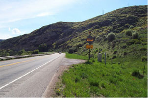
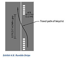
Rumble Strips
Return to Presentation Index · Return to Top · Next Slide
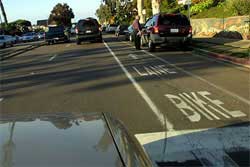
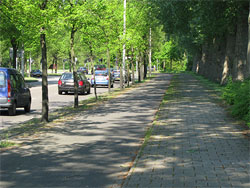
Bicycle Lanes: On-street lane for bicyclists.

Return to Presentation Index · Return to Top · Next Slide
Sometimes left side.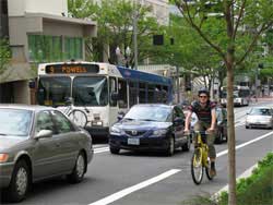 |
Sometimes contraflow.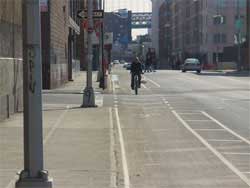
|
Return to Presentation Index · Return to Top · Next Slide
Return to Presentation Index · Return to Top · Next Slide
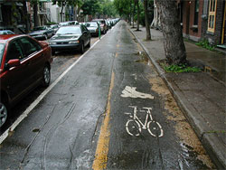
Cycle Tracks: Controversial
Return to Presentation Index · Return to Top · Next Slide
Return to Presentation Index · Return to Top · Next Slide
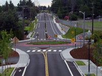
Photo from Bicycle Countermeasure Selection System
(BIKESAFE).
Roundabouts
Return to Presentation Index · Return to Top · Next Slide
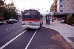
Possible Bicycle Treatment for Bridges and Roundabouts:
Olympia WA.
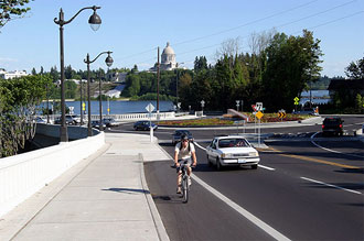
Photo from the Pedestrian and Bicycle Information Center.
Olympia, Washington.
Taken in 2006 by Dan Burden
Return to Presentation Index · Return to Top · Next Slide
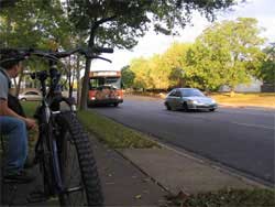
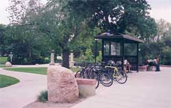
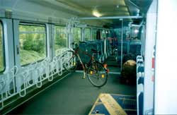
Photos from the Pedestrian and Bicycle Information Center.
Left: Austin, Texas. Taken in 2008 by Greg Griffin, AICP
Middle: Boulder, Colorado. Taken in 2004 by Austin Brown
Right: Train in Denmark. Taken in 2006 by Dan Burden
Return to Presentation Index · Return to Top · Next Slide
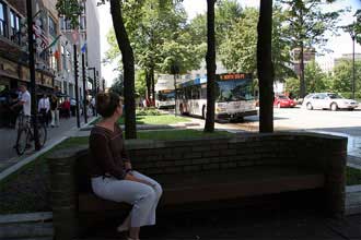
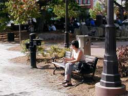
Photo from the Pedestrian and Bicycle Information Center.
Madison, Wisconsin. Taken in 2006 by Dan Burden
Return to Presentation Index · Return to Top · Next Slide
Eligible: Facilities related to transportation.
Photos from the Pedestrian and Bicycle Information Center.
Left: United States .Taken in 2006 by Dan Burden
Right: United States. Taken in 2006 by Annie Lux
Return to Presentation Index · Return to Top · Next Slide
Return to Presentation Index · Return to Top · Next Slide
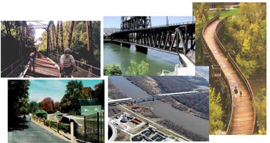
4 photos from the National Transportation Enhancements Clearinghouse.
Top right: Osage Prairie Trail, Tulsa OK.
Top middle: Steel Bridge, Portland OR
Bottom left: Farmington Canal, Cheshire CT
Right side: Soo Line "S" Bridge, Eau Claire WI
Bottom middle: Rich Zelensky, Nebraska Department of Roads, through the River Valley Trail Riders, Council Bluffs IA.
Return to Presentation Index · Return to Top · Next Slide
Return to Presentation Index · Return to Top · Next Slide
Return to Presentation Index · Return to Top · Next Slide
Return to Presentation Index · Return to Top · Next Slide
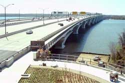
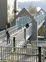
Woodrow Wilson Bridge: I-95 VA, MD, DC
Photo source: www.wilsonbridge.com/index.php/project-history/completed-activities/pedestrian-bike-path-update
Return to Presentation Index · Return to Top · Next Slide
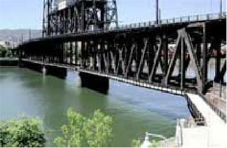
Steel Bridge, Portland OR
Photo: Mia Birk, Alta Planning + Design. From USDOT Report: Rails-with-Trails: Lessons Learned.
Return to Presentation Index · Return to Top · Next Slide
| Osage Prairie Trail Tulsa, OK 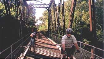
|
Soo Line "S" Bridge Eau Claire WI 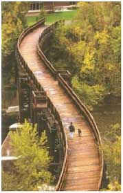
|
Photos from the National Transportation Enhancements Clearinghouse.
Return to Presentation Index · Return to Top · Next Slide
Farmington Canal Linear Park, Cheshire CT
Photo from the National Transportation Enhancements Clearinghouse.
Farmington Canal, Cheshire CT
Return to Presentation Index · Return to Top · Next Slide
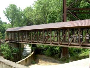
Ohio & Erie Canal Towpath Trail, Akron OH
Photo source: Stuart Macdonald, American Trails
Owner: City of Akron
Engineer: Akron Engineering Bureau.
Contractor: Cavanaugh Building.
Project Description
The Ohio & Erie Canal Towpath Trail extends over 100 miles from Cleveland to New Philadelphia. The Cascade Locks Bikeway is one of several trail sections being developed by the City of Akron. The City needed a bridge to extend the trail over the canal and under an active railroad track.
"The challenging site conditions were one of the issues and the active railroad hauling stone on the trestle above was another," said Mike Teodecki, Akron Engineering Bureau's project engineer for this section of the trail. "Stone fragments often fall off the trestle and that is a safety concern."
Considering site restrictions, limited access to one side of the canal, as well as requirements to stay within the park boundaries, designers recommended installing a Gateway® pedestrian bridge diagonally across the canal. Though the structure has a length of 130', it fits nicely within the space allotted. In addition, to protect the pedestrians from falling debris, a metal-pitched roof was installed.
Cavanaugh Building, the general contractor, installed the bridge for the City using two large cranes. The cranes were placed on opposite sides of the canal. From there, they lifted the structure and carefully moved it under the trestle and onto the abutments. In spite of the close quarters, the installation was done in a day.
Return to Presentation Index · Return to Top · Next Slide
Rail Bridge to Trail Bridge
Walkway Over the Hudson
Poughkeepsie - Highland NY
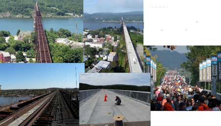
You might want to make sure this can hold tractor trailers!
Photo source: Stuart Macdonald, American Trails
See more at www.americantrails.org/photoGalleries/cool/16-Hudson-Poughkeepsie-rail-trail-bridge-photos.html
Return to Presentation Index · Return to Top · Next Slide
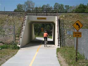
Clear Creek Trail crossing under Burlington Northern Railroad embankment,
Jefferson County, CO;
photo by Stuart Macdonald, August 1, 2009.
Return to Presentation Index · Return to Top · Next Slide
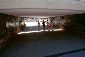
Photo from the Pedestrian and Bicycle Information Center.
Boulder, Colorado. Taken in 2006 by Dan Burden.
Return to Presentation Index · Return to Top · Next Slide
Return to Presentation Index · Return to Top · Next Slide
Return to Presentation Index · Return to Top · Next Slide
 Christopher B Douwes
