FHWA Supports:


(with additional slides for recreational trail context, corrections to accessibility information,
and slides for recreational bridges)
(Download Powerpoint Version / 4.9 MB)
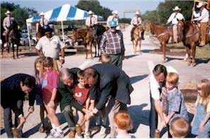
Photo: Transportation Alternatives Data Exchange (TrADE).
Mineral Wells to Weatherford Rail-Trail, Mineral Wells, TX.
Opening day and dedication of the Mineral Wells to Weatherford Rail. (Photo: Texas DOT).
Transportation Alternatives Program
Recreational Trails Program
Federal Highway Administration
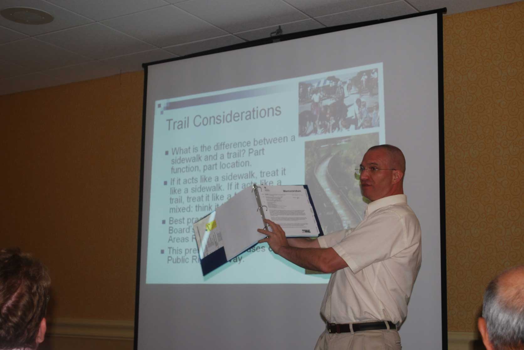
Photo of Christopher Douwes, Community Planner, FHWA, presenting at FHWA Civil Rights Discipline Training, June 23, 2009, Albuquerque NM. Photo: Henry Droughter, Equal Opportunity Specialist, FHWA Pennsylvania Division
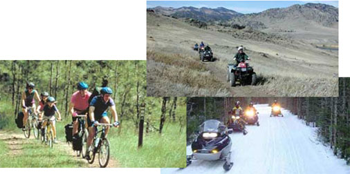
Photos from the Recreational Trails Program website.
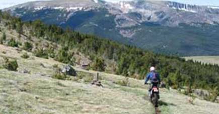
Left: Mountain bike trails at Butte State Park, Montana.
Top right: ATV trail on the Bull Run Guest Ranch near Cascade, Montana.
Bottom right: Snowmobiles at Eagle River, Wisconsin.
Photos from the Recreational Trails Program website
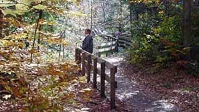
Left: Visitors enjoy a fenced trail near the Cycling the Pass stop on McKenzie Pass - Santiam Pass Scenic Byway, Oregon.
Right: Two-wheeling in the Lewis and Clark National Forest near Neihart, Montana.
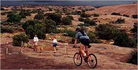
Photo from the Recreational Trails Program website.
Hikers and bikers both enjoy the Slickrock Trail in Moab, Utah,
despite threatening storm clouds from the north.
©2000. A. Crane.
What is the trail purpose?
Surface: Firm and stable for accessibility.
But not all recreational trails will be accessible.
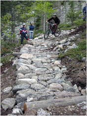
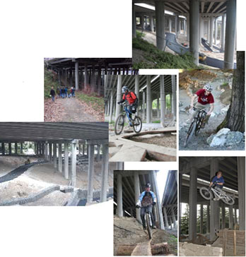
Photos: From International Mountain Bicycling Association.
Publication developed with funding in part through FHWA's Recreational Trails Program.
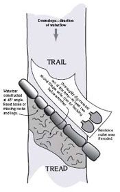
Grade reversals stop water flowing down the trail.
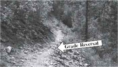

Photo: USDA Forest Service, Trail Construction and Maintenance Notebook.
Drawing: International Mountain Bicycling Association.
Easy way to get water off an existing trail.
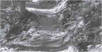
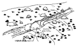
Photo and Drawing from USDA Forest Service, Trail Construction and Maintenance Notebook.
| PROW | ORAR | Trail | |
| General: | 2% | 3% | 5%, 3% preferred |
| Exception: | 5%* | 5%** | 10%** |
* At street crossings without stop control or at midblock.
** If needed for drainage on an unpaved surface.
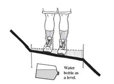
If your ankles start to roll, the tread has too much outslope.
Drawing from USDA Forest Service, Trail Construction and Maintenance Notebook.
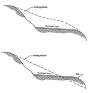
Prefer a "full bench cut" over a "half bench" cut.
Drawings from USDA Forest Service, Trail Construction and Maintenance Notebook.

Drawing from USDA Forest Service, Trail Construction and Maintenance Notebook.
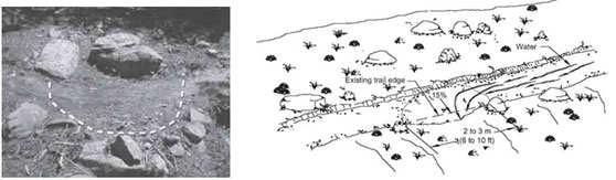
Photo and Drawing from USDA Forest Service, Trail Construction and Maintenance Notebook.
Drawing from USDA Forest Service, Trail Construction and Maintenance Notebook.