


April 9, 2020
Innovation of the Month:
Unmanned Aerial Systems
Last week, we introduced you to unmanned aerial systems and several of their uses and benefits. States are using UAS to enhance their program and project delivery to great success.
The West Virginia Division of Highways (WVDOH) has completed over 500 flight missions including mapping, reconnaissance, and construction inspection. WVDOH currently is piloting the use of UAS on three large construction projects. On the first project—a four lane divided highway on a new alignment— WVDOH is using UAS on a regular flight schedule for material estimation. Often, access to large construction sites is limited and dangerous due to earth moving techniques and equipment. The UAS data-gathering flights can be performed in a fraction of the time it would take a field survey crew. In most cases, the UAS are only in flight for 30 minutes or less and can be launched and viewed from a secure and safe location.
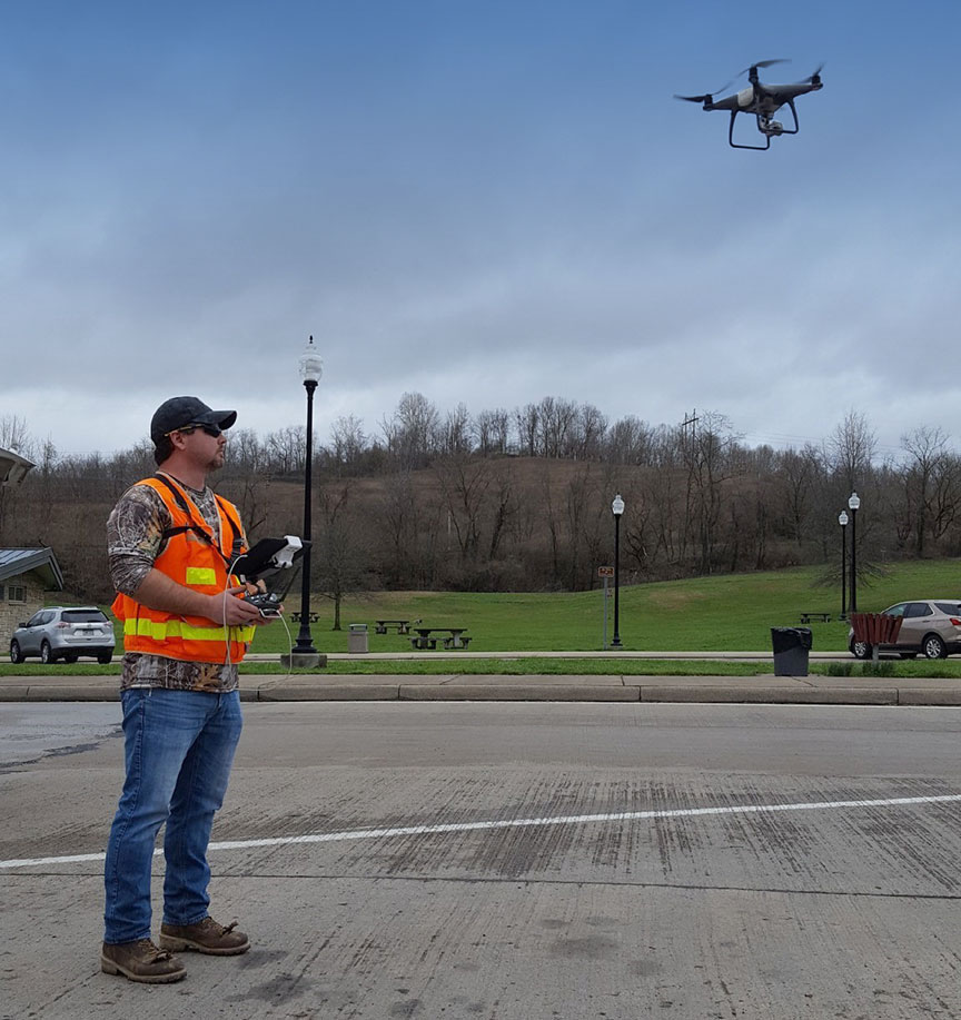
In another case, the West Virginia Department of Commerce wanted to spotlight a high-profile project featuring changing traffic patterns. WVDOT used UAS footage to produce videos showing project progress, which have proven to be very effective for public outreach.
In a third project—another four lane highway on new alignment that goes through a portion of a national forest —WVDOH has begun collecting data through UAS to share project impacts and progression with resource agencies while reducing the number of visitors inside the construction zone. The team is leveraging artificial intelligence to control the flight of the drone over a seven-mile path following the proposed new centerline of the road. Periodic flights will follow this path throughout the project’s life. The information provided by these flights will reassure stakeholders that the project’s impacts meet expectations while working in the national forest.
To learn how your agency can effectively use UAS, please contact James Gray or John Haynes with the EDC-5 UAS team.
Recycle the Value of That Bridge!
Did you know you can “recycle” transportation assets? We’re not about conserving landfill space—asset recycling is a value capture method that generates new revenue for highway agencies by selling or leasing government-owned assets like toll highways, bridges, or excess rights-of-way to private sector investors.
In Indiana, the lease of the 157-mile Indiana Toll Road enabled the state to retire $225 million in debt and use the remaining funds to pay for other infrastructure projects. In 2015, Indiana awarded a new $5.725 billion, 66-year lease and transferred ownership of the toll road to a new investor. The concessionaire is spending $260 million in capital improvements to pavement, bridges, and travel plazas.
With the lease proceeds, Indiana has funded more than 773 projects totaling $3.13 billion, established a trust fund with $500 million to pay for projects into the future, and distributed approximately $500 million to local governments. Accelerating these projects avoids rising construction costs and creates a friendly business environment, resulting in a competitive advantage for the state and encouraging economic development.
Does your state have assets to recycle? To find out how value capture methods can improve your bottom line, contact Stefan Natzke, FHWA Office of Planning, Environment, and Realty, or Thay Bishop, FHWA Center for Innovative Finance Support.
Agencies Reduce Flooding Impacts on the Public through Enhanced Traveler Information
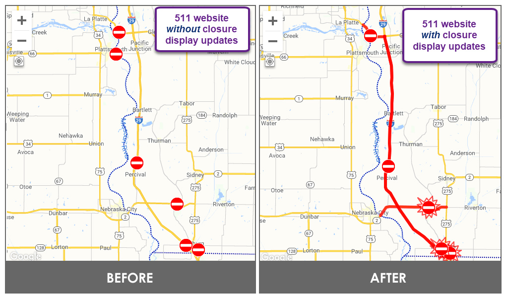
As part of their Weather-Responsive Management Strategies (WRMS), several agencies have modified their traveler information systems in an effort to provide better flood-related data to travelers. The Iowa Department of Transportation (IDOT) re-designed its traditional closure icons on its 511 traveler information map to improve public understanding of the impact of major flooding events. The addition of a painted line showing the extent of closures has been effective and is now used for construction and other events, as applicable.
Recognizing the need for better information about high-potential flooding areas, the Houston area’s regional transportation management center, Houston TranStar, coordinated with agency partners to develop flood thresholds for notifying the traveling public. The notifications for rainfall rates and stream levels are based on information from 170 flood sensors around the region. Once the threshold is exceeded, an alert triggers that pushes notifications to registered users and displays information on the traveler map, which is frequently referenced on social media. The alerts encourage travelers to exercise caution and avoid travel in identified areas where flooding is likely.
To learn more about how Iowa and Houston are enhancing their traveler information to mitigate flooding impacts, contact Tina Greenfield with IDOT or Valerie Taylor with Houston TranStar. For additional WRMS information and publications, check out the WRMS Toolkit. To learn more about how you can implement systems like this in your agency, contact David Johnson, EDC-5 team lead for WRMS.
About EDC
Every Day Counts, a State-based program of the Federal Highway Administration’s Center for Accelerating Innovation, works with State, local, and private sector partners to encourage the adoption of proven technologies and innovations to shorten and enhance project delivery.