
The Acadiana Planning Commission (APC) houses the Acadiana MPO (AMPO). The APC comprises a seven parish region, while AMPO fits within a subarea of six parishes. The AMPO area encompasses all of Lafayette Parish and portions of Acadia, Vermilion, Iberia, St. Landry and St. Martin Parishes. The AMPO Study Area is approximately 650 square miles with a population of 340,389.
The primary purpose of a travel demand model is to “help in making well-informed transportation policy decisions by showing the likely effects of policy changes on the transportation network. They can also show how changes in employment, population, land use, and development patterns, as well as investments in transportation infrastructure, might affect travel in a region.”1 The AMPO model is used to answer transportation planning questions and inform policy decisions in the Acadiana region. Some of these include:
The 2010 Census Lafayette Urbanized Area boundaries were expanded to include greater portions of Iberia, Acadia, Vermilion, St. Martin and St. Landry Parishes. On July 18, 2012 the United States Department of Transportation designated AMPO as a Transportation Management Area (TMA). AMPO worked with the Louisiana Department of Transportation and Development (DOTD) to identify the planning area boundaries. The AMPO study area increased from 426 sq. miles to 650 sq. miles and from a population of 245,619 to a population of 340,389.
Robust, sustained growth is expected in the AMPO study region through the year 2040. The region’s population is projected to increase by 148,000 new residents (44%) from 2010 to 2040. Figure 1 shows the Year 2010 AMPO household population by transportation analysis zone (TAZ), and AMPO’s location within Louisiana. Lafayette, in the center of the planning area, is approximately 60 miles east of Baton Rouge.
Traditionally, this MPO area is largely traveled by auto. There are no marine ports, few railways, and two small airports. Trucks move most of the commerce through the AMPO area via two major interstates, I-10 and I-49. I-49 terminates at I-10 in Lafayette and becomes the signalized highway, US-90. The largest planned project in the region is the conversion of parts of US-90 into a freeway, called the I-49 Connector Project. Bike and pedestrian access is limited, but is growing. Transit represents less than 2% of all trips within the region.
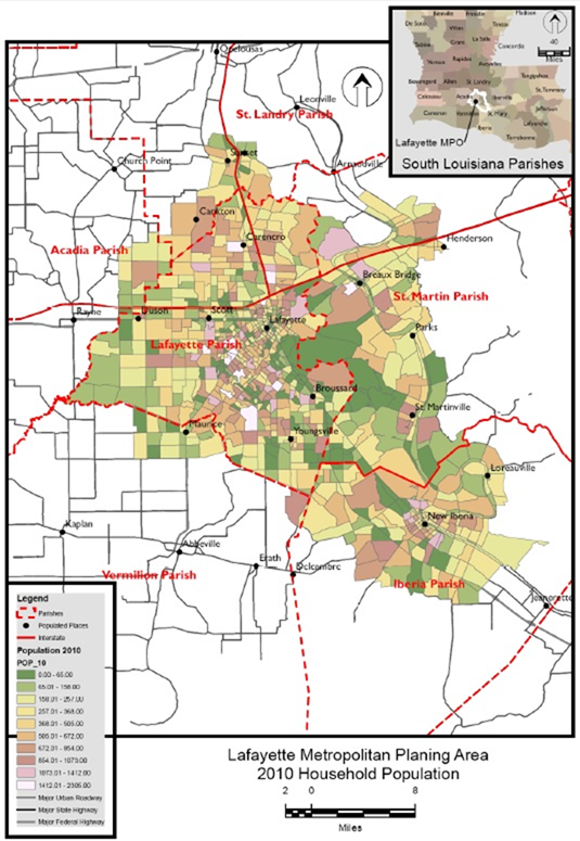
Figure 1 AMPO Regional Boundary and Household Population
(Source: APC, October, 2016.)
1 Peer Review Process Guide: How to Get the Most Out of Your TMIP Peer Review. FHWA, Travel Model Improvement Program.

