
DVRPC functions as the Federally designated metropolitan planning organization (MPO) for the Philadelphia region. The primary responsibilities of the MPO's transportation modeling group include the following:
In addition, DVRPC's modeling group is responsible for developing and maintaining the region's transportation model.
DVRPC is the planning organization for the Greater Philadelphia region, which constitutes 2 States, 9 counties, and 351 municipalities. The region covers 3,800 square miles and has a population of roughly 5.6 million people and 2.1 million households. By 2040, the population is projected to exceed 6.2 million. Figure 2‑1 shows the geography of the region.
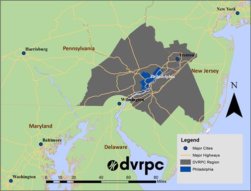
(Source: DVRPC Presentation to Peer Review Panel, October 29, 2014.)
The region's urban core is located in Philadelphia and represents the region's largest activity center. There are several other urban and suburban activity centers as well, including Trenton, Camden, and the King of Prussia area. The periphery of the region is dominated with many rural and farming areas. Figure 2‑2 shows the land use characteristics of the region. In total, less than a third of the region's land is developed, with the majority being used for agriculture or otherwise vacant.
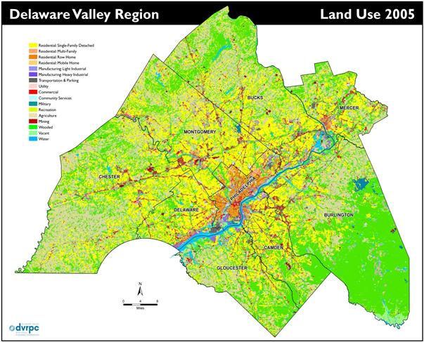
Figure 2‑2: DVRPC Land Use Characteristics
(Source: DVRPC Presentation to Peer Review Panel, October 29, 2014.)
Figure 2-2 depicts the spatial distribution of land use categories across the DVRPC region. Development is centered in Philadelphia, and development intensity decreases as one moves from the city core to the outer reaches, with pockets of development paralleling the region's major corridors. Much of the region's periphery is used for agriculture or is otherwise vacant.
The region contains 18 bridges connecting New Jersey and Pennsylvania, most of which are tolled. There are two major tolled highways in the region, but no HOV facilities. In the urban areas of the region, transit represents an important mode with upwards of 125 bus lines, 4 heavy rail lines, 9 light rail and streetcar lines, and 14 regional rail lines serving the region.

