
PSRC functions as the federally designated metropolitan planning organization (MPO) for the Seattle region. The primary responsibilities of the MPO's transportation modeling group include the following:
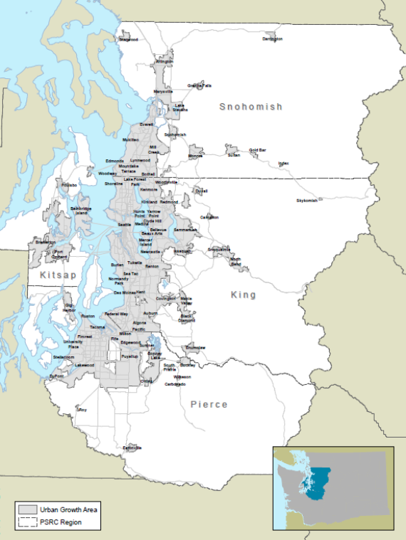
PSRC is the planning organization of the Greater Seattle region in Washington, which includes 4 counties and over 70 cities and towns. The region covers 6,290 square miles and has a population of roughly 3.8 million people. By 2040, the population is projected to reach 5 million. Figure 2‑1 shows the geography of the region.
(Source: http://www.psrc.org/assets/11419/PSRCmpo.pdf?processed=true.)
The region's urban core is located in Seattle and represents the region's largest activity center. However, Tacoma in the south, Everett in the north, Bellevue in the east (across Lake Washington), and Bremerton in the west (across Puget Sound) are all major activity centers as well, as shown in Figure 2‑2.
(Source: http://depts.washington.edu/hov/.)
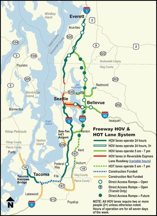
While the region has only two toll roads, there is consideration about implementing tolls on many of the region's limited access facilities (mostly existing roadways) by 2040. In fact, a recent Traffic Choices study was designed for PSRC to get a better sense of how travelers in the region would respond to tolls. The region has a number of managed/high-occupancy vehicle (HOV) facilities, including facilities along major stretches of I-5 and I-405, the two major north-south highways connecting Everett in the north and Tacoma in the south to Seattle and Bellevue. The region's HOV and high occupancy-toll (HOT) facilities are shown in Figure 2‑2.
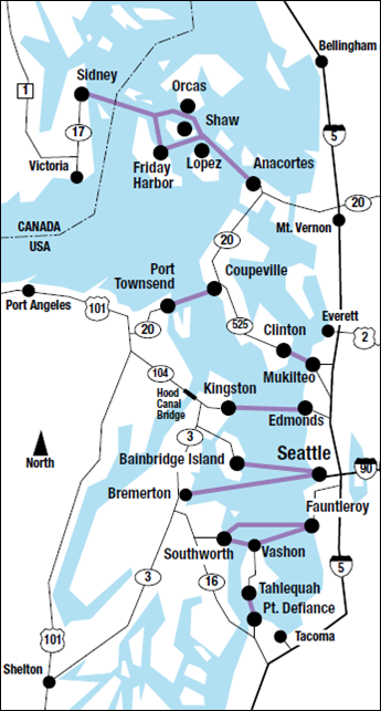
The region's ferry system (shown in Figure 2‑3), operated by Washington State Ferries, is one of the largest in the world, offering major connections between Seattle and Bainbridge, Seattle and Bremerton, Edmonds and Kingston, and Faunt and Southworth. The region's ferries serve over 20 million riders each year.
(Source: http://www.wsdot.wa.gov/ferries/pdf/2015Fall.pdf.)
The network of ferries speaks to the immense number and level of physical barriers in the region. Puget Sound, and its various inlets and bays, forms a barrier between Kitsap and King Counties. But the region also contains a number of other smaller water barriers, as well as mountains, that surround the region to the north, south, and east. These physical barriers have resulted in a number of unique transportation issues, like the ferry system and need for transit.

