Bottomless Culvert Scour Study: Phase II Laboratory Report
Appendix A: Scour Maps
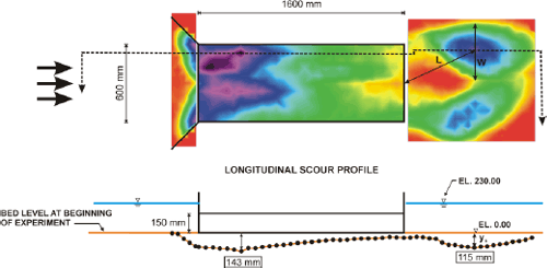
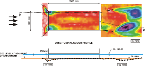
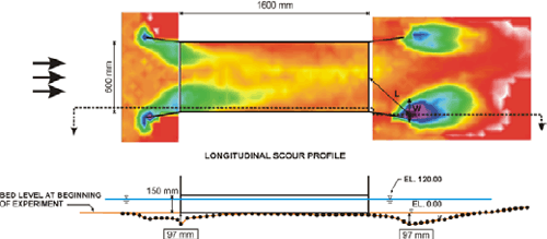
Note: D50 is 2 mm; the depth of the water, h, is 23 cm; the velocity, V, is 14 cm/s.
Figure 62. Diagram. Scour map (top) and profile (bottom), culvert submerged, February 11, 2003.
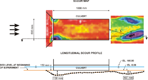
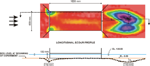
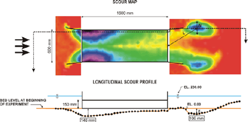
Note: D50 is 2 mm; the depth of the water, h, is 10 cm; the velocity, V, is 14 cm/s.
Figure 63. Diagram. Scour map (top) and profile (bottom), free surface, February 25, 2003.
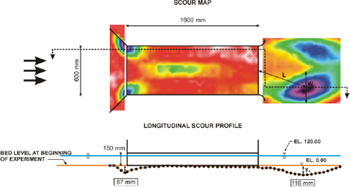
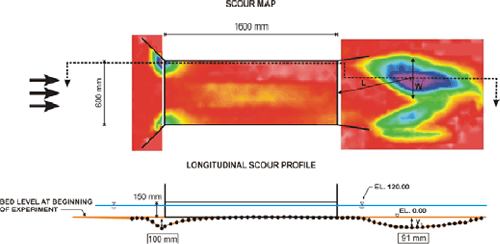
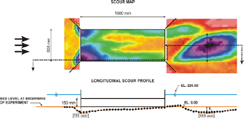
Note: D50 is 2 mm; the depth of the water, h, is 12 cm; the velocity, V, is 15 cm/s.
Figure 64. Diagram. Scour map (top) and profile (bottom), free surface with circular bevel at exit, March 25, 2003.
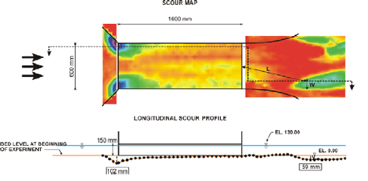
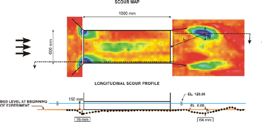
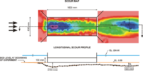
Note: D50 is 2 mm; the depth of the water, h, is 13 cm; the velocity, V, is 16 cm/s.
Figure 65. Diagram. Scour map (top) and profile (bottom), free surface with streamlined bevel at exit, April 7, 2003.
Note: D50 is 2 mm; the depth of the water, h, is 12 cm; the velocity, V, is 15 cm/s.
Figure 66. Diagram. Scour map (top) and profile (bottom), free surface with short streamlined bevel at exit, April 29, 2003.
Note: D50 is 2 mm; the depth of the water, h, is 12 cm; the velocity, V, is 15 cm/s.
Figure 67. Diagram. Scour map (top) and profile (bottom), free surface with wingwalls at outlet, July 22, 2003.
Note: D50 is 2 mm; the depth of the water, h, is 12 cm; the velocity, V, is 15 cm/s.
Figure 68. Diagram. Scour map (top) and profile (bottom), free surface with 8-degree wingwalls at outlet, August 6, 2003.
Note: D50 is 2 mm; the depth of the water, h, is 12 cm; the velocity, V, is 15 cm/s.
Figure 69. Diagram. Scour map (top) and profile (bottom), free surface with 8-degree wingwalls at outlet (smooth walls), October 7, 2003.
Note: D50 is 2 mm; the depth of the water, h, is 12 cm; the velocity, V, is 15 cm/s.
Figure 70. Diagram. Scour map (top) and profile (bottom), free surface with 8-degree wingwalls at outlet and inlet (smooth walls), December 9, 2003.
Note: D50 is 2 mm; the depth of the water, h, is 23 cm; the velocity, V, is 14 cm/s.
Figure 71. Diagram. Scour map (top) and profile (bottom), submerged with 8-degree wingwalls at outlet and inlet (smooth walls), December 16, 2003.
Note: D50 is 2 mm; the depth of the water, h, is 23 cm; the velocity, V, is 13 cm/s.
Figure 72. Diagram. Scour map (top) and profile (bottom), submerged with 45-degree wingwalls at outlet and inlet, October 27, 2004.
Note: D50 is 2 mm; the depth of the water, h, is 23 cm; the velocity, V, is 13 cm/s.
Figure 73. Diagram. Scour map (top) and profile (bottom), submerged with 45-degree wingwalls at outlet and inlet and Chang’s pile dissipater at outlet, November 10, 2004.

Note: D50 is 2 mm; the depth of the water, h, is 23 cm; the velocity, V, is 13 cm/s; the discharge is 0.054 m3/s; the riprap is 25.4 mm.
Figure 74. Diagram. Scour map (top) and profile (bottom), MDSHA Standard Plan, submerged with 45-degree wingwalls at outlet and inlet, March 19, 2004.
Previous | Contents | Next
|


