A Review of Pedestrian Safety Research in the United States and Abroad
Final Report
Part 1. Introduction
Walking, the most traditional mode of transportation, can carry a high risk of injury or death on many of our Nation's streets and highways. Motor vehicles only have been around for about a century, but during that comparatively short time, they often have made walking hazardous.
Emphasis on highway transportation historically has focused on increasing the safety and mobility of motor vehicles; less attention has been given to pedestrians. The trend has begun to shift in recent years. Several detailed studies have been conducted on various aspects of pedestrian safety. These studies have attempted to quantify the magnitude and characteristics of pedestrian collisions and identify the traffic and roadway characteristics associated with such crashes. Some research has also involved attempts to evaluate the safety effects of various roadway and educational treatments. (Editor's note: The terms "accident", "collision", and "crash" are used throughout this report. Some authors use one term and some another. All of these terms should be assumed to mean a crash between a pedestrian and a motor vehicle.)
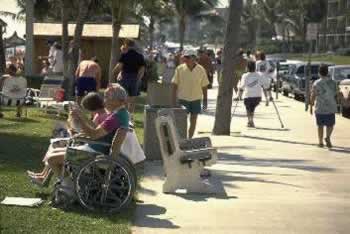 |
| Figure 1. Pedestrians include a wide range of ages and physical abilities |
The purpose of this report is to provide an overview of research studies on pedestrian safety, including details of pedestrian crash characteristics, measures of pedestrian exposure and hazard, and specific roadway improvements and their effects on pedestrian safety. Pedestrian educational considerations and enforcement programs also are discussed. Because this report is confined to a review of safety research, it follows that other important topics are left out. Thus, we do not address matters of facility design, finance, pedestrian comfort, convenience, factors affecting the amount of walking by pedestrians, and other salient issues.
This report is an update resulting from two earlier reports. The most recent was Synthesis of Safety Research: Pedestrians, by C.V. Zegeer (FHWA-SA-91-034, August 1991). Before that was Chapter 16, "Pedestrian Ways," by R.C. Pfefer, A. Sorton, J. Fegan, and M.J. Rosenbaum, which was published by the Federal Highway Administration (FHWA) in Synthesis of Safety Research Related to Traffic Control and Roadway Elements (Volume 2, December 1982). This updated report includes results from numerous foreign and domestic studies. A review of pedestrian safety research from Australia, Canada, the Netherlands, Sweden, and the United Kingdom is given at: www.walkinginfo.org/rd/international.htm.
Organization of this Report
This report consists of five parts. Part 1 is an executive summary followed by introductory text. Part 2 deals with statistics regarding traffic collisions and injuries to pedestrians. Part 3 reviews published research on the effectiveness of facilities and other measures adopted for increased pedestrian safety. Most research cited was carried out in the United States; many studies are recent, but some date back to the 1960s. Some older studies now may be less valid. There is also a series of reviews of pedestrian safety research in several foreign countries, authored by research professionals in Australia, Canada, United Kingdom, the Netherlands, and Sweden. These may be found at www.walkinginfo.org/rd/international.htm.
Summary of Main Findings
In terms of marked vs. unmarked crosswalks at uncontrolled intersections (i.e., no stop sign or traffic signal on the approach roadway) on a two-lane road,
the presence of a marked crosswalk alone is associated with no difference in pedestrian crash rate compared to an unmarked crosswalk. On multilane roads with
traffic volumes above 12,000 vehicles per day, having a marked crosswalk alone (without other substantial improvements) is associated with a higher pedestrian
crash rate (after controlling for other site factors) compared to an unmarked crosswalk. More substantial improvements are recommended to provide for safer
pedestrian crossings at such pedestrian crossings, such as adding traffic signals (with pedestrian signals) when warranted, providing raised medians, installing
speed-reducing measures, and/or others. Providing raised medians on multilane roads can substantially reduce pedestrian crash risk (and can also make it easier to cross the street). There is evidence that substantially improved nighttime lighting can enhance pedestrian safety in certain situations. At intersections with traffic signals, adding a WALK/DON'T WALK signal with a standard timing scheme (i.e., motorists move parallel to pedestrians and may
turn right or left on a green light across pedestrians' path) has no significant effect on pedestrian crashes. Providing an exclusive pedestrian interval (i.e.,
motorists are stopped in all directions during the same interval each cycle while pedestrians cross in any direction) reduces pedestrian collisions by 50 percent.
However, exclusive timing schemes can increase pedestrian and motorist delay and are most appropriate at downtown intersections with a combination of heavy
pedestrian volumes, good pedestrian compliance, and low vehicle volumes. Allowing vehicles to make a right-turn-on-red (RTOR) maneuver appears to result in a small but clear safety problem for pedestrians. In fact, 21 percent
of motorists violate NO TURN ON RED (NTOR) signs if given the opportunity, and 23 percent of RTOR violations result in a conflict with a pedestrian. Countermeasures
that have been effective in reducing pedestrian risks related to RTOR include illuminated NTOR signs, offset stop bars at intersections where RTOR is allowed
(i.e., motorists are more likely to make a full stop often), variations in NTOR signs, and others. Various pedestrian and motorist warning signs have been found to reduce vehicle speeds or conflicts between pedestrians and motorists. These devices include
the "strong yellow green" pedestrian warning sign, YIELD TO PEDESTRIANS WHEN TURNING sign, PEDESTRIANS WATCH FOR TURNING VEHICLES sign, three-section
WALK WITH CARE signal head, a DON'T START display to replace the flashing DON'T WALK display, and others. Curb medians provide a safer environment for pedestrians compared with two-way, left-turn lanes (TWLTLs), while undivided highways have the highest crash
risk for pedestrians in TWLTLs settings. Numerous treatments exist to address the needs of pedestrians with disabilities, such as textured pavements, audible and vibrating pedestrian signals,
larger signs and pedestrian signals, wheelchair ramps, and others. While formal safety studies are difficult to conduct on such treatments, benefits may result
from such devices, depending on site conditions and pedestrian needs. Careful placement of bus stops can affect pedestrian safety. Use of bus stops on the far side of an intersection and at locations with good sight distance
and alignment (e.g., not on steep grades or on horizontal curves) is important. Safety of trips to and from school can be enhanced by sidewalks and proper signalization, but also by well-trained adult crossing guards and selective
police enforcement. Certain warning signs (e.g., flashing school speed limit signs) and markings (e.g., school crosswalks) are also appropriate and beneficial
to pedestrians in many school zones. Pedestrian safety and mobility are enhanced by sidewalks and walkways. This is a critical component of a pedestrian transportation network in urban and
suburban areas. Rural roads should also provide shoulders for pedestrian travel. Overpasses and underpasses can substantially improve safety for pedestrians needing to cross freeways or busy arterial streets at certain locations.
However, such facilities must be carefully planned and designed to encourage pedestrians to use the facilities and not continue to cross at street level. Countermeasures to improve conspicuity of pedestrians include a flashlight, jogger's vest, dangle tags, and rings (retroreflective material on the head
band,
wrist bands, belt, and ankle band). Such measures can increase a motorist' visibility distance of a pedestrian up to 1,300 feet, compared with about 200 feet for
a "base pedestrian" wearing blue jeans and a white t-shirt. Several studies have shown that converting from two-way to one-way streets can substantially reduce pedestrian collisions. In many cases, however,
converting from two-way to one-way streets may not be solely justified by pedestrian safety considerations. More often, several concerns such as capacity, traffic
circulation, and overall traffic safety are major considerations. However, one-way streets can greatly simplify the task of crossing a street, particularly if
the one-way street conversion does not result in increased vehicle speeds. While traffic-calming measures are primarily intended for neighborhood streets to reduce vehicle speeds and/or reduce cut-through vehicle traffic, measures
such as street closures, speed humps, chicanes (series of alternating curb extensions), traffic curbs, diverters, and others are in use in various U.S. cities.
While controversial, many of these measures have been found to effectively improve safety for pedestrians and/or traffic as a whole based on reductions in crashes,
vehicle speeds, and/or reductions in cut-through traffic on neighborhood streets. Educational measures have been found to reduce crashes involving child pedestrians to age groups receiving the educational program. However, most U.S.
educational programs have received few if any formal evaluations and had limited measurable effects. Enforcement of traffic laws and regulations represents another important element in safe pedestrian activity in a roadway environment. This includes not
only the enforcement of pedestrian regulations (e.g., jaywalking, crossing against the signal) but also motorist actions related to pedestrians (e.g., speeding,
yielding to pedestrians when turning, drunk driving). While a number of U.S. cities (including Seattle, Milwaukee, and San Diego) have had active police
enforcement programs in recent years, no quantitative studies have been done to determine the specific effects of police enforcement on pedestrian crashes and
injuries. Such a study would be difficult to conduct because of many other contributing crash factors in a city.
|
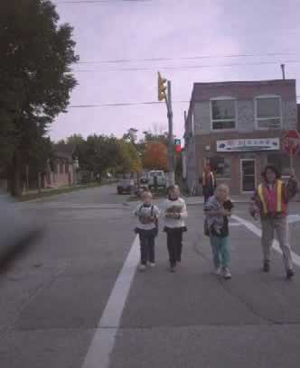
| Figure 2. School-trip safety can be enhanced by well-trained adult crossing guards |
Evolution of Vehicle/Pedestrian Collision Problems
Even the ancients knew it was a good idea to separate pedestrians from vehicles roadways. Fruin (1973) presents a comprehensive historical perspective of the methods used in the past to limit vehicular intrusion into cities; regulations prohibiting heavy wagons within the central city after dusk; vehicle/ pedestrian separation using stone barriers and metal spikes; and special areas along main thoroughfares where pedestrians could rest. Medieval city planners provided central pedestrian plazas as an open space for the marketplace and the cathedral, as well as a location for festive occasions and recreation. In a number of cities, pedestrians were protected from the elements by galleries, canopies, colonnades, and porticos.
The introduction and increased use of motor vehicles in urban areas has made it much more difficult to ensure pedestrian mobility and safety. Most space provided for pedestrians has been sacrificed to provide space for motor vehicle traffic. Both motorist and pedestrian face visual clutter of traffic signals and signs.
The central business district (CBD) of a city hosts various land uses: office buildings, government, shopping, entertainment centers, restaurants, historical sites, and high-rise residential developments. The CBD is the focal point of the regional transportation network and the confluence of transit and highways. Because of its flexibility, walking is the only means of transportation satisfying the short, dispersed trip linkages required in the CBD. Downtown-origin-and-destination surveys in most cities show that approximately 90 percent of all internal trips within the CBD are made on foot.
The traditional urban core is often superimposed on an archaic street system surviving from past land use and a smaller population. The street system of the Manhattan financial district of New York City, for example, dates to colonial times when the tallest structure was two or three stories. Now these same streets serve buildings rising 50 to 100 stories, representing millions of square feet of office space. Thousands of workers and visitors enter and leave these buildings each day, exceeding the capacity of the sidewalk and spilling over into the roadway. In such situations, maximum use of sidewalk area and flow capacity is a necessity.
In many high-density CBDs, the sidewalk width has been reduced to facilitate vehicular traffic movement. This reduces pedestrian traffic capacity, but does not always produce a commensurate increase in vehicle capacity. The wider streets increase the likelihood of pedestrian-vehicle crosswalk conflicts, which limits vehicle capacity at intersections.
The potential pedestrian capacity of the CBD sidewalks is further reduced by the intrusion of refuse cans, fire hydrants, fire alarm boxes, parking meters, traffic signals, control boxes and poles, signposts, newsstands, telephone booths, mailboxes, bus benches, planters, sewer and ventilation gratings, and other street furniture. In addition, building service operations, such as unloading or loading of trucks, often inconvenience and sometimes endanger the pedestrian. Many intersections were built with little control over the location of fixed sidewalk furniture and utilities that often appear in clusters at intersections, the most critical points in the pedestrian circulation network.
 |
 |
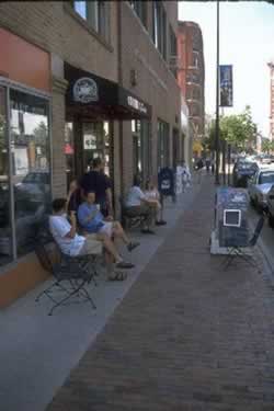
| Figure 3. Pedestrian capacity of CBD sidewalks is reduced by light posts, mailboxes, parking meters, etc. |
Pedestrians waiting at intersections need space, and intersections must accommodate weaving, opposing pedestrian flows. The intersection is also the most common location for bus stops and rapid transit entrances. The pedestrian is further harassed by vehicles stopped in the crosswalk or turning into the path of crossing pedestrians. When a rapid transit entrance is situated along a narrow sidewalk near an intersection, narrow subway stairs can cause pedestrian queues both in the transit station below and on the surface.
This all adds to inconvenience, potential danger, and delay for the pedestrian. Although the total amount of pedestrian delay time may far exceed driver delay time within the CBD, traffic signalization is usually designed to facilitate vehicular flow. Often, the only consideration given to pedestrians at signals is to meet the minimum pedestrian WALK and clearance times, which may not be sufficient for pedestrians with special crossing needs. Where automatic detection is provided for motor vehicles, pedestrians typically must push a button to be detected. In some cases, long cycle lengths encourage pedestrians to cross against a signal.
The rectangular grid pattern of the typical CBD is not conducive to characteristically short pedestrian trips. In some instances, the grid pattern of Manhattan's streets requires a time- and energy- consuming 1,000-foot walk for a straight-line trip distance of only 200 feet. Larger midblock buildings with frontages on adjacent streets are often used as through-routes so the pedestrian can reduce trip distances. This practice is more common in inclement weather. Depending on city location, one day in four may be too windy, cold, wet, or hot for the pedestrian's comfort. But, protection of the pedestrian from the elements is a low priority in most cities.
Guides and Model Programs
There is some variation among the States' laws and regulations for pedestrian movement, though the Uniform Vehicle Code (1992) and the Manual on Uniform Traffic Control Devices (1998 and 2001) have helped to reduce this variability. Since the early 1970s, numerous publications have discussed alternative measures to prevent pedestrian crashes. Several studies in the 1970s suggested possible countermeasures for predominant pedestrian crash types, such as dart-outs, midblock dash crashes, and others. Brief synopses of some of these are provided in the following paragraphs.
A recent FHWA guide provides a matrix of 47 possible pedestrian treatments for 13 groups of pedestrian crashes (Zegeer et al., Pedestrian Facilities Users Guide: Providing Safety and Mobility, FHWA, March, 2002). The matrix of candidate engineering countermeasures is given in table 1. This guide provides information for each of the 47 engineering treatments, including a description of the countermeasure, considerations for using it, implementation cost, and a photo and/or sketch. A countermeasure matrix is also provided in that report (see table 2) for use in addressing various performance objectives (e.g., reducing vehicle speeds, reducing vehicle volume). Finally, the guide provides examples of pedestrian case studies and success stories, as well as recommendations and priorities for installing sidewalks and walkways, marked crosswalks and other pedestrian crossing treatments. This guide may be found at http://www.walkinginfo.org/rd/for_ped.htm#guide.
Table 1. Matrix of potential engineering countermeasures for urban pedestrian crashes
| CRASH GROUP |
Midblock Dart/Dash |
Multiple Threat |
Midblock Mailbox Etc. |
Failure to Yield (Unsignalized) |
Bus-Related |
Turning-Vehicle At Intersection |
Through Vehicle At Intersection |
Walking Along Roadway |
Working/Playing In Road |
Not in Road |
Backing Vehicle |
Crossing Expressway |
| COUNTERMEASURES |
|
|
|
|
|
|
|
|
|
|
|
|
| 1. Sidewalk/Walkway |
|
|
|
|
 |
|
|
|
|
|
|
|
| 2. Curb Ramp |
|
|
|
 |
|
|
|
|
|
|
|
|
| 3. Crosswalk Enhancements |
|
|
|
|
|
|
|
|
|
|
|
|
| 4. Transit Stop Treatments |
|
|
|
|
|
|
|
|
|
|
|
|
| 5. Roadway Transit |
|
|
|
|
|
|
|
|
|
|
|
|
| 6. Overpass/Underpass |
|
|
|
|
|
|
|
|
|
|
|
|
| 7. Street Furniture |
|
|
|
|
|
|
|
|
|
|
|
|
| 8. Bike Lane/Shoulder |
|
|
|
|
|
|
|
|
|
|
|
|
| 9. Road/Lane Narrowing |
|
|
|
|
|
|
|
|
|
|
|
|
| 10. Fewer Lanes |
|
|
|
|
|
|
|
|
|
|
|
|
| 11. Driveway Improvement |
|
|
|
|
|
|
|
|
|
|
|
|
| 12. Raised Median |
|
|
|
|
|
|
|
|
|
|
|
|
| 13. One-Way Street |
|
|
|
|
|
|
|
|
|
|
|
|
| 14. Smaller Curb Radius |
|
|
|
|
|
|
|
|
|
|
|
|
| 15. Right-Turn Slip Lane |
|
|
|
|
|
|
|
|
|
|
|
|
| 16. Modern Roundabout |
|
|
|
|
|
|
|
|
|
|
|
|
| 17. Modified T-Intersection |
|
|
|
|
|
|
|
|
|
|
|
|
| 18. Intersection Median Barrier |
|
|
|
|
|
|
|
|
|
|
|
|
| 19. Curb Extension |
|
|
|
|
|
|
|
|
|
|
|
|
| 20. Choker |
|
|
|
|
|
|
|
|
|
|
|
|
| 21. Pedestrian Crossing Island |
|
|
|
|
|
|
|
|
|
|
|
|
| 22. Chicane |
|
|
|
|
|
|
|
|
|
|
|
|
| 23. Mini-Circle |
|
|
|
|
|
|
|
|
|
|
|
|
| 24. Speed Humps |
|
|
|
|
|
|
|
|
|
|
|
|
| 25. Speed Table |
|
|
|
|
|
|
|
|
|
|
|
|
| 26. Raised Intersection |
|
|
|
|
|
|
|
|
|
|
|
|
| 27. Raised Ped Crossing |
|
|
|
|
|
|
|
|
|
|
|
|
| 28. Gateway |
|
|
|
|
|
|
|
|
|
|
|
|
| 29. Landscape Options |
|
|
|
|
|
|
|
|
|
|
|
|
| 30.Paving Treatments |
|
|
|
|
|
|
|
|
|
|
|
|
| 31. Driveway Link/Serpentine |
|
|
|
|
|
|
|
|
|
|
|
|
| 32. Woonerf |
|
|
|
|
|
|
|
|
|
|
|
|
| 33. Diverter |
|
|
|
|
|
|
|
|
|
|
|
|
| 34. Full Street Closure |
|
|
|
|
|
|
|
|
|
|
|
|
| 35. Partial Street Closure |
|
|
|
|
|
|
|
|
|
|
|
|
| 36. Pedestrian Street |
|
|
|
|
|
|
|
|
|
|
|
|
| 37. Traffic Signal |
|
|
|
|
|
|
|
|
|
|
|
|
| 38. Pedestrian Signal |
|
|
|
|
|
|
|
|
|
|
|
|
| 39. Pedestrian Signal Timing |
|
|
|
|
|
|
|
|
|
|
|
|
| 40. Signal Enhancement |
|
|
|
|
|
|
|
|
|
|
|
|
| 41. RTOR |
|
|
|
|
|
|
|
|
|
|
|
|
| 42. Advanced Stop Lines |
|
|
|
|
|
|
|
|
|
|
|
|
| 43. Sign Improvement |
|
|
|
|
|
|
|
|
|
|
|
|
| 44. School Zone Improvement |
|
|
|
|
|
|
|
|
|
|
|
|
| 45. Identify Neighborhood |
|
|
|
|
|
|
|
|
|
|
|
|
| 46. Speed-Monitoring Trailer |
|
|
|
|
|
|
|
|
|
|
|
|
| 47. Parking Enhancements |
|
|
|
|
|
|
|
|
|
|
|
|
| 48. Ped./Driver Education |
|
|
|
|
|
|
|
|
|
|
|
|
| 49. Police Enforcement |
|
|
|
|
|
|
|
|
|
|
|
|
Table 2. Matrix of potential "performance objectives" for urban pedestrian crashes
| Objectives |
A. Pedestrian Facility Design |
B. Roadway Design |
C. Intersection Design |
D. Traffic Calming |
E. Traffic Management |
F. Signals and Signs |
G. Other Measures |
| 1. Reduce Speed of Motor Vehicles |
|
- Add Bike Lane/Shoulder
- Road Narrowing
- Reduce Number of Lanes
- Driveway Improvements
- Curb Radius Reduction
- Right-Turn Slip Lane
|
|
- Curb Extension
- Choker
- Chicane
- Mini-Circle
- Speed Humps
- Speed Table
- Raised Intersection
- Driveway Link/Serpentine
- Woonerf
|
|
- Signal Enhancement (e.g. Adjust Signal Timing for Motor Vehicles)
|
- Speed-Monitoring Trailer
- School Zone Improvement
|
| Use in Conjunction With Other Treatments |
|
|
|
- Landscaping Options
- Paving Treatments
|
|
|
|
| 2. Improve Sight Distance and Visibility for Motor Vehicles adn Pedestrians |
- Crosswalk Enahncements
- Roadway Lightning
- Move Poles/Newspaper Boxes at Street Corners
|
|
- Curb Extension
- Speed Table
- Raised Pedestrian Crossing
- Raised Intersection
- Paving Treatments
|
|
|
- Sign Improvement (e.g., Warning Sign)
- Advanced Stop Lines
|
|
| 3. Reduce Volume of Motor Vehicles |
|
|
|
|
- Diverters
- Full Street Closure
- Partial Street Closure
- Pedestrian Street
|
|
|
| 4. Reduce Exposure for Pedestrians |
|
- Road Narrowing
- Reduce Number of Lanes
- Raised Median
- Pedestrian Crossing Island
|
|
- Curb Extension
- Choker
- Pedestrian Crossing Island
|
|
- Pedestrian Signal Timing
- Accessible Pedestrian Signal
|
|
| 5. Improve Pedestrian Access and Mobility |
- Sidewalk/Walkway
- Curb Ramps
- Crosswalk
- Enhancements
- Transit Stop Treatments
- Overpasses/Underpasses
|
|
|
- Choker
- Pedestrian Crossing Island
|
|
- Traffic Signal
- Signal Enhancement
- Accessible Pedestrian Signal
- Pedestrian Signal Timing
|
|
| 6. Encourage Walking by Improving Aesthetics |
- Street Furniture
- Roadway Lightning
- Landscaping Options
|
|
|
- Gateway
- Landscaping
- Paving Treatments
|
|
|
|
| 7. Improve Compliance With Traffic Laws |
|
|
|
- Traffic Calming: Choker, Chicane, Mini-Circle, Speed Hump, Speed Table
|
|
|
- Speed-Monitoring Trailer
- Pedestrian/Driver Education
- Police Enforcement
|
| 8. Eliminate Behaviors That Lead to Crashes |
|
|
|
- Traffic Calming: Choker, Chicane, Mini-Circle, Speed Hump, Speed Table
|
|
|
- Pedestrian/Driver Education
- Police Enforcement
|
FHWA's Model Pedestrian Safety Program, written in 1977 and updated in 1987, provides a six-step process for planning, implementation, and evaluation relative to an agency's pedestrian safety program. The User's Guide Supplement presents detailed information on the various countermeasures for pedestrian crashes, including their advantages and disadvantages and implementation considerations. Details on work-zone management for improved pedestrian protection is given in Work Zone Traffic Management, a report published by FHWA in 1989.
In 1981, a report by Vallette and McDivitt reviewed available pedestrian literature and operational experiences of 19 U.S. cities concerning pedestrian safety programs. The study included the development of a matrix of 450 pedestrian-related articles and publications by 71 subject categories. Operational experiences of 19 city agencies were provided based on visits and interviews with those agencies relevant to their safety program coordination, traffic engineering, school and child safety programs, provisions for the handicapped, public information and education, enforcement of pedestrian-related laws, safety analysis, and safety program recommendations and philosophy.
The WALK ALERT program is a national pedestrian safety program, a cooperative effort of the National Safety Council, FHWA, National Highway Traffic Safety Administration (NHTSA), and more than 100 service and community organizations. The primary objective is to reduce pedestrian crashes. The 1989 WALK ALERT Program Guide (National Safety Council, 1988) provides the steps needed to organize and implement a local pedestrian safety effort. The guide includes information on engineering improvements, educational materials for all age levels, and possible enforcement/laws and ordinances to improve pedestrian safety. Information is also provided for working with the news media, along with a resource guide that lists pedestrian safety programs, audiovisuals, and print materials recommended for the WALK ALERT program.
In 1988, a Transportation Research Board (TRB) synthesis, Pedestrians and Traffic-Control Measures, was published by C. Zegeer and S. Zegeer. This report provides details on publications and information related to 21 specific types of engineering traffic-control measures. This information is based on questionnaire responses from 48 city and state transportation agencies on pedestrian facilities, including traffic and roadway conditions under which each measure is most and least effective. The report includes discussions of special pedestrian situations (e.g., work-zone travel) and traffic-control needs for special pedestrian groups (e.g., college students, children in school zones, older and handicapped adults). Recommendations are provided for selecting effective traffic-control measures to improve pedestrian safety and movement.
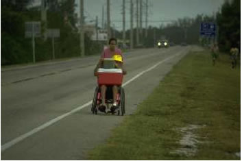
A 1987 National Cooperative Highway Research Program (NCHRP) report, Planning and Implementing Pedestrian Facilities in Suburban and Developing Rural Areas contains information on providing for pedestrian needs outside of urban areas. The report discusses the nature of suburban and rural pedestrian problems and how they occur, the planning process, pedestrian facilities within highway right-of-way, and practical considerations for providing such facilities. A summary addresses pedestrian facility problems and possible solutions, and a sample of such information is given in table 1. Many of the deficiencies that were found in suburban and developing rural areas were attributed to planners' failure to think about how to get pedestrians safely and conveniently from one place to another.
 |
|
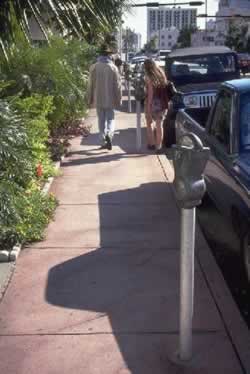
Figure 4. Pedestrians in rural and developing areas need to be able to get from one place to another safely and conveniently
|
A report entitled, Handbook on Planning, Design, and Maintenance of Pedestrian Facilities (Bowman, Fruin, and Zegeer, 1989) assembled current information to help design, construct, and maintain pedestrian facilities. The planning and design details are emphasized for such facilities as sidewalks and walkways, crosswalks, curb ramps and refuge islands, overpasses and underpasses, pedestrian priority zones (e.g., malls, auto-restricted zones, and temporary street closings), traffic-control devices, and pedestrian facilities in work zones. The report also provides information on pedestrian characteristics and how to conduct pedestrian traffic and safety studies.
Table 3. Partial summary of pedestrian facility problems and possible solutions.*
| Description of Problem |
Magnitude of Problem |
Possible Solutions |
Current Level of Use or Acceptance |
Limitations in Applicability |
Potential Effectiveness |
Potential Effectiveness |
Cost |
Impact on Other Groups |
Comment |
| Cross Section Design
Difficulty of crossing wide, arterial streets, especially undivided arterials |
Major |
1. Install medians on all new suburban highways of 4 or more lanes. |
Moderate |
Virtually no limitations for new hwys. However, some limitations are currently perceived. |
High |
Moderate |
Moderate |
Positive |
Potentially the most effective solution to street crossing problems. |
| 2. Install European-style refuge islands in strategic locations on existing
undivided highways. |
Low |
Must narrow lanes on existing hwys. to accommodate refuge islands. Must be well
lighted. |
High |
Moderate |
Low to moderate |
Minimal |
This solution is greatly underutilized in U.S. |
| 3. Design for reduced street width between signalized intersections (since capacity constraints
are at signal[s]. |
Low |
Could only be done where spacing between intersections is high. |
Moderate |
High |
Low |
Negative |
Probably not feasible as a general practice. |
| 4. Introduce additional traffic signals to facilitate ped. crossings. |
Low |
Could only be done in a few selected locations. |
Moderate |
High |
Moderate |
Highly negative |
More feasible where ped. crossings are concentrated at a point |
| 5. Provide midblock actuated flashing ped. signal. |
Low |
Should only be installed in key locations. |
Moderate |
Moderate |
Low |
Slightly negative |
Designed to inform driver of presence of ped; may not make crossing easier |
| 6. Provide ped. overpass. |
Low |
Only effective where at-grade crossing is blocked or is inconvenient. |
Moderate- depends on no. of peds |
Moderate |
High |
Positive |
Lack of use of facility continues to be a problem. |
| Difficulty of crossing highways with two-way left turn lanes |
Moderate to Major |
1. Reduce use of this technique and provide medians to control access. |
Low |
Would need to design infrequent U-turn capability. |
High |
High |
Moderate to high |
Negative |
Merchants and drivers will object heavily. |
| 2. Install refuge islands in spots where no turning is necessary. |
Low |
Must have at least some "dead spots" where turning would not generally
occur. |
High |
Moderate |
Low |
Minimal |
Islands must be well-lighted and marked. |
| No facilities provided for ped. to walk along side of road |
Major |
1. Require sidewalk/pathway with all new hwy. construction. Paved or stabilized
shoulder adequate in outlying areas. |
Moderate |
Only allowed exclusion should be low-volume residential streets. |
High |
Moderate |
Moderate |
Minimal |
Could be required by FHWA for Federal projects. |
| 2. Provide easier methods for obtaining easements to address existing highways
constrained by right of way. |
Low |
Probably would be viewed as giving excess authority to public agencies. |
High |
High |
Low |
Negative |
Would put property owners at a disadvantage |
| Narrow bridges with no pedestrian accommodations |
Moderate |
1. Design all new bridges with shoulder or raised walkway. |
Moderate |
None |
Moderate to high |
Moderate |
Moderate to high |
Positive |
|
| 2. Design low-cost walkway system for attaching to outside of bridge. |
Low |
Feasibility and design dependent on structural nature of existing bridge |
Moderate to high |
Moderate |
Moderate |
Positive |
|
| *Source: Smith, S.A., et al., 1987. |
Planning Community Pedestrian Safety Programs- An Agenda for Action (NHTSA, 1980) is a guide to assist local communities in either integrating pedestrian safety into an existing community traffic safety program or developing and implementing a new and independent pedestrian safety program. The components of community programs are discussed in addition to methods for developing the plan of action and program evaluation.
As discussed above, a number of user guides and procedural manuals have been written on developing local or statewide pedestrian safety programs (e.g., WALK ALERT Program Guide, Planning Community Pedestrian Safety Programs, Model Pedestrian Safety Program User's Guide) (National Safety Council, 1988; Planning Community Safety Programs, 1980; Work Zone Traffic Management, 1989). Other publications document city pedestrian safety programs and/or provide information from previous pedestrian literature in selected areas (e.g., Vallete and McDivitt, 1981; Zegeer and Zegeer, 1988). Still others assist the planning, design, implementation, and maintenance of pedestrian facilities (e.g., Smith et. al., 1987 and Bowman et. al. 1989).
FHWA-RD-03-042
|


