|
Lesson 13: Selecting Bicycle Facility Types and Evaluating Roadways
| 
|
| | |
| 
|
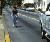
| (Some of these pictures show bicyclists not wearing helmets. FHWA strongly recommends that all bicyclists wear helmets.) |
Lesson Outline
- Bicycle facility type selection.
| – Comparison of approaches. |
| – AASHTO guidance. |
- Roadway evaluation.
| – Bicycle compatibility index. |
| – Bicycle level of service. |
Bicycle Facility Types
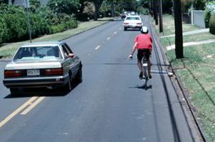
- Shared road with regular lane width.
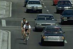
– Most existing roads. - Wide curb lane.
– Shared outside lane.
|
|
| | |
|
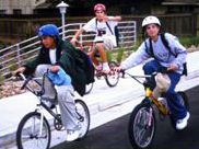
| (This picture shows bicyclists not wearing helmets. FHWA strongly recommends that all bicyclists wear helmets.) |
Bicycle Facility Types
| (This picture shows bicyclists not wearing helmets. FHWA strongly recommends that all bicyclists wear helmets.) |
How to Select Facility Type
- No national standards.
- Different State and local guidelines.
- Common factors:
| – Vehicle traffic volumes. |
| – Vehicle traffic speeds. |
| – Other road cross section or traffic variables. |
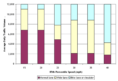
Comparison of Approaches
- 2002 Review of North American and European guidelines.
- Shared roads: low volumes/speeds.
- Wide curb lanes: moderate volumes/speeds.
- Bike lanes: higher volumes/speeds.
- Separate path: special case.
AASHTO Guidance on Facilities
- Facility selection is essentially a State/local policy decision.
- It may be based on several factors:
| – Specific corridor conditions. |
| – Facility costs. |
| – Bicyclist skill level. |
| Advanced | Basic | Children |

| 
| 
|
| | Source: PBIC (Dan Burden), www.pedbikeimages.org |
Roadway Evaluation
- Integral to planning: an inventory of existing conditions.
- How suitable are certain roads for bicycling?
| – Bicycle compatibility. |
| – Bicycle level of service. |
| – Bicycle suitability. |
| – Bicycle stress level. |
| – Other names. |
Bicycle Compatibility Index
- Product of 1998 FHWA study.
- Empirical model that uses:
| – Presence and width of shoulder or bike lane. |
| – Vehicle traffic volume and speed. |
| – Presence of vehicle parking. |
| – Type of roadside development. |
Bicycle Level of Service
- Product of 1997 study in Florida, with subsequent testing and validation.
- Empirical model that uses:
| – Road width. |
| – Presence and width of shoulder or bike lane. |
| – Vehicle traffic volume, speed, and type. |
| – Pavement surface condition. |
| – Presence of vehicle parking. |
Applications for Evaluation Tools
- Documenting existing conditions.
- Comparing alternatives.
- Identifying design configurations for improvements to existing roads.
- Prioritizing/programming improvements.
- Creating bicycle maps.
Lesson Summary
- No national standards for facility selection:
| – Use State/local guidelines. |
| – General principles. |
- Roadway evaluation tools:
| – Two commonly used models. |
| – Numerous applications. |
FHWA-HRT-05-110
|


