U.S. Department of Transportation
Federal Highway Administration
1200 New Jersey Avenue, SE
Washington, DC 20590
202-366-4000
Federal Highway Administration Research and Technology
Coordinating, Developing, and Delivering Highway Transportation Innovations
 |
| This report is an archived publication and may contain dated technical, contact, and link information |
|
Publication Number: FHWA-RD-98-166
Date: July 1999 |
Guidebook on Methods to Estimate Non-Motorized Travel: Supporting Documentation2.13 Latent Demand Score
Descriptive Criteria: What is It? Categories: Authors and Development Dates: Landis (1996) Purpose: The Latent Demand Score (LDS) method, developed by Bruce Landis, provides a way to estimate the latent or potential demand for bicycle travel, i.e., the level of travel that would occur if a bicycle facility existed on a road segment. The LDS method may be combined with supply-side facility analysis methods, such as bicycle level of service measures, to indicate facilities with the greatest need for improvement. Structure: The method analyzes the proximity and trip generation potential of activity centers to determine the potential demand for the facility. Activity center potential is analyzed using probabilistic gravity model techniques. The LDS model involves the following steps: 1. Estimate the percentage of trips taken by bicycle by area residents for home-based work, home-based shopping, home-based recreational/social, and home-based school trips. 2. Using a geographic information system (GIS), geocode the locations of activity centers near the proposed facility. 3. Establish the Tripmaking Probability Summation (TPS) (see "Assumptions"). 4. Validate the Demand Indicator Values (DIVs). 5. Multiply the DIVs with its trip generation for each activity center using the ITE Trip Generation manual. 6. Add the DIVs to calculate the segment's Latent Demand Score. Calibration/Validation Approach: Public participation and analyses on the conditions of the current roadway systems can be used to validate and justify the LDS results. Inputs/Data Needs: The LDS model requires the following data items:
The model also uses the ITE Trip Generation manual. Computational Requirements: Uses spreadsheets and GIS. User Skill/Knowledge: Users should be familiar with probabilistic gravity models and should know how to operate a GIS. Assumptions: To establish potential home-based work markets for bicycle travel, census tracts were categorized by the number of home-based work trips with durations of less than 10 minutes. Autos were assumed to travel at an average of 48 km/h, so the distances involved total less than 8 km. The LDS model assumptions are described below. To determine the TPS as stated in step 3, it is necessary to perform the following calculations:
Facility Design Factors: The LDS only considers the demand-side for potential bicycle facilities and does not take into consideration the current road conditions. Nevertheless, Landis has developed a supply-side method called the Interaction Hazard Score or IHS Model that would complement the LDS results. 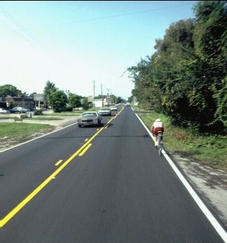
The output consists of road segments ranked according to their latent travel demand. Road segments with high latent demand would have the highest priority for future funding. When using supply-side analyses such as level-of-service measures along with the LDS, the highest priority road segments are those with low levels of service and high-potential demand. Real-World Examples: Three localities in Florida are using the Latent Demand Model along with bicycle level-of-service models. The city of Tampa uses the methods to prioritize funding for new bicycle facilities while Hillsborough County uses the methods to prioritize improvements to existing bicycle facilities. The city of Birmingham, Alabama, incorporated the Latent Demand Model results involving facility prioritizations into their Bicycle, Pedestrian, and Greenway Plan. The Latent Demand Model has also been tested recently in Philadelphia, PA. Contacts/Source: Bruce Landis, Sprinkle Consulting Engineers (Tampa, Florida). Publications: Landis, Bruce, and Jennifer Toole. Using the Latent Demand Score Model to Estimate Use, Forecasting the Future, Pro Bike/Pro Walk 96, Bicycle Federation of America -- Pedestrian Federation of America, September 1996. Evaluative Criteria: How Does It Work? Performance: Since the LDS only addresses the potential demand on improved road facilities, it works best when accompanied by a mechanism that addresses the current road conditions. Use of Existing Resources: Some data used in the model can be readily obtained from sources such as the census. Other data (e.g., the types and locations of activity centers) may need to be collected locally. Travel Demand Model Integration: The model is not intended to be integrated into regional travel models. Applicability to Diverse Conditions: It is possible to change the impedance factors to account for different local conditions. For example, the city of Birmingham added an impedance variable to account for mountainous terrain. To adjust for different travel patterns, they stratified the distance impedance variable into three groups: rural, suburban and urban. Usage in Decision-Making: The LDS is used primarily to prioritize the expenditures for existing and proposed bicycle facilities. Ability to Incorporate Changes: Since the calculations are performed using spreadsheets, input variables can be changed with ease. Ease-of-Use: Since the model uses software that is familiar to most professionals (i.e., spreadsheets and GIS), it is relatively simple to operate. Nevertheless, it is necessary to understand how to apply the modeling technique to the localized environment because each jurisdiction will have to customize it to meet its needs. Comments: Jennifer Toole (jtoole@rbagroup.com) stated in an e-mail the following advantages and disadvantages of the model: Advantages: "It is a gravity model, and our clients have appreciated its similarity to other travel demand models. Also, we have been able to use it to shore up political support for bicycle facility construction. Most importantly for master planning projects, the model has enabled us to make informed decisions about appropriate priorities - decisions that are based less on anecdotal evidence and more on objective input." Disadvantages: "The model doesn't define potential ridership - rather, relative demand compared to other segments of the route system."
FHWA-RD-98-166 |

