U.S. Department of Transportation
Federal Highway Administration
1200 New Jersey Avenue, SE
Washington, DC 20590
202-366-4000
Federal Highway Administration Research and Technology
Coordinating, Developing, and Delivering Highway Transportation Innovations
 |
| This report is an archived publication and may contain dated technical, contact, and link information |
|
Publication Number: FHWA-RD-98-166
Date: July 1999 |
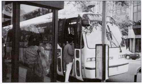
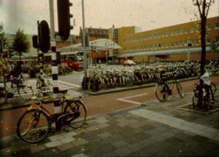
Guidebook on Methods to Estimate Non-Motorized Travel: Supporting Documentation2.7 Discrete Choice Models: Transit Access
Descriptive Criteria: What is It? Categories: Authors and Development Dates: Wilbur Smith Associates (1996) Purpose: This method describes a realworld application of discrete choice modeling to predict bicycle and pedestrian mode share for transit access trips for the Chicago Transit Authority (CTA) and Metra rail systems in Chicago. Structure: Two discrete choice models are estimated, one for access mode to Metra (commuter rail) and one for access mode to CTA (rapid rail). A nested logit form is used, for which the first-level choice is motorized vs. non-motorized, and the second-level choices are car vs. bus and walk vs. bike. (For a discussion of logit modeling techniques including nested logit models, see Ben-Akiva and Lerman, 1985.) The models include the following variables:
To estimate changes in mode share based on model results, sub-models were developed based on distance from transit station. The areas around stations were divided into five concentric rings in increments of a 0.8-km radius. Population density was estimated for each ring by classifying the station as one of five types of land use: dense urban, urban, dense suburban, suburban, or other. These submodels were developed because of the importance of access distance in choice of access mode. For the other variables, average values were used when estimating the mode choice impacts of the various bike or walk improvements. Calibration/Validation Approach: The model coefficients were adjusted so that current access mode shares more closely matched access mode shares as reported from two sources: (1) the Metra mode of access survey for Metra stations; and (2) the intercept survey for CTA stations.
Inputs/Data Needs: Two new data sources were used for developing the model: 1. An intercept survey of transit users. Respondents were asked for trip characteristics (modes, times, length, cost, and purpose), reasons for not choosing alternative modes, and socioeconomic characteristics. To use the results in model development, characteristics of alternative modes had to be assumed based on the information given by the respondent. 2. A stated-preference survey using IVIS (Interactive Video Interview Station) techniques. IVIS equipment was set up at workplaces in downtown Chicago; respondents included drive-alone as well as transit commuters. Trip characteristics and socioeconomic data were collected. In addition, respondents were given a series of hypothetical choices which required them to make tradeoffs between travel time, travel cost, parking costs, and access improvements. Video images were used to help describe bicycle and pedestrian access improvements. An existing data source, the Metra mode of access survey, was used to calibrate the model (see "Calibration/Validation Approach," above) The existing regional household survey performed by the Chicago Area Transportation Study (CATS) was considered for calibration but was felt to be less reliable for the purposes of this study. Potential Data Sources: See "Inputs/Data Needs," above. Computational Requirements: Discrete choice models can be estimated using a desktop microcomputer with specialized software. User Skill/Knowledge: The model requires knowledge of stated preference surveys and discrete choice modeling. Assumptions: See entry on "Discrete Choice Models," Method 2.5. Facility Design Factors: The following factors were included in the model:
In addition, the presence of paths, lanes, and routes were tested as variables but were not included because of lack of statistical significance. The following walk improvements were included in the model:
Output Types: An alternatives analysis was conducted to estimate the change in transit access mode share as a function of various combinations of improvements. The five alternatives tested were labeled as: Present conditions; Bicycle parking; Transportation Systems Management (TSM)/low capital; Pedestrian improvements; and High capital. The mode share effects of other improvements included in the model, both individually and in combination, could also be easily estimated. Real-World Examples: Wilbur Smith Associates (1996) developed this model and applied it to the CTA and Metra rail systems in Chicago. Contacts/Source: Joe Moriarty, Chicago Regional Transit Authority, Chicago, IL. (Models were developed for the Chicago Regional Transit Authority by Wilbur Smith Associates, in conjunction with Resource Systems Group, Applied Real Estate Analysis, and the League of American Bicyclists.) Publications: Wilbur Smith Associates. Non-Motorized Access to Transit: Final Report. Prepared for Regional Transportation Authority, Chicago, IL, July 1996 Evaluative Criteria: How Does It Work? Performance: The accuracy of the model predictions has not yet been tested. Use of Existing Resources: This method requires new data collection and analysis efforts. Travel Demand Model Integration: The project report recommends that the access to transit model be linked to the main Chicago area mode choice model. This will give the Chicago RTA a more comprehensive planning tool for evaluating the mode choice and ridership impacts of multiple changes in the transportation system. Applicability to Diverse Conditions: The models were meant to be representative of the CTA and Metra systems as a whole; use of the model to predict mode choice impacts at specific stations is recommended only with caution, since other factors which vary from station to station may not be captured in the model. Similarly, it is possible that the models estimated here could be transferred to other transit systems. However, conditions external to the model would have to be assumed similar to Chicago area conditions. Usage in Decision-Making: The model has been used for prioritizing stations, selecting case study locations, identifying design improvements, and estimating the cost-effectiveness of improvements. Ability to Incorporate Changes: The effects of different levels of facility design factors already included in the model can easily be estimated. Estimating the effects of new facility design factors would require additional survey efforts. Ease-of-Use: Development of the model requires knowledge of stated-preference surveying and discrete choice modeling. Once the model is developed, it can be applied to different data sets using a spreadsheet.
FHWA-RD-98-166 |

