
Innovation Synergy
Pairing advanced geotechnical methods and unmanned aerial systems yields benefits
The New Hampshire Department of Transportation (NHDOT) combined two Every Day Counts innovations—advanced geotechnical methods in exploration (A-GaME) and unmanned aerial systems (UAS)—to improve condition assessment and stability evaluation of rock slopes.
NHDOT funded a research project through the University of Vermont (UVM) that assessed the use of UAS to make transportation project development safer, more cost efficient, and more effective. One focus of the study was on Route 302 in Crawford Notch State Park, which had a 100-foot high rock cut-slope with a poor overall stability rating.
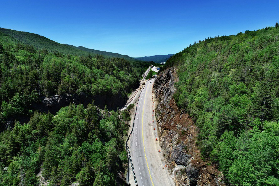
The New Hampshire Department of Transportation combined drone photos with photogrammetry from its A-GaME toolbox to characterize rock structure conditions on Route 302.
Traditionally, rock structure conditions influencing stability of rock slopes are mapped using manual measurement. Introducing UAS to the process allowed engineering geologists to capture rock structure data in areas accessible only by rope or too difficult and dangerous to reach at all. UVM collected 310 high-resolution images during UAS flights in Crawford Notch.
NHDOT used photogrammetry techniques, one of its A-GaME methods for rock slope characterization, to create a detailed three-dimensional (3D) point cloud model. This technique is faster than traditional methods, and the number of measurements obtained by analyzing photogrammetric data provides better characterization of rock structure conditions, resulting in a more comprehensive stability analysis of the cut.
Data analyzed from the 3D point cloud can be transferred into other software for further analysis, visualization, and future access. Detailed 3D models like these allow engineering geologists and geotechnical experts to make better decisions on the stability of new cut-slope designs and geologic hazards from existing rock slopes. Measurements taken over time can also help detect changes in rock slopes. Asset managers can detail these changes and monitor slopes for movement that may indicate the potential for rockfall releases or rockslides.