Combining data from multiple streams to improve transportation systems operations
Crowdsourcing is a low-cost, powerful tool that leverages the public to collect data to improve traveler information, traffic incident management, signal timing, weather-responsive management, work zone management, and more. Crowdsourcing overcomes gaps in geographic coverage of traditional intelligent transportation system (ITS) monitoring systems, lags in information timeliness, monitoring equipment costs, and jurisdictional data stovepipes.
In Every Day Counts round five (EDC-5), most participating agencies focused on improving one aspect of operations using crowdsourced data, most commonly traveler information and incident management. The EDC round six (EDC-6) initiative on crowdsourcing for advancing operations helps agencies transform crowdsourcing from single-source, single-purpose data use into a system that gathers multiple streams of data and integrates the data for use in multiple areas to improve real-time operations and operational systems planning.
“Most agencies have the potential for far greater benefits from crowdsourcing,” said James Colyar, Federal Highway Administration transportation specialist and co-leader of the EDC-6 team. “The EDC-6 focus is on deepening crowdsourcing roots for more fruitful benefits, including evolving to modern data management practices, integrating crowdsourced and traditional transportation data, analyzing archived data to improve operational planning and performance management, and expanding real-time application and types of crowdsourced data.”
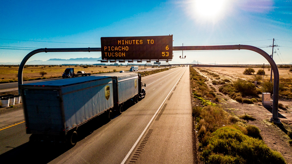
 Agencies use crowdsourced data to improve real-time traveler information, such as dynamic message signs for motorists.
Agencies such as the Indiana Department of Transportation (INDOT) have found that even a single integrated, archived, and shared crowdsourced data stream can transform traffic operations. “Crowdsourced data has proven to be extremely versatile and INDOT is very pleased by the savings in time and money it has enabled across the department,” said Ed Cox, INDOT’s engineering director of traffic management.
INDOT processes speed data from 6,500 interstate and 35,000 non-interstate segments every minute to provide real-time dashboards for incident detection at traffic management centers (TMC). TMC operators also use the dashboards to monitor work zone delays, and law enforcement officers at work zone sites can monitor queues and identify potential crashes. The data feed real-time travel estimates for over 200 routes through dynamic message signs. In all, INDOT uses vehicle probe data for nearly a dozen operational capabilities.
INDOT stores the vehicle probe data and enables engineers to query the data for multiple purposes. Using the data, traffic engineers now prioritize corridors for signal retiming rather than simply retiming on a 3-year cycle. The data supplant costly floating car studies to confirm signal timing improvements. Retiming the 9-mile U.S. 31 arterial corridor, for example, saved 116,000 hours a year in travel time, equivalent to $2.75 million.
By using vehicle probe data, INDOT has begun retiring ITS devices and will eliminate 50 percent of roadside sensors. The agency will also forego a planned ITS field device expansion. INDOT will save $28 million in ITS infrastructure deployment costs and $750,000 per year in communications service and maintenance costs by using probe data.
—MORE INFORMATION
View the “Adventures in Crowdsourcing” webinar series for innovative applications and best practices to help agencies get the greatest value from crowdsourced data.
Contact James Colyar of the FHWA Office of Operations or Greg Jones or Ralph Volpe of the FHWA Resource Center for information, technical assistance, and training, including customized virtual workshops.
In Every Day Counts round six, agencies can benefit from deepening crowdsourcing roots:
Adding data sources and applications. The Virginia Department of Transportation (VDOT) collects, integrates, and uses multiple crowdsourced data. VDOT applies vehicle probe and free navigational app data to improve incident detection, share quantitative and comparative travel times through dynamic message signs and its 511 app, evaluate work zone queues, and better track performance. The agency also uses the data for speed enforcement and speed limit studies.
Improving data management. The Kentucky Transportation Cabinet (KYTC) is transitioning to a modern data management architecture that supports multiple operational capabilities and research. KYTC has seen cost savings and added functionalities by integrating vehicle probe data, weather data, navigation app data, and automatic vehicle location data with its linear referencing system in real time.
Sharing and integrating data. The Delaware Department of Transportation (DelDOT) collects data through crowdsourcing for agency use and provides data to the traveling public. DelDOT shares crowdsourced event data from Waze through its 511 app and encourages travelers to report issues through the app to help identify hazards.
Improving archived data use. Lake County, IL, records event data such as crashes and potholes through the Waze Connected Cities partnership. The county also archives travel time data on a network of 600 road segments through the Waze Traffic View tool. This allows signal coordination and signal timing studies on demand. Lake County expects a $5 million benefit over the next 5 years by using verified crowdsourced data versus more expensive manual signal timing studies.
- Cover
- Innovations for a Nation on the Move
- State Transportation Innovation Councils Deploy Homegrown Innovations
- Arizona and Maryland State Transportation Innovation Councils Demonstrate Success
- Crowdsourcing for Advancing Operations
- Next-Generation Traffic Incident Management
- EDC Legacy: A Network of Solutions to Make Roads Safer
- Learn About Every Day Counts Round Six Innovations
- About Innovator
