
Next-Generation Traffic Incident Management
Integrating technology, data, and training helps agencies take TIM to the next level
An estimated 6 million collisions reported by police, 32 million motorist assists, and 174,000 vehicle fires occur every year in the United States. Each incident places responders and motorists at high risk of secondary collisions (collisions that occur at the scene or in the queue of a prior incident), cause congestion, and negatively impact the economy and the public’s quality of life. Traffic incident management (TIM) has become the state of the practice to effectively reduce the dangers and mitigate the impacts of incidents.
Next-generation traffic incident management (NextGen TIM) focuses on working with State, local, and Tribal partners to improve TIM on all roadways by integrating proven, yet underutilized, innovative technology, data, and training strategies. In Every Day Counts round six, these entities are poised to take TIM to the next level using innovative approaches that will continue to improve safety and travel reliability and save lives, time, and money.
Applying TIM Locally
While TIM efforts have assumed focus on high-speed roadways, the concepts of TIM are applicable to all roads. NextGen TIM applies TIM to local roadways by encouraging the application of low-cost solutions like stakeholder meetings, development of policies and procedures, and participation in TIM training.
When officers from the Oro Valley Police Department in Arizona became focused on TIM practices and began tracking TIM-related metrics in computer-aided dispatch (CAD), roadway and incident clearance times were reduced by 32 percent during the first 6 months of 2018.
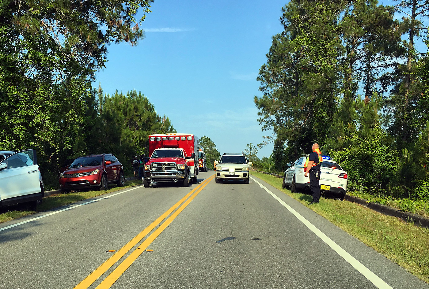 TIM strategies are applicable on local as well as high-speed roads.
Promoting Training
NextGen TIM continues to promote TIM training with innovative remote delivery approaches and new content. NextGen TIM strives to institutionalize training through policies, ensuring training will continue even after TIM training champions move on. Technology-focused training will be available to supplement the National Responder Training Program. TIM-related lessons will provide information on integrated CAD, unmanned aerial systems (UAS), connected and automated vehicles, TIM data collection and use, and traffic management centers (TMCs).
The Arizona Highway Patrol estimates that by implementing training and other TIM strategies, it saves 44,000 hours of patrol time per year, the equivalent of about 25 full-time officers.
Advancing Data Use
NextGen TIM focuses on advancing the collection, analysis, and use of incident data. With better data and analytics, agencies can quantify program performance, demonstrate program effectiveness, and improve TIM planning and resource management. TIM data can come from public safety CAD system time stamps, police traffic crash reports, or TMCs. Real-time data dashboards are an effective way to analyze and present data to promote organizational goals.
Georgia reduced clearance times for commercial vehicle crashes by 82 percent with data from its Towing Recovery Incentive Program. Puerto Rico deployed a mobile app for safety service patrols to augment the exchange of incident data and accurate reporting.
Crowdsourced data, which can be obtained whenever and wherever people travel, is another data type that is improving TIM. With crowdsourced data, agencies can detect and verify incidents and manage incident-related queues.
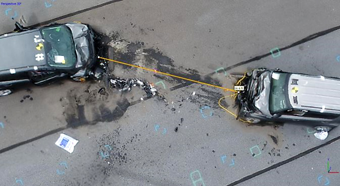 Using measurements from photos captured by unmanned aerial systems accelerates crash investigations.
Integrating Technology
CAD integration facilitates the timely sharing of information between public safety and transportation agencies and improves coordination of resources, traveler information, and safety. CAD integration streamlines and improves analysis and reporting of TIM performance measures and reduces time for law enforcement agencies to notify the public. CAD integration also allows departments of transportation (DOTs) to mobilize resources faster, improve traveler information, and enhance the depth and accuracy of data for performance analysis.
UAS reduce responder time on incident scenes, accelerate crash investigations, and offer a cost-effective measuring and mapping alternative. UAS are remotely controlled by a pilot and can be easily flown over a traffic crash scene to capture high-definition images. UAS image processing is capable of photogrammetry, in which measurements can be taken from the images. Using known measurements in the UAS image allows measurement between any two points in the image. In North Carolina, the Highway Patrol and DOT found that UAS mapped a two-car crash in 25 minutes, while three-dimensional laser mapping required 1 hour and 51 minutes.
Additional technologies include video sharing and alert systems. Video sharing allows cameras mounted on service patrol vehicles to stream images from incident scenes to TMCs, as well as TMC images back to responder vehicle computers. Responder-to-vehicle alert systems improve safety by increasing advance warning of incidents. When responder vehicles are stopped along roadways, approaching drivers can be warned through in-vehicle navigation providers that receive alerts when responder vehicle emergency lighting is activated.