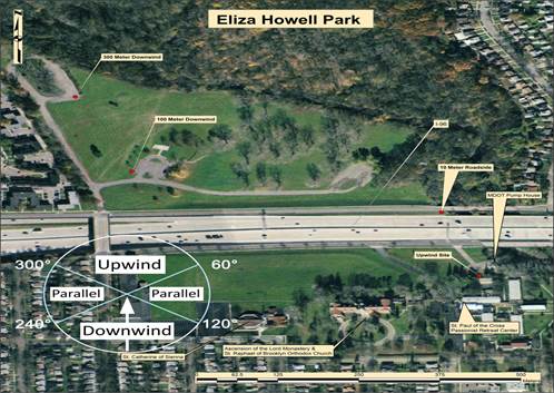
The site selection process consisted of a series of seven steps (1) determine site selection criteria2; (2) develop list of candidate sites and supporting information; (3) apply site selection filter ("coarse" and "fine"), (4) site visit; (5) select candidate site(s) via team discussion; (6) obtain site access permission(s); and (7) implement site logistics. This process resulted in the selection of a location along I-96, just east of Telegraph Road (US 24).3
Of the eighteen sites evaluated, the I-96 site was considered the "optimal" site of all the monitoring sites considered3. This site had the most advantages and fewest disadvantages of all the monitoring sites considered in meeting the project objectives.
This site had high AADT (165,300 AADT for 2006), no noise walls, meteorological and traffic data availability, manageable site logistics including right-of-way (ROW) access, and favorable wind direction4. Of the disadvantages, this site did not permit a perpendicular transect and it is in an urban industrialized area that may contain potentially confounding nearby sources.