April 16, 2020
Innovation of the Month:
Unmanned Aerial Systems
A key theme emerges while looking at how agencies around the country bring unmanned aerial systems (UAS) into their surface transportation programs. UAS can take an already robust program and increase efficiencies, reduce costs, and extend capabilities. Last week we looked at how West Virginia uses UAS to enhance its survey program. This week we will look at how UAS has enhanced bridge safety inspections.
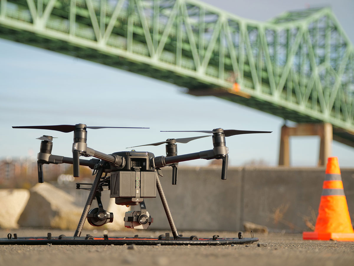
The Massachusetts Department of Transportation (MassDOT) uses UAS to provide supplemental information to its bridge inspectors, providing immediate imagery of hard-to-reach areas. MassDOT identified the Tobin Bridge as a candidate for UAS supplemented inspection. The bridge, which spans over two miles, including a quarter-mile over the Mystic River, connects the cities of Boston and Chelsea. The environment around the bridge presents challenging inspection conditions, which UAS are ideally suited to overcome.

MassDOT selected a UAS with increased flight stability for this mission, as winds around the bridge can buffet smaller aircraft. This UAS was also equipped with two high-resolution cameras each with varied focal lengths. This feature enabled the inspection team to capture wide-angle shots and detailed up close images.

In addition to being in a challenging inspection environment, the bridge is also close to Boston Logan Airport, approximately one and a half miles from airport runways. This required MassDOT to apply for Certificates of Authorization (COA) from the Federal Aviation Administration to conduct the flight mission in controlled airspace. The bridge inspection team also partnered with the airport authority, Massachusetts State Police, and other surrounding local police jurisdictions to inform all stakeholders that professional UAS operators were conducting the flight.

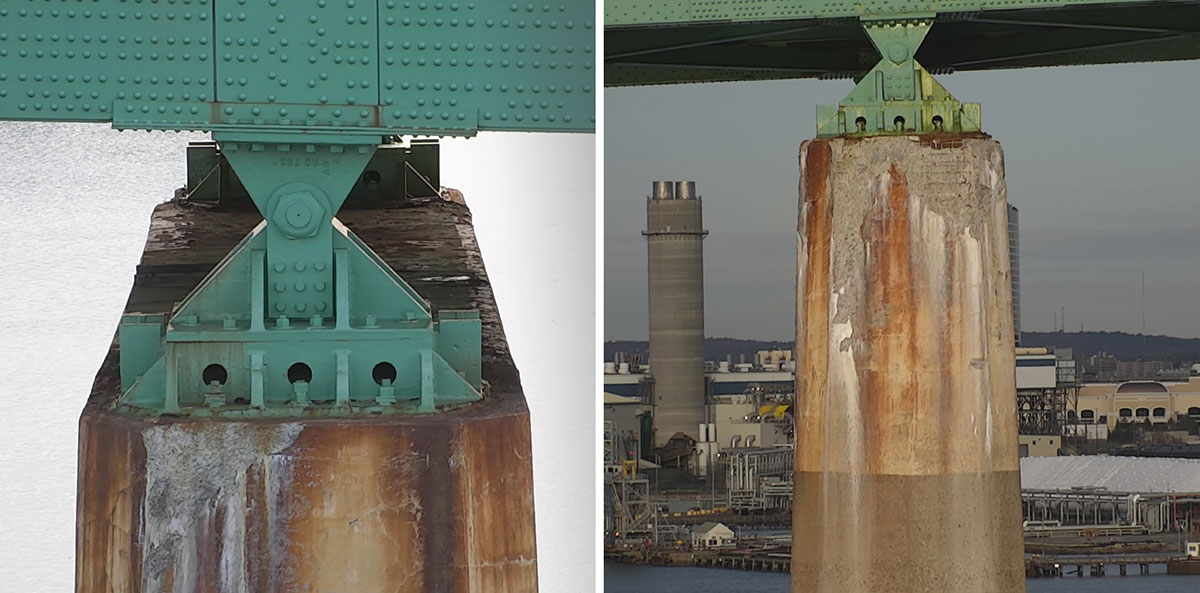
The MassDOT teams successfully and safely collected all desired imagery of the Tobin Bridge piers and the structure as a whole. The images were available to inspectors almost immediately, and provided a detailed record of the bridge conditions that can be used in future review.
To learn how your agency can use UAS to enhance its bridge inspection program, please contact James Gray or John Haynes with the EDC-5 UAS team.
EDC Outtakes – Unmanned Aerial Systems
In EDC Outtakes—a series of short interview videos—State practitioners and FHWA personnel give insight into the current round of EDC innovations. In our latest edition, Ivan Ramirez, construction manager for the Contra Costa Transportation Authority, recalls a situation where his agency used unmanned aerial systems to investigate a road issue and ultimately identify a larger problem using the bird’s eye view of the area.
Keep reading EDC News for future editions of EDC Outtakes!
Don’t Miss the First EDC Storyboard- Telling the Story of Curve Warning Signs
The EDC team will begin sharing innovation deployment stories in an interactive digital slideshow, that incorporates images, video, and graphics to create a highly visual experience for our readers.
Our first storyboard comes from the focus on reducing rural roadway departures (FoRRRwD) team and promotes greater use of curve warning signs. More than 36,000 people die each year on the nation’s highways. Over 25 percent of those fatalities occur on horizontal curves—curves that change a road’s direction or alignment. Curve warning signs, such as chevrons, are cost-effective tools proven to reduce horizontal curve crashes. For instance, chevrons reduce nighttime crashes on curves by 25 percent.
Check it out and let us know what you think about the storyboard!
For more information on using curve warning signs on your roadways, contact Cate Satterfield or Dick Albin with the EDC FoRRRwD team.
Weather Responsive Management Strategies Webinar Series—Use of Unmanned Aerial Systems in Support of WRMS
On April 29, from 3:00-4:30 pm ET, the weather responsive management strategies (WRMS) team will host the first webinar in a series, where panelists from Delaware, North Carolina, and North Dakota will share experiences emphasizing how unmanned aerial systems (UAS) have supported their flood management efforts. This webinar will also identify situations where UAS could be useful during flood events, and describe how transportation agencies can prepare for their use.
To learn more about this webinar series please watch this video or contact David Johnson, team lead for WRMS. To participate in the webinar, please register here.
Did You Catch the Last Innovator?
The March/April issue of Innovator is available on its new web platform, accessible from any device! This new and improved format will optimize your reading experience, whether you access it from your mobile phone, tablet, or computer.
In this issue:
- Virtual Public Involvement Tools Meet Today's Needs
- Unmanned Aerial Systems Take Flight in Highway Transportation
- Innovation Synergy: UAS Videos Enhance Virtual Public Involvement Techniques
- Safety Awards Highlight Every Day Counts Innovations
- And more…
Comments? Questions? We'd love your feedback! Drop us a line and let us know what you think.
Read past issues and sign up to receive Innovator by email here, or text "FHWA Innovation" to 468311 to get Innovator on your smartphone.
About EDC
Every Day Counts, a State-based program of the Federal Highway Administration’s Center for Accelerating Innovation, works with State, local, and private sector partners to encourage the adoption of proven technologies and innovations to shorten and enhance project delivery.


