


The Central Artery/Tunnel Project opened three major highway tunnels and an innovative river crossing. The reconstruction of I-93 through downtown Boston.
Source: Credit to Massachusetts Turnpike Authority
| Project Name | Boston Central Artery/Tunnel Project |
|---|---|
| Location | Boston, Massachusetts |
| Project Sponsor / Borrower | Massachusetts Turnpike Authority |
| Program Areas |
|
| Value Capture Techniques | Value Capture: Reconnecting Communities with Highway Capping Park and Leveraging Private Sector Investments. There was a missed opportunity with value capture – private landowners and developers with property bordering what is now The Greenway have benefitted from a big windfall as the value of their land has shot up. The project has proven successful as a public space and catalyst for development including attracted over $7 billion in private investment, adding more than 43,000 jobs along the I-93 corridor and in the South Boston Seaport District |
| Mode | Highway, Tunnel, and Bridge |
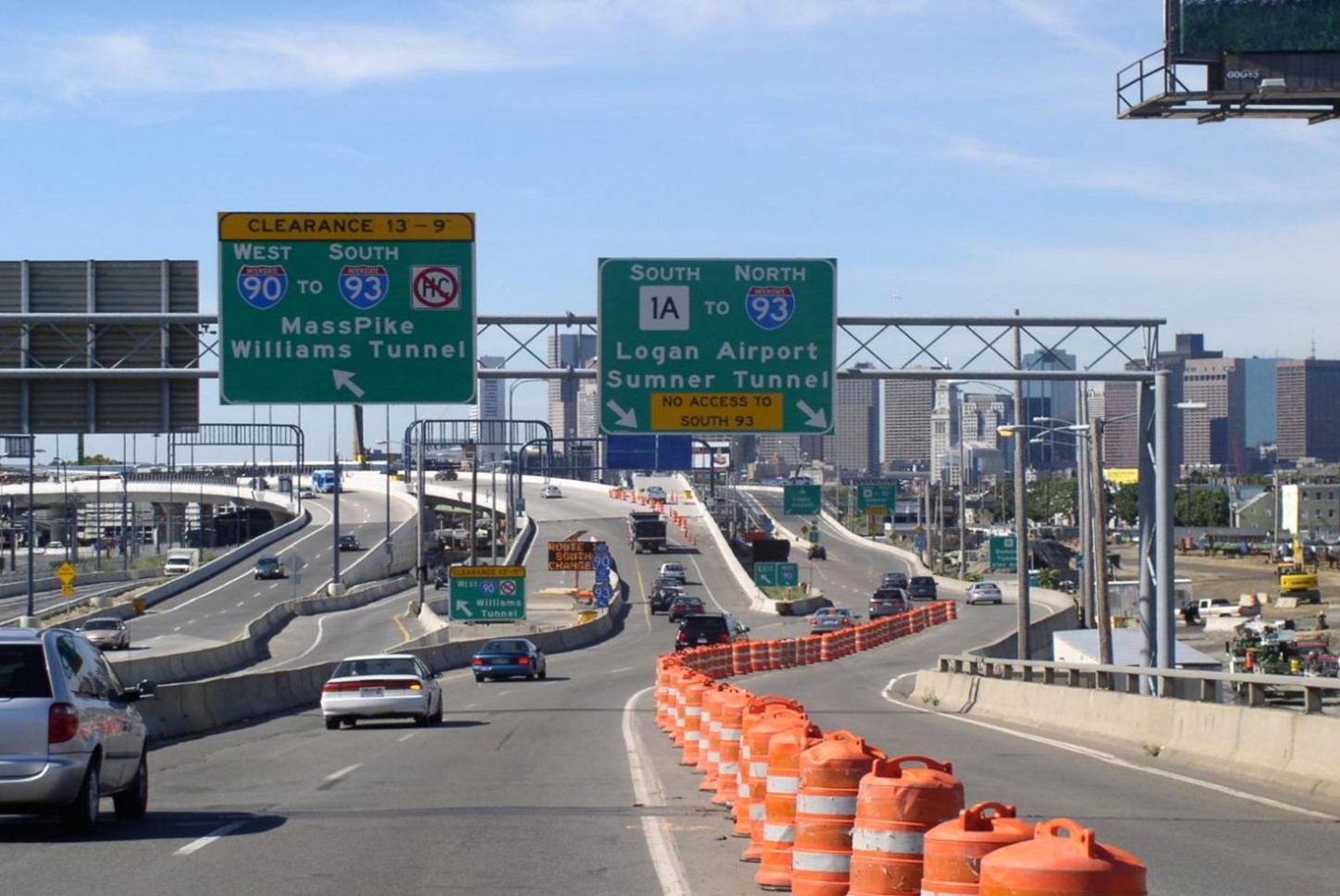
| Description | The project built a framework for future growth in the city and New England in general. The Boston, Massachusetts had a world-class traffic problem called the Central Artery. The Central Artery was an elevated highway running through the center of downtown. When it opened in 1959, the Central Artery carried about 75,000 vehicles a day. In the early 1990s it carried upwards of 200,000 making it one of the most congested highways in the United States. The accident rate on the Central Artery was four times the national average. The two tunnels between downtown Boston and East Boston/Logan Airport had the same issue. Without major improvements, Boston expected a traffic jam for up to 16 hours a day by 2010. The annual cost to motorists from this congestion was an estimated $500 million. Costs included a high accident rate, wasted fuel from traffic, and late deliveries. The elevated highway displaced 20,000 residents. It also cut off the North End and Waterfront neighborhoods from downtown. This limited these areas' ability to take part in the city's economic life. The Boston’s Big Dig project replaced the elevated deteriorating six-lane elevated Central Artery (I-93) with an underground expressway beneath the existing road, extended the I-90 tollway underground to the South Boston Seaport and Logan International Airport, built a new 10-lane bridge over the Charles River, and built a new 4-lane tunnel under Boston's harbor and ship channel. A new underground transit line (Silver Line) was also built as part of a package of transportation improvements. By removing the elevated highway, the project created more than 300 acres of open land while reconnecting downtown Boston to the waterfront and spur economic development. The project has been called the largest, most challenging highway project in U.S. history. |
| Cost | $ 14.8 billion |
| Funding Sources |
|
| Project Delivery / Contract Method | Design-Build |
| Private Partner | The Central Artery/Tunnel Project was first owned and managed by the Massachusetts Highway Department. It was then run by the Massachusetts Turnpike Authority (MTA) and was part of the Metropolitan Highway System (MHS). Bechtel/Parsons Brinckerhoff (B/PB) provided design and construction management consulting. This is a joint venture of Bechtel Corporation of San Francisco and Parsons Brinckerhoff Quade & Douglas, Inc., of New York. |
| Project Advisors / Consultants | Design and construction management consultants: Bechtel Corporation and Parsons Brinckerhoff |
| Lenders | Bondholders |
| Duration / Status | Construction occurred from 1991 to 2007. The project conceived (1985), planned, designed, and constructed over a period of 25 years, from 1982 through 2007. |
| Financial Status / Financial Performance | Bonds to be paid in full by 2038 |
| Innovations |
|
| Related Links / Articles |
|
| Contacts | Jonathan Gulliver – Massachusetts Highway Administrator |
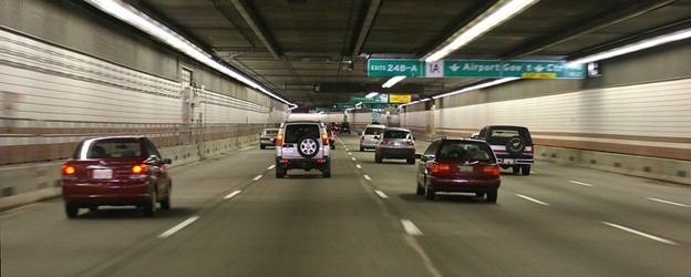
Interstate 93 tunnel in Boston, part of the Central Artery/Big Dig Project
Source: Credit to Rene Schwietzke
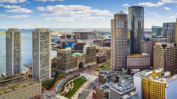
Aerial photo of Boston, showing The Greenway (45 parks and major public plazas) running through the middle of City of Boston.
Source: Credit to the Massachusetts Department of Transportation