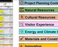
The CTIP program has funded multiple, innovative projects focused on sustainability to help practitioners advance the industry.
Innovative and Sustainable Transportation Evaluation Process (INSTEP), 2015
The goal of this project is to demonstrate the use of INSTEP as a tool to facilitate the sustainable development of transportation projects. INSTEP is a non-prescriptive, sustainability evaluation, guidance, and education system. The open database platform will allow users to access best practices, compile data-driven sustainability oriented performance metrics across a range of agency transportation projects, and enable reporting associated with overarching federal sustainability guidance. The construction and design module will be piloted on 10 projects within the Bureau of Land Management, U.S. Forest Service and National Park Service (NPS). The NPS is the lead agency. ...show more about
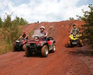
Remote Wet Weather Management System to Prevent Resource Damage and Extend Off Highway Vehicle (OHV) Use Opportunities, 2014
Across the United States, transportation agencies manage thousands of miles of native-surfaced roads and trails that are subject to resource damage from motorized vehicle use during overly wet conditions. Implementation of a remote system enables road and trail managers to make quick and easy, yet scientific-based trail/road closure decisions in response to deteriorating ground conditions. This information maximizes road and trail use to the public and minimizes potential resource damage from sediment. The remote sensing technology will be deployed in the National Forests of Tahoe (Nevada) and Sierra (California), and at Bureau of Land Management's Ivanpah Dry Lake (California) in the Mojave Desert. Soil moisture and compaction correlations are complete and equipment installations are underway. Extended extreme dry weather conditions may require a longer monitoring period in order to demonstrate this deployment. The U.S. Forest Service is the lead agency. ...show more about
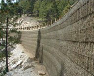
Using Locally Available Sustainable Resources for Mechanically Stabilized Earth Walls, 2014
Select fills are commonly specified for the construction of mechanically stabilized earth walls. Often, select fill materials are not available locally and their import to the jobsite and the associated disposal of local native soils increases project costs, environmental and socioeconomic impacts. With less funding being stretched further in the transportation industry, the demand for use of on-site materials will increase annually. This project will finalize planning, design and quality control tools based on prior work that established a risk based framework for using locally available sustainable resources. These tools will be implemented for the design and construction of mechanically stabilized earth walls on two projects. ...show more about
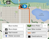
Digital Trip Planning Coordination, 2014
More and more visitors to public lands are using digital tools to find out about attractions on federal lands and to plan their travel. These tools can help visitors make efficient decisions about what transportation resources to use, and provides an opportunity for Federal Land Management Agencies to communicate about emergencies, congestion, planned road maintenance, and other transportation disruptions. This pilot in Boston National Historical Park in Boston National Historical Park and Acadia National Park will deploy enhanced trip planning data layers to existing online resources such as apps and visitors maps. Experience gained will be used in other Federal recreational areas. The National Park Service is the lead agency. ...show more about